Remains Of West Coast Bomb Cyclone Will Bring Stormy Weather To Colorado On Tuesday
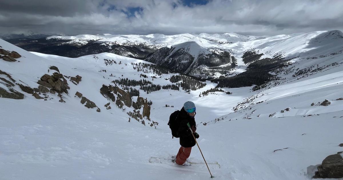
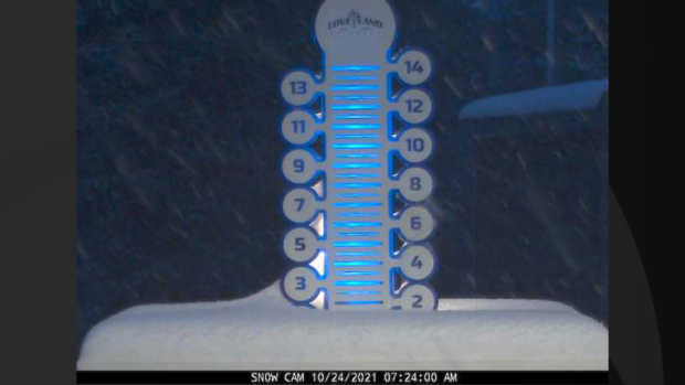
DENVER (CBS4) - A fast-moving storm system will move away from Colorado today after leaving a few inches of fresh snow in the mountains overnight. As of 7 a.m. on Sunday the Loveland Ski Area was reporting a few inches of new accumulation.
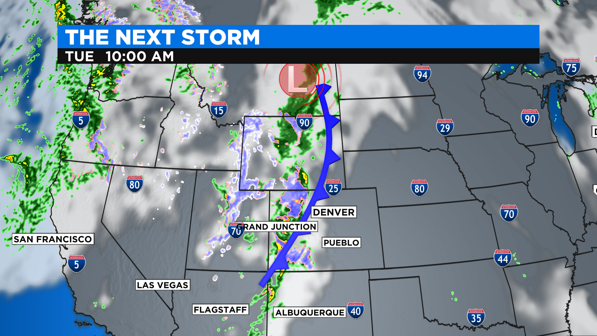
The next storm is already hitting the West Coast with large waves, high wind, intense rain and heavy mountain snow. This storm is considered a bomb cyclone because of how fast it intensified off the west coast of Washington state overnight. The storm is just one in a series of recent storms connected to an atmospheric river of moisture that has been slamming the Pacific Northwest.
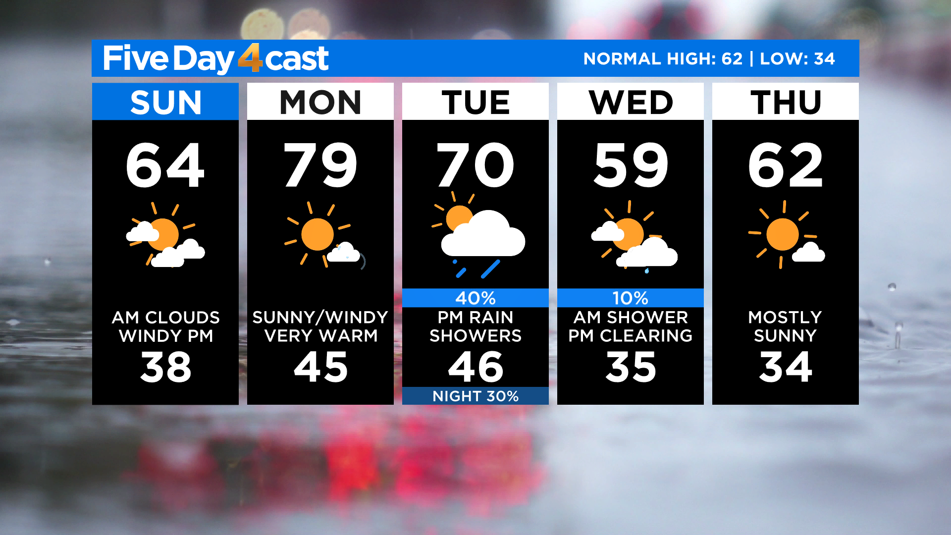
Remains of the bomb cyclone will reach Colorado by Tuesday and it will bring some strong gusty wind, light to moderate mountain snow and some rain showers to the Denver area. We could even see a few thunderstorms by Tuesday afternoon on the eastern plains. Ahead of this storm we expect a very warm and windy day on Monday.
Please note that this incoming storm will weaken substantially after it makes landfall in Washington and Oregon. It will not be anything like the bomb cyclone that hit Colorado back in March of 2019.
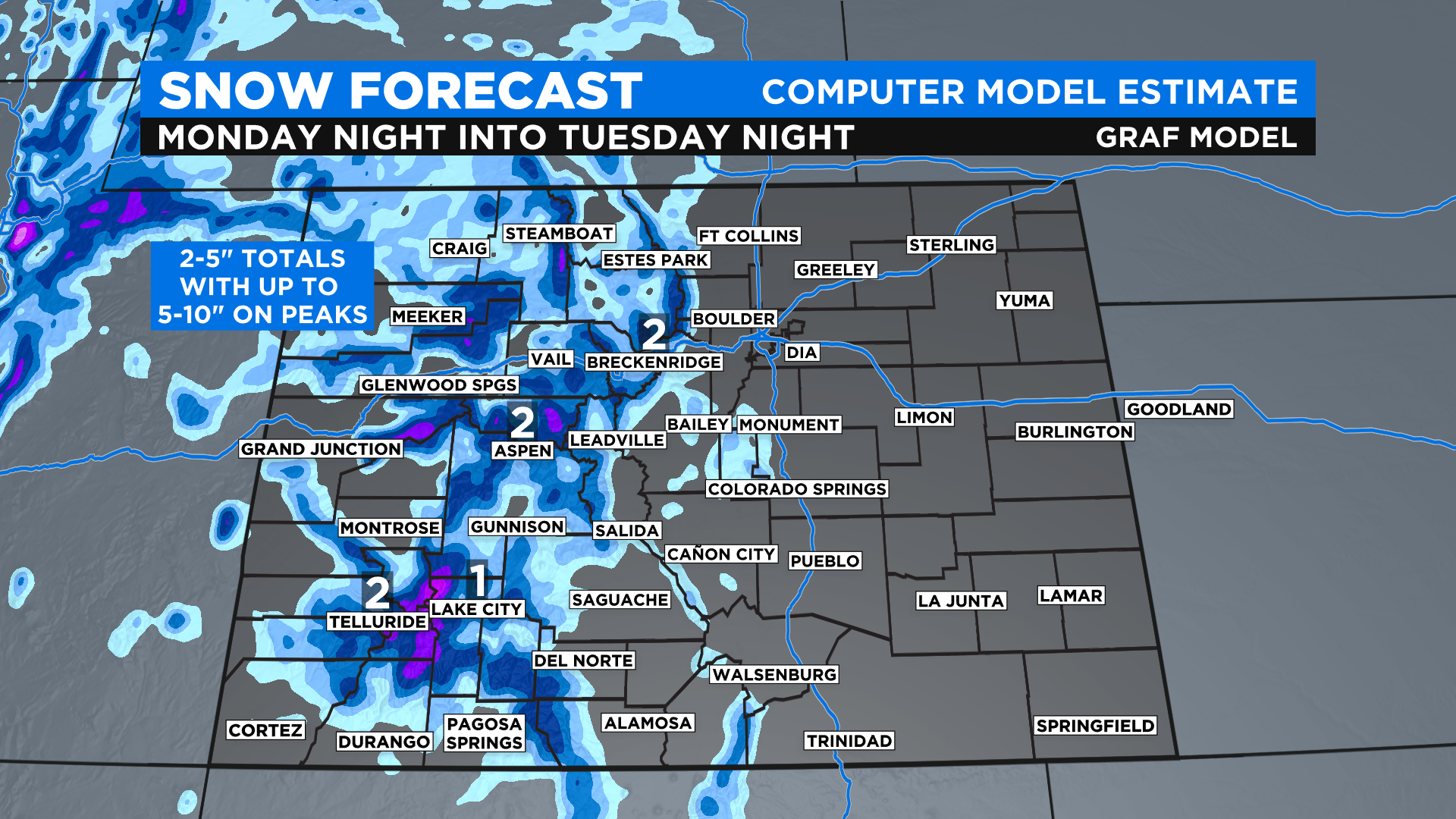
Right now we are giving a general mountain snowfall forecast of 2-5 inches, starting Monday night and ending early Wednesday. Some pockets of 5-10 inches will fall on higher peaks and favored terrain, shown in purple on the map below.
This storm will be moving pretty fast so it will not have the ability to be an epic snow producer. But as we know all too well, you don't need epic snowfall to make for some tough mountain travel so keep that in mind this week.
High temperatures will be comfortable around Colorado on Sunday with 40s and 50s in the mountains and mostly 60s across the lower elevations. Some 70s are possible in the southeast part of the state. It will be a windy at times, especially during the early afternoon.
The week ahead will be somewhat of a temperature roller coaster with the warmest day being Monday. There are a few computer forecast models that give Denver a high in the lower 80s by Monday afternoon. The record for the date is 84 degrees set in 2017.