Denver Weather: Two Storms Hit Colorado This Week, The Second A Bigger Deal For The Metro Area
UPDATE: Denver Weather: First Freeze In 5 Months, Up Next Is A Chance For Snow
DENVER (CBS4) - The first of two storm systems that will impact Colorado this week arrives late Monday night into Tuesday morning. Snow will spread across the mountains but Denver and the Front Range will be left mostly dry.
Snow from the initial storm will arrive in the mountains after midnight Monday night and snow should be falling along most of the I-70 mountain corridor between Georgetown and Avon Tuesday morning. Drivers leaving the Denver metro area should be prepared for winter driving conditions on I-70 above Georgetown on Thursday.
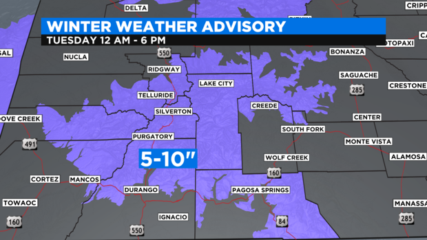
The first Winter Weather Advisory of the season has been issued for mountain areas west of Vail Pass from 12 a.m. until 6 p.m. Tuesday for 4-8 inches for the mountains surrounding Vail, Aspen, Crested Butte, and Steamboat Springs.
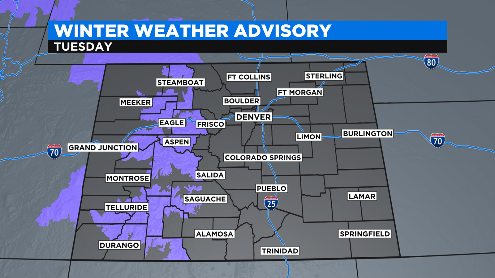
Farther south, higher accumulation is possible in the San Juan Mountains with at least 5-10 inches for the mountains around Telluride, Lake City, and Ouray. Wolf Creek Pass could get at least a foot of snow. All of these areas are also under a Winter Weather Advisory on Tuesday.
For the Denver metro area, the weather will shift from mostly sunny skies and high temperatures near 70 degrees on Monday to partly cloudy skies and high temperatures in the 60s on Tuesday. In order words, there won't be much of a change. Since the storm is arriving from the west, downsloping winds will work hard to keep Denver and the Front Range dry. That said, there is still a 30-40% for a few rain showers surviving far enough east to bring a few rain drops to the Denver metro area Tuesday afternoon.
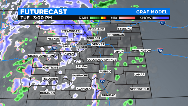
Although it stays mostly dry in the metro area with this first storm, it will be windy at times from Monday afternoon through Tuesday night with wind gusts reaching 30 mph. That same wind in the mountains will cause limited visibility when combined with the snow.
RELATED: Refresh Your Chain And Traction Law Knowledge Before Traveling Mountain Highways In Colorado
The weather will become quiet statewide on Wednesday before the second storm arrives on Thursday with another good chance for snow showers in the mountains and a somewhat better chance for showers reaching Denver and the Front Range Thursday afternoon. This second storm is also colder with metro area high temperatures dropping into the 50s for Thursday and Friday and overnight lows dipping into the 30s. It's possible it could become cold enough before the moisture ends Thursday night for a quick snow shower in Denver but no accumulation is expected. And if the metro area doesn't have the first freeze of the season on Thursday night, it seems likely for Friday night.