Big Colorado Weather Swing Ahead With Record Highs To Mountain Snow This Week
UPDATE: Tuesday Is Our Final Warm Day, Cool And Wet Weather Is Coming
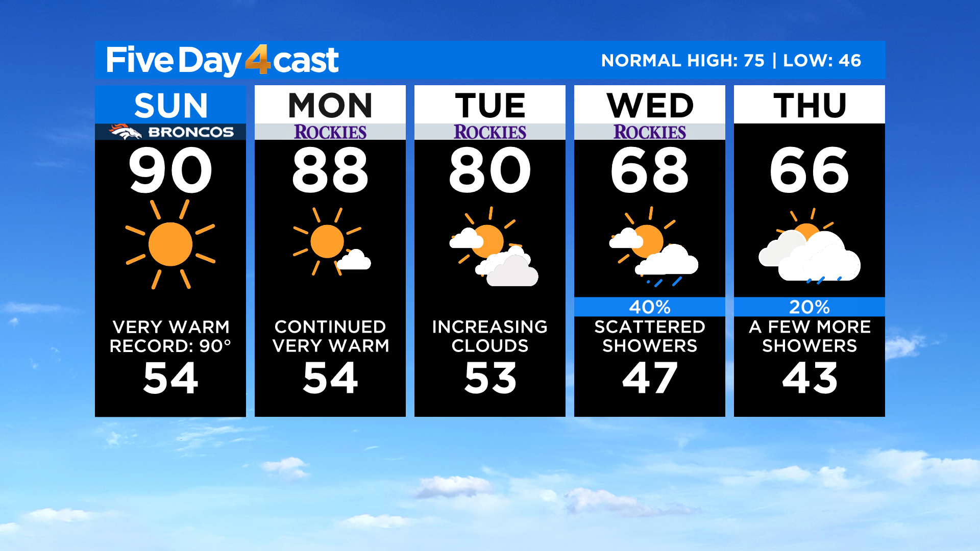
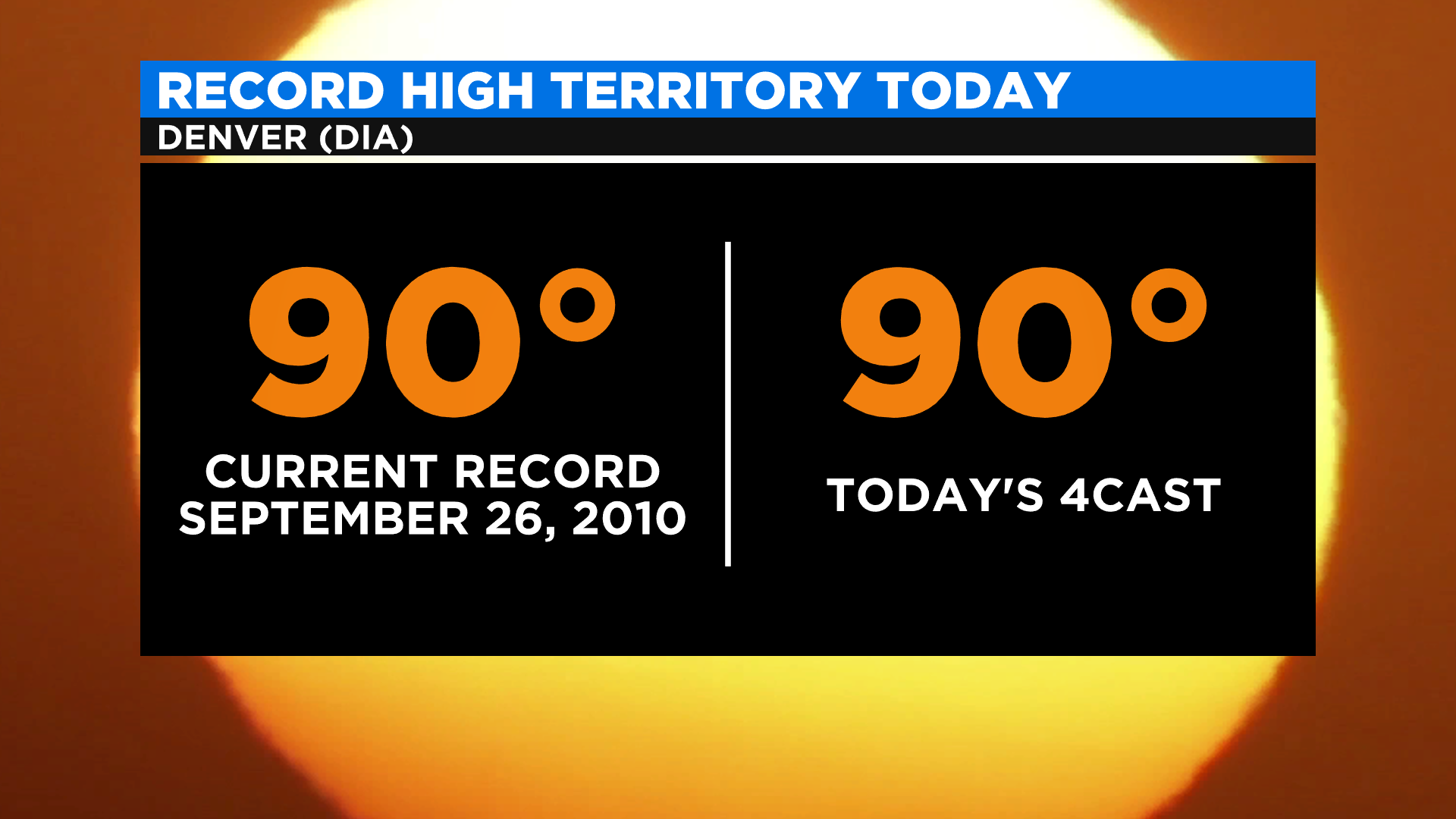
DENVER (CBS4) - Colorado is known for large and abrupt weather changes and that will definitely hold true this week. We'll start with record highs possible today along the Front Range and on the Eastern Plains with temperatures as much as 10 degrees above normal elsewhere.
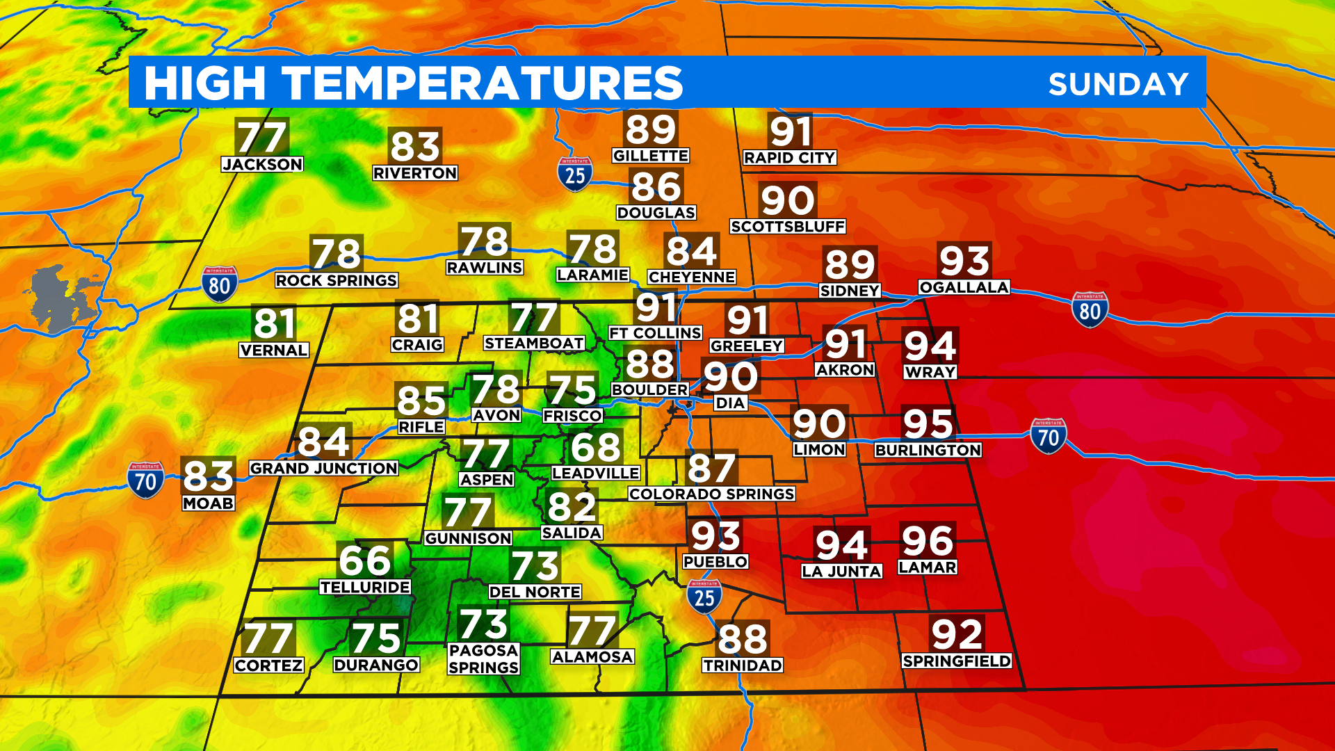
The unusually warm weather will stick around into Monday with summer-like temperatures expected once again around the state. The clouds will increase throughout the day and we could see a few scattered showers develop in the mountains.
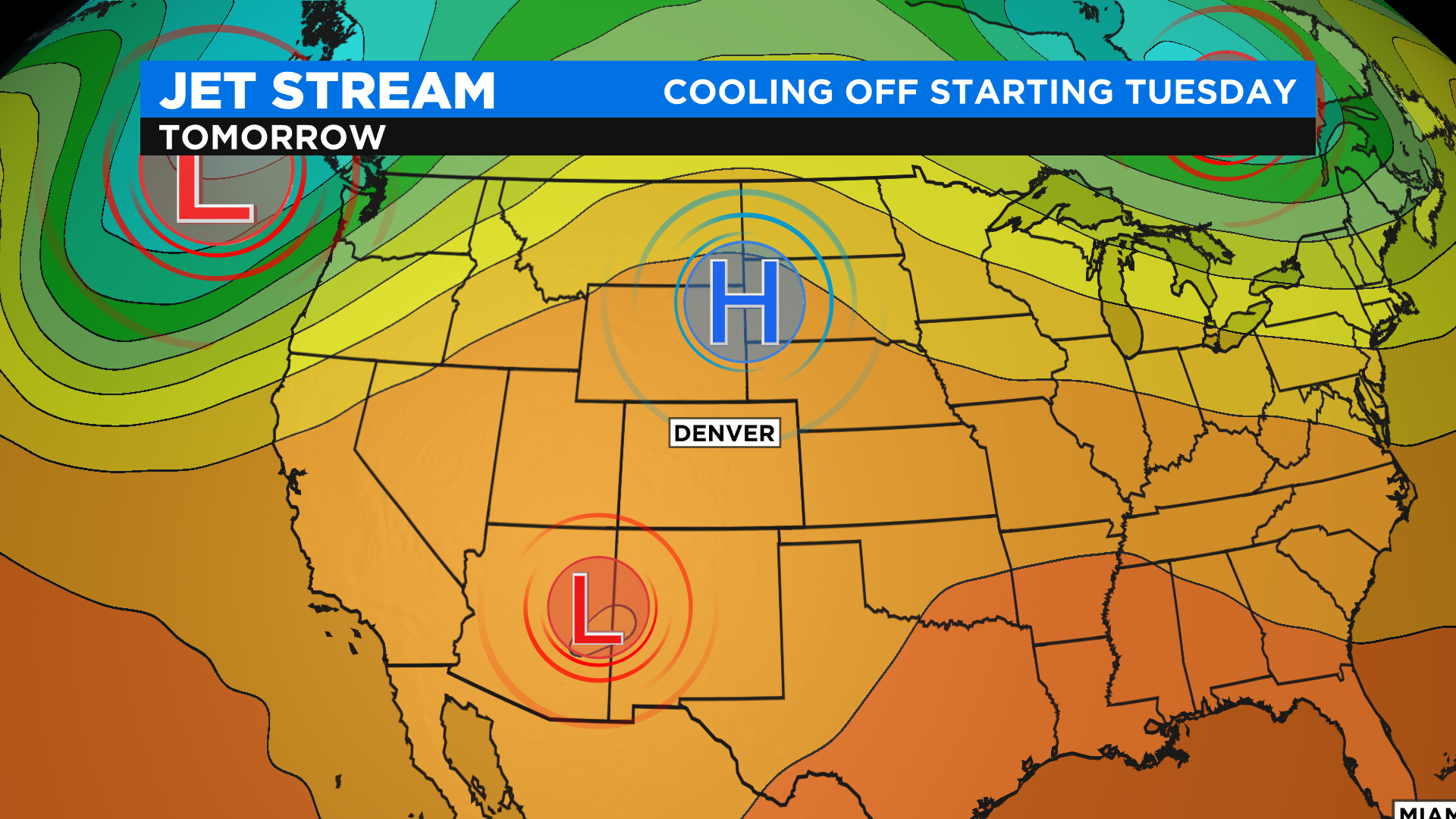
A new storm moving into the Pacific Northwest will push a strong cold front into Colorado by Tuesday. As it approaches it will pick up an area of low pressure that is cut-off from the main jet stream and currently spinning over Arizona. These two features will combine to drop temperatures below normal across Colorado starting Wednesday. It will also bring a chance for rain to the lower elevations and accumulating snow in the mountains.
Right now it looks like the snow levels will stay pretty high in the mountains with the potential to see a few inches above 10,000 feet. Depending on how the precipitation aligns with the coldest air we could see places in the foothills pick up some flurries mixed in with the rain.
The cooler and unsettled weather pattern will stick around for a few days with highs running at or below normal through the upcoming weekend. Right now the average high in Denver is in the middle 70s.