Colorado Weather: Finally A Day Without The Threat For More Mudslides
DENVER (CBS4) - Much drier weather will dominate most of Colorado on Wednesday including in the mountains where the threat for flash flooding and mudslides has finally ended.
There were multiple mudslides near Poncha Springs late Tuesday night that closed Highway 285 and there have been many mudslides near wildfire burn scars across the state since last week.
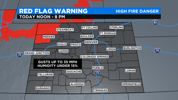
A quick change in the weather pattern will see some mountain communities rapidly shift to a threat for new wildfires and instead of flash flooding. The northwest corner of Colorado including Craig and Meeker is under a Red Flag Warning from 12 p.m. until 8 p.m.
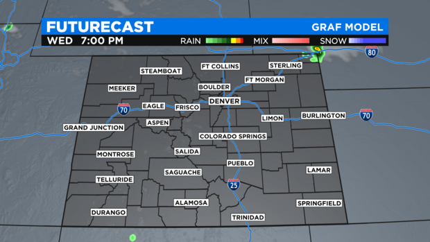
The only region of the state that could see a few showers and thunderstorms late in the day on Wednesday is far northeast Colorado near Julesburg. A few storms moving southeast through the Nebraska panhandle could briefly impact the I-76 corridor east of Sterling.
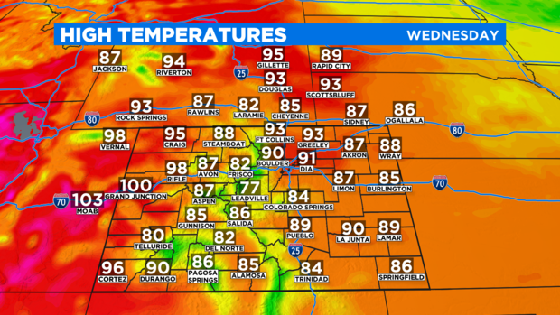
Otherwise Wednesday will be sunny, dry, and very warm. High temperatures in the Denver metro area will be at least 5-10 degrees warmer than Tuesday and some areas on the Western Slope will approach 100 degrees including in Grand Junction.
Then 100 degree heat will then shift east to the urban corridor for Thursday which should be the hottest day in Denver in 3 weeks. Friday will also be hot and could tie the record in Denver which is 98 degrees from July 9, 1989. A chance for late day thunderstorms will also return for Friday and Saturday.