Winter Storm: Flooding A Concern After Historic 2020 Wildfire Season
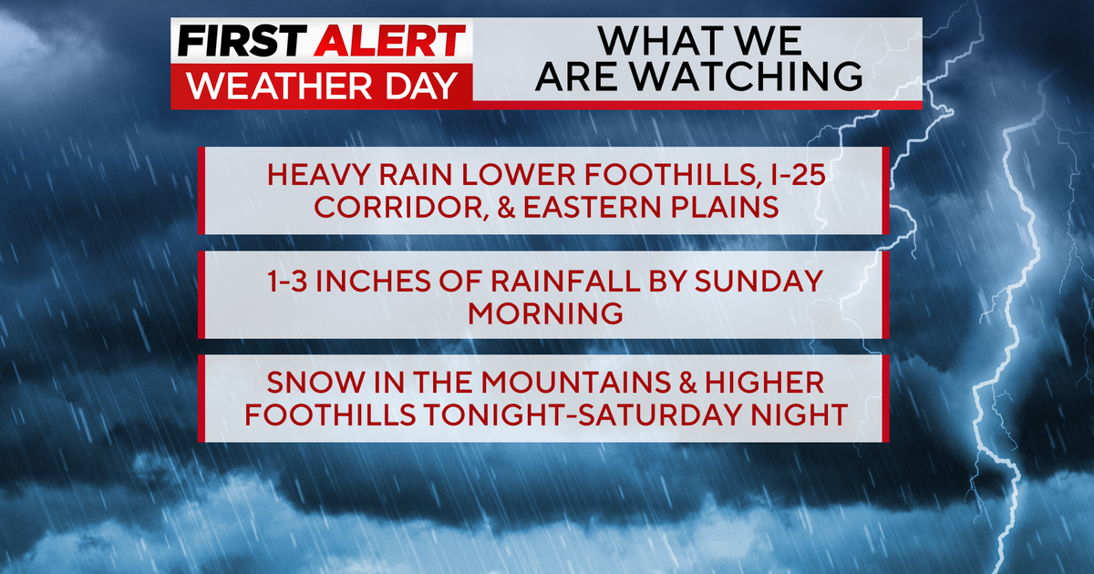
LARIMER COUNTY, Colo. (CBS4)- Northern Colorado, specifically Larimer County, could see the most snow of the Front Range this weekend, with more than 30 inches forecasted to fall in 48 hours. The snow could be up to five feet in some of the foothills of Larimer County, near Estes Park and Rocky Mountain National Park.
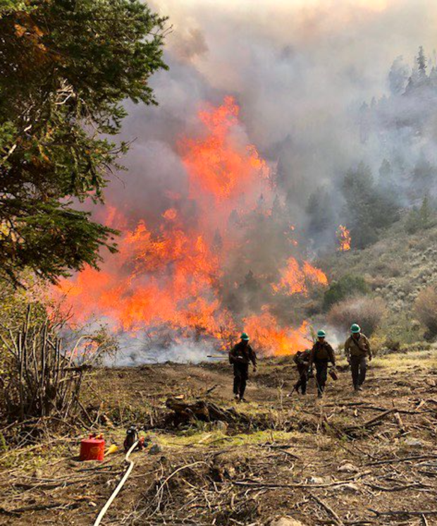
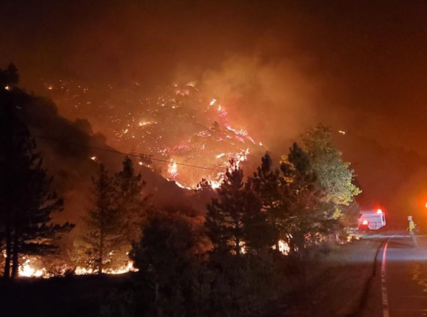
Because of the record-setting wildfire season in 2020, including the state's largest fire in history with the Cameron Peak Fire, Larimer County Sheriff Justin Smith said first responders are preparing for the worst while praying for the best.
"Since the fire last fall, we have been in planning operations recognizing the burn scar any sort of moisture can be problematic," Smith said. "One concern is the sliding of those soils that were burned very heavily... And then the other part of that is volumes of water coming down."
Smith said significant amounts of snow could potentially trap many who were evacuated from their homes just months ago. He urged those residents to have 72 hours worth of food and medications on hand before the snow starts falling this weekend.
"We have seen some that put five feet or more up in the Estes Park area," Smith told CBS4's Dillon Thomas. "If you have a significant amount of snow, and it melts quickly, obviously you would be looking at flash flooding coming down."
While hoping it won't be necessary, Smith said his agency is working with others to be as prepared as possible. Agencies from CDOT to the National Guard are on standby to be of assistance in the case of an emergency.
"(Agencies are teaming up to) be able to get out to assist people and perform rescues as needed," Smith said. "(The snow) certainly brings some real challenges. But, preparation makes a real difference. A lot of this has to do with being prepared to handle things you can't plan for."
The entire I-25 urban corridor from Colorado Springs to Denver to Cheyenne is under a Winter Storm Watch starting at midnight Friday night through midnight Sunday night. The I-70 mountain corridor between Denver and Avon is also under a Winter Storm Watch starting at 5 p.m. Friday.
The highest snow totals in Colorado will be over the higher peaks and mountain passes with at least 36-48 inches of snow possible over Berthoud and Loveland Passes as well the I-70 approaches to the Eisenhower Tunnel.
For much of the Denver metro area, a total of 15 to 25 inches of snow is expected with about half piling up by Saturday night and the remainder falling on Sunday. Even higher amounts are possible in Boulder and Fort Collins with totals reaching near 30 inches in some areas.