Denver Weather: Winter Storm Hits, Some Areas Will Experience Whiteouts
DENVER (CBS4) - Rain will change to snow along Colorado's Front Range on Thursday with 4-8 inches of wet slushy snow expected in most areas. Amounts will be higher south and west of the Denver metro area while locations to the east may experience the worst conditions thanks to fierce winds and whiteouts.
RELATED: Snowstorm Causes Causes Interstate Closures In Colorado, Deputy Hurt In I-70 Crash
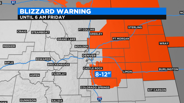
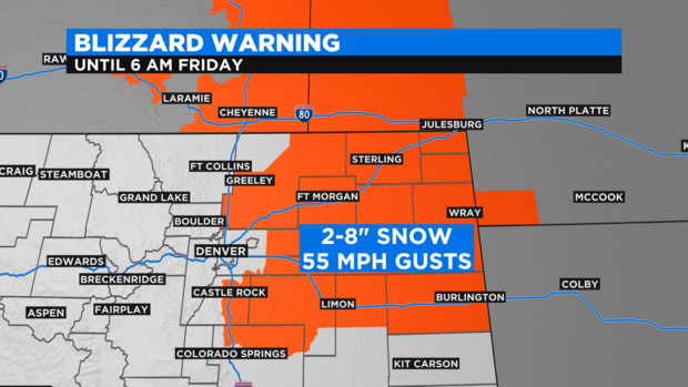
A Blizzard Warning has been issued until 6 a.m. Friday for areas south and east of the immediate metro area including the Palmer Divide in Douglas and Elbert Counties and all of the Eastern Plains along and north of I-70. Snow totals will range from 8-12 inches in the Castle Rock, Franktown, and Elizabeth areas to 2-8 inches farther east.
The worst conditions in the state from a impact standpoint (not snowfall) will be on the Eastern Plains where wind gusts up to 55 mph will cause considerable blowing and drifting snow. Visibility will be severely impacted and some sections of I-70 and/or I-76 may be closed on the plains because of adverse conditions.
For the Denver, Boulder, and Fort Collins areas, a Winter Storm Warning has been issued from Noon on Thursday until 6 a.m. Friday. Most neighborhoods in the metro area will get rain Thursday morning followed by snow Thursday afternoon and evening. Snowfall rates could reach up to 2 inches per hour meaning there could be very heavy snow at times.
Most of the Denver and Boulder area will see 4-8 inches of slushy accumulation. Amounts should be less from Longmont north to Fort Collins with 3-5 inches in these areas. Greeley should get less than 4 inches.
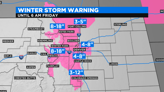
Meanwhile the foothills of Jefferson, Boulder, and Larimer Counties including Evergreen, Conifer, Nederland, Ward, and Estes Park will see 8-18 inches of snow. The mountains of Summit County, the Winter Park area, and the Rocky Mountain National Park region should get the same and will likely be on the higher end of the snow forecast.
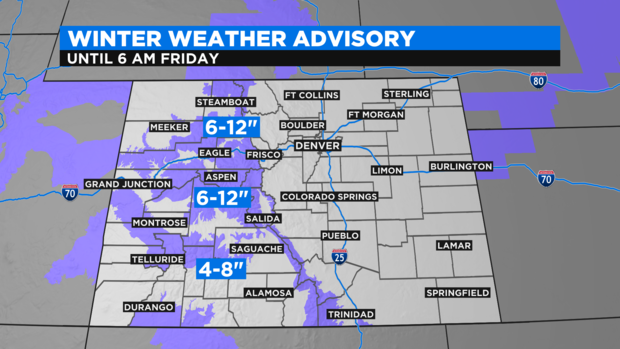
Farther west there is a Winter Weather Advisory for mountain areas west of Vail Pass for 6-12 inches of snow for the mountains surrounding Vail, Aspen, Crested Butte and Steamboat Springs. The San Juan Mountains in southwest Colorado including Telluride are also under an advisory for 4-8 inches of additional snow on Thursday.
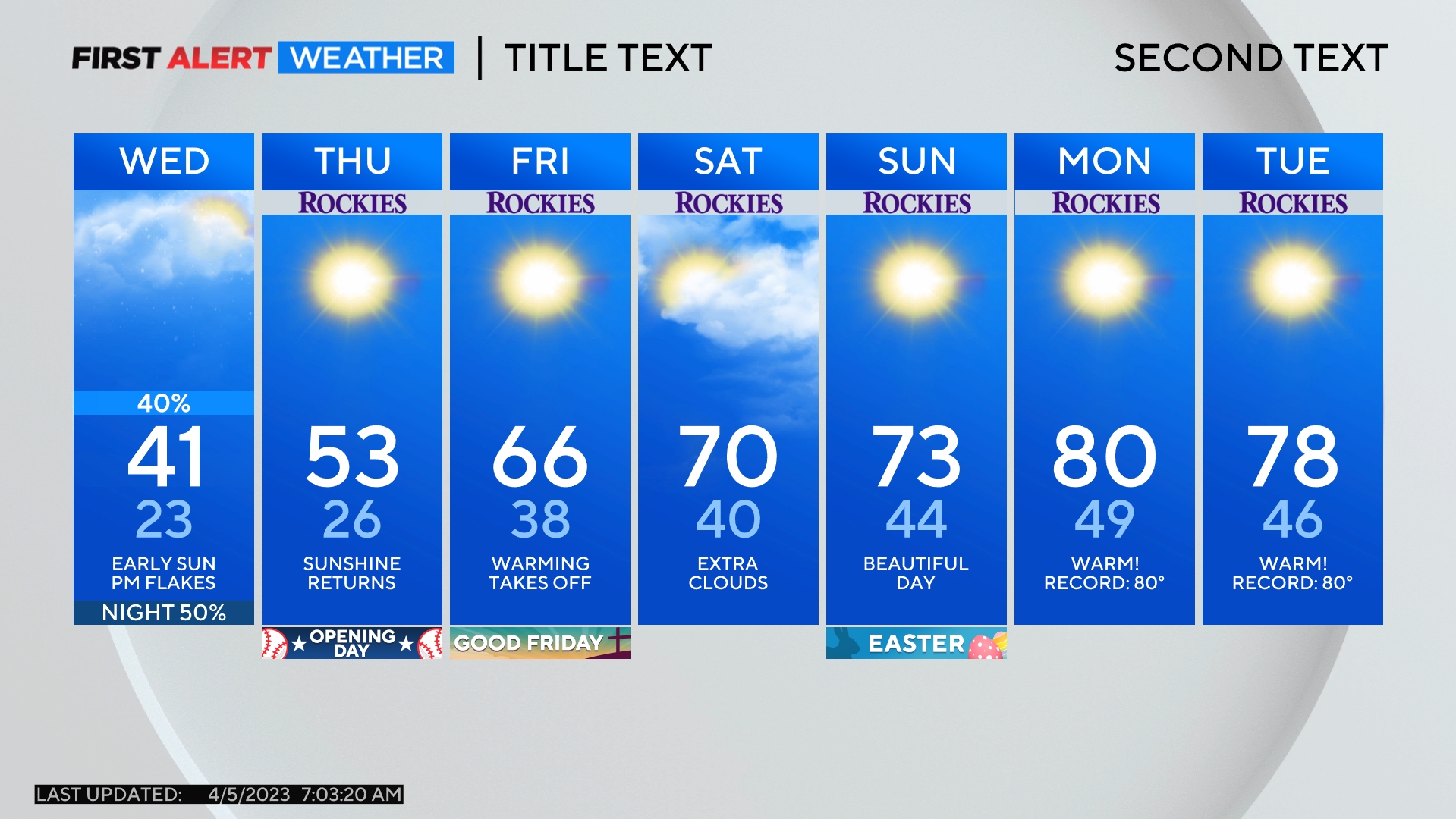
A second piece of energy behind the main storm system will arrive on Friday. This will bring another good chance for snow in the mountains and perhaps a few afternoon snow showers in the metro area. Very little if any additional accumulation is expected on the urban corridor on Friday.
Drier and warmer weather will return for the weekend and Monday.