Colorado Weather: Next Front Range Snow Just A Few Days Away
DENVER(CBS)- In the wake of our fast moving snowstorm that moved out on Thursday morning, Colorado has a warming trend to look forward to between now and Saturday. After that a cold front will blast through, and it will be a snowmaker for the Centennial State .
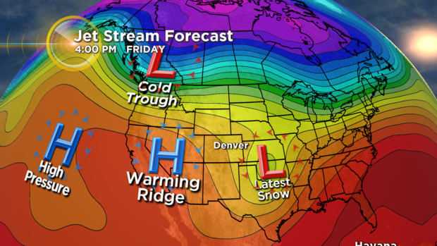
Saturday night another cold trough of low pressure with an associated cold front will ooze into the central Rockies. This will cause a 20 to 30 degree drop in temperature along another blast of snow.
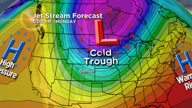
Snow forecast models at this time are indicating there will be some significant snow fall again rolling in on Sunday. The storm system is still 3 days away so these numbers are not set in stone and a lot could change between now and the end of the weekend. But, they do give us an idea that there will be an impact with accumulating snow and possible slick roads.
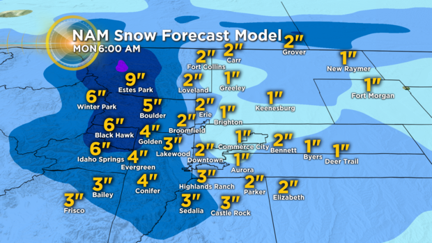
The NAM or North American Model has the potential for 1 to 3 inches over the Denver metro area for Sunday.
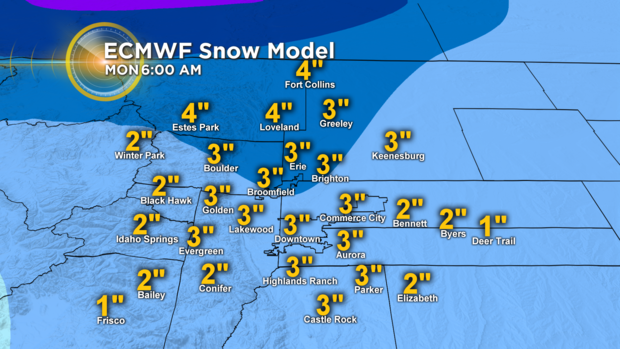
The European Model has the potential for 1 to 4 inches over the Denver metro area for Sunday.
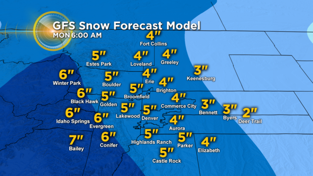
The GFS or Global Forecast System Model has the potential for 2 to 5 inches over the Denver metro area for Sunday.
So at this point the blending of all three of these models would indicate at least the chance for 2 to 5 inches of snow late Saturday night into Sunday night. Again, we are three days out so I would stress don't pay so much attention to your specific number but, more to the idea that there could l be winter-like driving conditions Sunday into Monday morning across the Front Range.