Denver's Biggest Snow So Far This Season Possible Friday
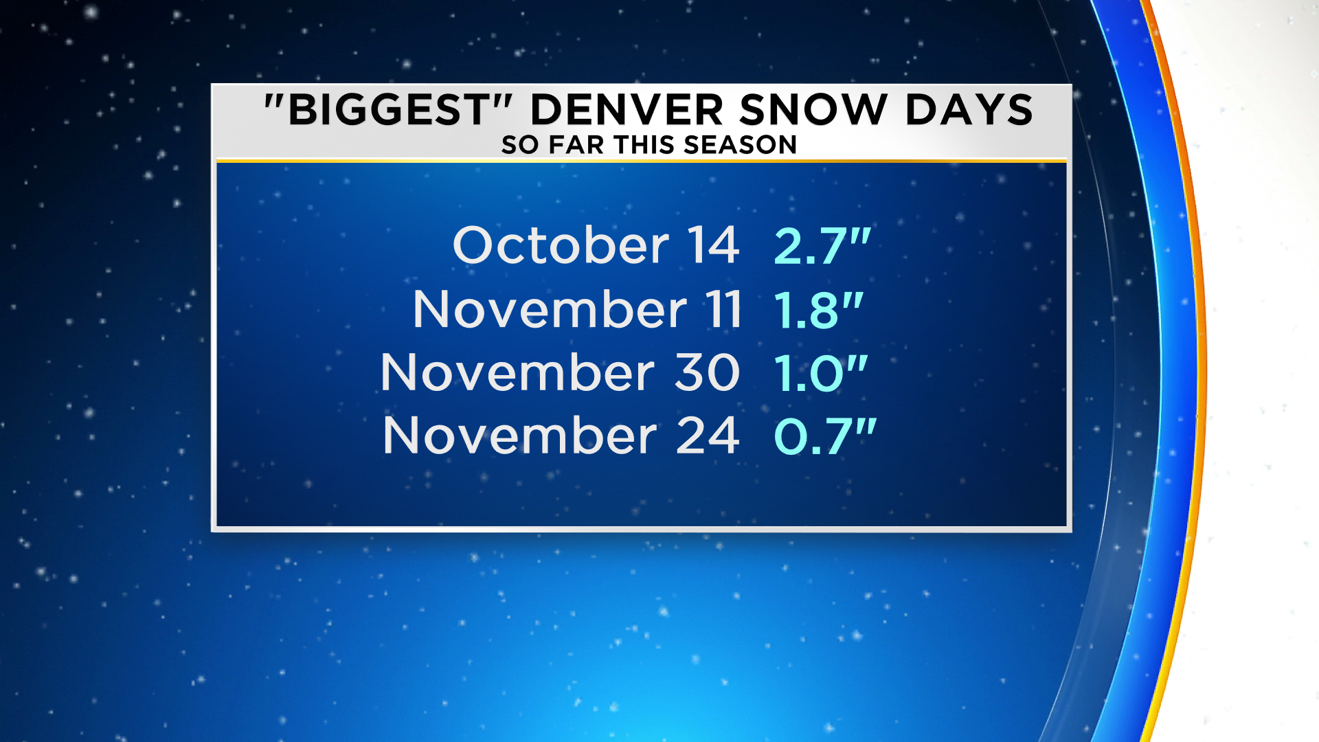
DENVER (CBS4) - A storm will track east across Colorado on Friday bringing a virtual guarantee of snow in the Denver metro area. And if we officially get anything more than 2.7 inches of snow, it will be Denver's snowiest day so far this season.

Ahead of the storm it will be dry and mild on Thursday. And once the first precipitation from the storm reaches the Front Range after midnight Thursday night, it may still be warm enough for rain. However, by 4 a.m. Friday it should be cold enough for any rain to change into snow. Then long periods of light snow will continue through Friday night before ending Saturday morning.
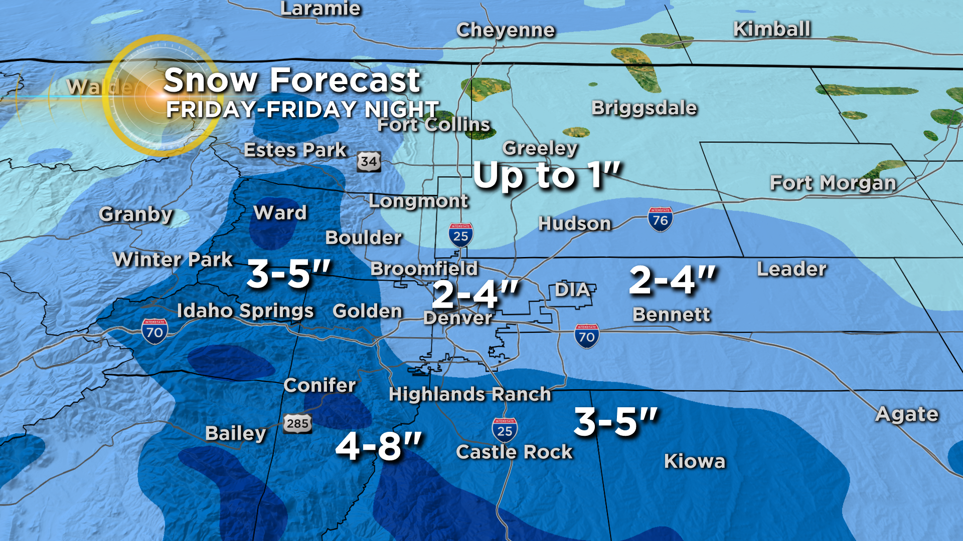
In terms of accumulation, totals should range from 2 to 5 inches across most of the metro area. Higher amounts up to 8 inches are possible in Jefferson and Douglas Counties above about 7,000 feet including the Highway 285 corridor above Indian Hills. Meanwhile Northern Colorado including the Fort Collins, Loveland, and Greeley areas will see less. These areas should generally get less than 1 inch.
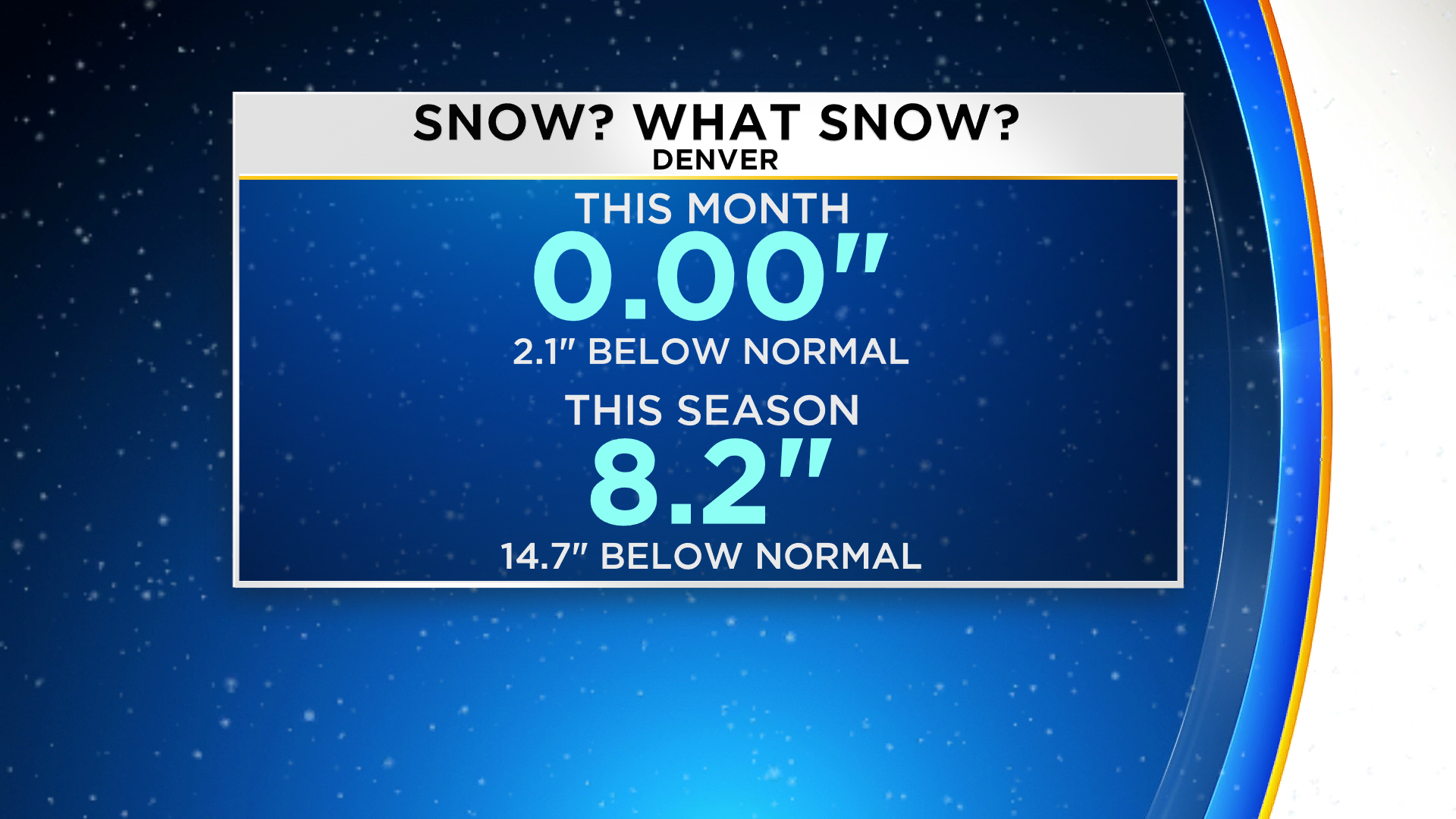
Any accumulation will be welcomed in the metro area. For the season we are almost 15 inches below normal through January 10 with only 8.2 inches of snow since October.
Even more remarkable is our snowiest day so far this season was on October 14 when Denver's official snowfall was only 2.7 inches (as measured at DIA)
In terms of travel impacts, if the rain/snow transition happens fast enough early Friday, travel impacts east and north of C-470 will likely be limited through at least Friday afternoon. But if we get enough rain to cause wet roads, it's possible a glaze of ice could develop once temperatures drop below freezing.
The possibility of ice is our biggest concern for Friday morning. It could be just enough ice to cause numerous accidents and major delays. If the ice doesn't materialize, the snow alone probably won't be enough to cause significant problems during the Friday morning drive.
It's a different story south and west of C-470 (foothills and Palmer Divide) due to colder temperatures reaching those higher elevations sooner. Based on the data available Thursday morning, it appears these areas have the highest likelihood of Friday morning travel issues. Later in the day travel issues could happen anyone on the Front Range.
CBS4 has partnered with the Denver Rescue Mission to Spread the Warmth this winter. We're bringing the community together for Coloradans experiencing homelessness. Find out how to help at CBSDenver.com/SpreadtheWarmth/.