Tonight's Storm To Bring High Avalanche Danger, Possible Rock Slides
By Chris Spears
DENVER (CBS4) - A relatively warm, moist storm will move into Colorado Saturday.
Air with this storm originated in the central Pacific Ocean so there is potential to see a lot of water, especially in the mountains.
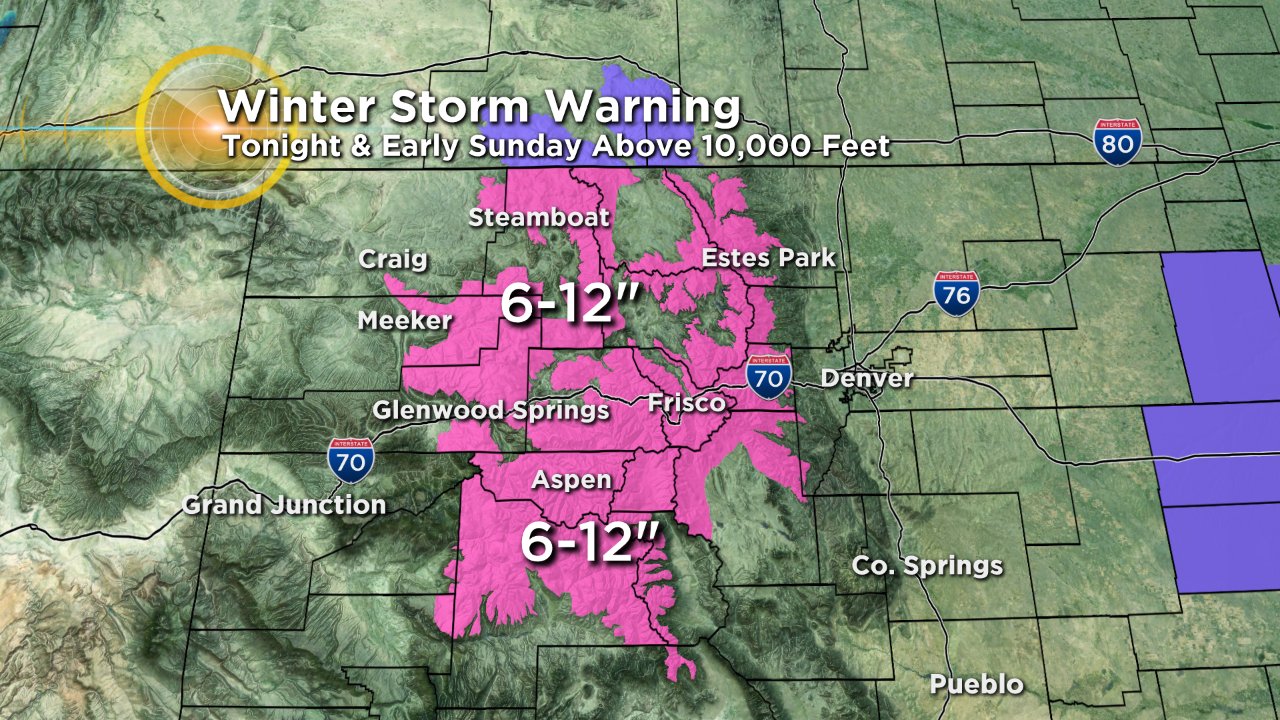
Initially the mountains will mostly see rain with snow levels starting off well above 10,000 feet Saturday afternoon. Snow levels will lower overnight.
Accumulations of a foot or more will be possible above 10,000 feet with some isolated pockets up to 18 inches possible.
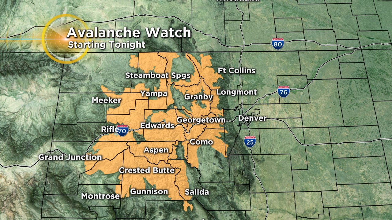
Avalanche danger will rise sharply with the combination of wind and moisture on the way.
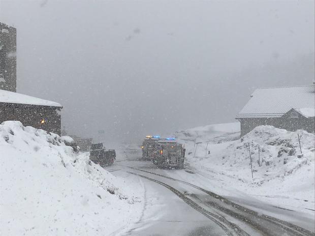
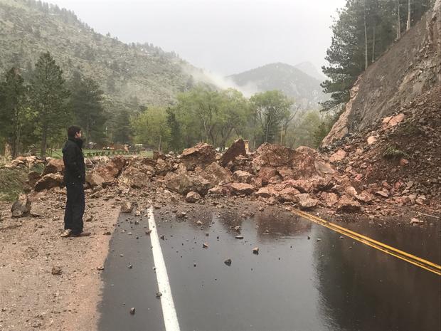
Because of the recent freeze-thaw cycles and the rain and snow we could even see issues with mud and rock slides on some mountains roads over the next 24 hours.
Check the latest road conditions if you plan to travel in Colorado's high country overnight or early Sunday.
Meteorologist Chris Spears travels weekly in the CBS4 Mobile Weather Lab reporting about Colorado's weather and climate. Check out his bio, connect with him on Facebook or follow him on Twitter @ChrisCBS4.