Fire Danger Remains High Along The Front Range
FORT COLLINS, Colo. (CBS4) - A lot of snow is expected for the western and southwestern mountains, but only a chance for snow along the Front Range. The dry conditions mean the fire danger remains high.
"The vegetation on the plains is dry, the vegetation in the foothills is dry," said Nolan Doesken, State Climatologist at Colorado State University.
Parts of Colorado experience mild temps and no precipitation. Although most aren't complaining, too much of a good thing could be a problem.
"The fact that this is proving to be, and there's a few days left, but for now it's proving to be one of the driest Januarys in Colorado history," Doesken said.
Those dry conditions mean fire danger continues. It's a rare event for the middle of January.
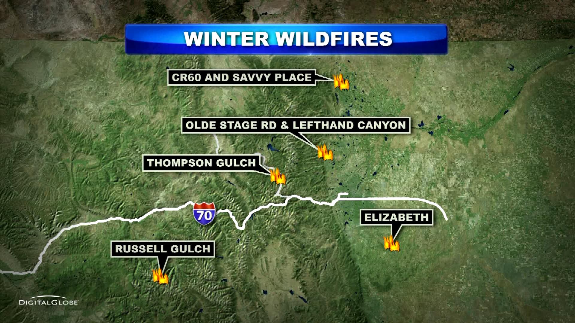
According to the National Weather Service, there have been five significant fires since Jan. 17.
"This isn't nice at all to be dealing with fire danger at all in January," Doesken said.
The mild temps also mean the water lookout for next year is uncertain.
"We're now statewide about 60 percent of the average snow water content we'd expect for this time of year and that's a big enough deficit that it'll be hard to make it up."
Doesken says it's a waiting game and he hopes for late season precipitation.
"Springs in Colorado can change the picture in a big way," he said. "There's still hope for that."
Wildfire Resources
- Visit CBSDenver.com's Wildfire Resources section.
- Read recent Wildfire stories.
Wildfire Photo Galleries
- See images from the most destructive wildfires (Waldo Canyon, High Park and Fourmile) and largest wildfire (Hayman) in Colorado history.