Fast, Potent Storm Arrives Sunday
By Chris Spears
DENVER (CBS4) - St. Patrick's Day will be dry and mild statewide with the only real weather issue being wind as a storm system approaches from the west.
Clouds will begin to increase across western Colorado this evening and snow is expected to develop in the mountains sometime around or after midnight.
It looks like snow is possible most of the day on Sunday in Colorado's high country with several inches of accumulation. A few spots could see up to a foot.
The forecast is much more difficult for Denver, the Front Range Foothills and the eastern plains.
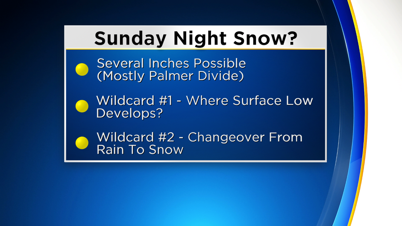
Sunday may be looking at rain showers and afternoon thunderstorms with snow developing overnight into Monday morning. At this point it looks like about 1 to 2 inches of snow may be possible in the Denver metro area.
But the timing of rain to snow and amounts will ultimately depend on where the surface area of low pressure spins up.
Meteorologist Dave Aguilera will have more this evening so be sure to check back!


Meteorologist Chris Spears travels weekly in the CBS4 Mobile Weather Lab reporting about Colorado's weather and climate. Check out his bio, connect with him on Facebook or follow him on Twitter @ChrisCBS4.