DENVER (CBS4) - The first images from NOAA's next-generation weather satellite are in and they're absolutely stunning.
GOES-R launched from Florida on Nov. 19 after a brief delay due to Hurricane Matthew. Just 10 days later the spacecraft's name was changed to GOES-16 after it successfully reached a geostationary orbit approximately 22,000 miles above Earth's equator.
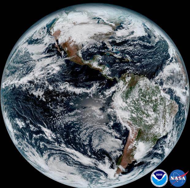
This composite color full-disk visible image is from 1:07 p.m. EDT on January 15, 2017 and was created using several of the 16 spectral channels available on the GOES-16 Advanced Baseline Imager (ABI) instrument. The image shows North and South America and the surrounding oceans. GOES-16 observes Earth from an equatorial view approximately 22,300 miles high, creating full disk images like these, extending from the coast of West Africa, to Guam, and everything in between. (credit: NASA/NOAA)
After several weeks of testing NASA released the first high-resolution images captured by the spacecraft on Jan. 15, providing a level of detail never seen before.
GOES-16 can scan the planet five-times faster than current satellites and it has four times greater resolution.
It can provide a full disk image of the Earth every 15 minutes, one of the continental U.S. every five minutes, and it can look at small-scale features such as hurricanes and wildfires every 30 seconds.
The satellite uses 16 spectral channels to creates images.
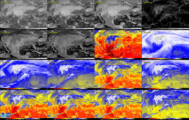
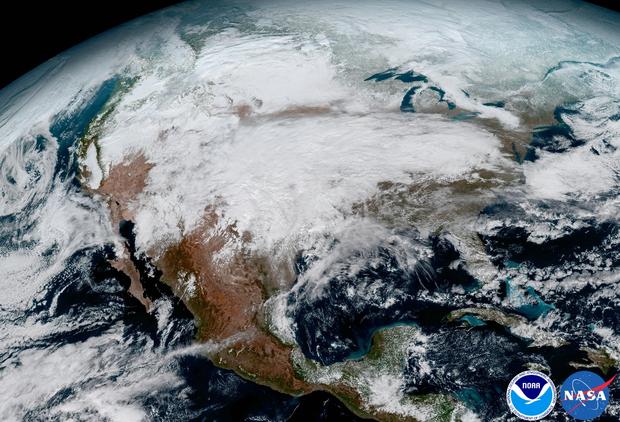
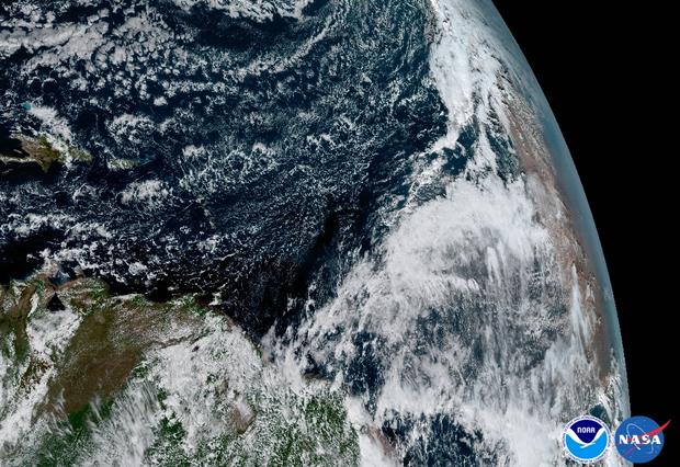
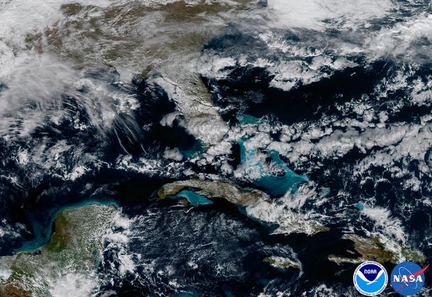
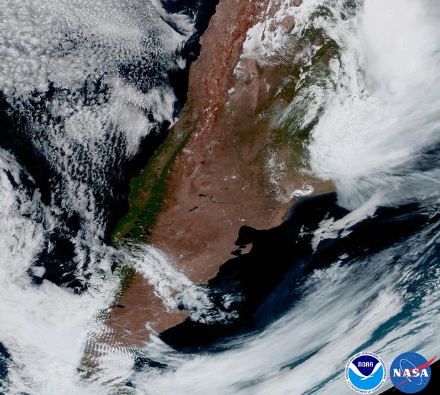
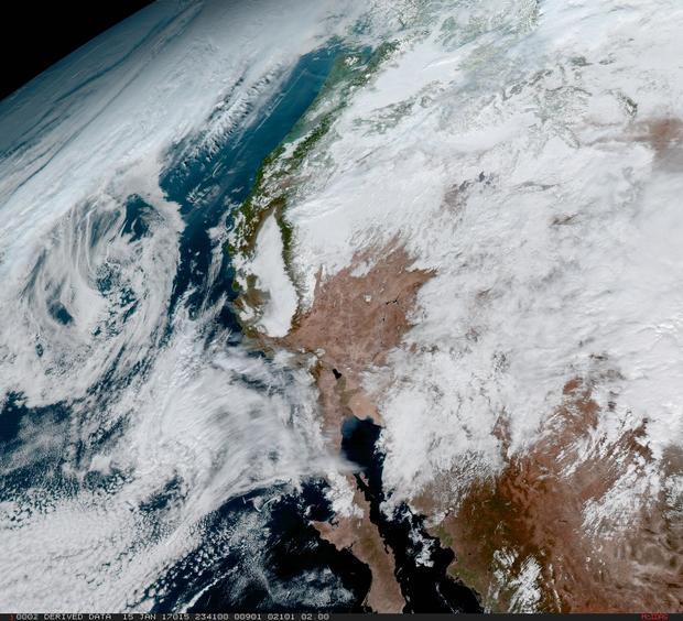
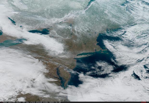
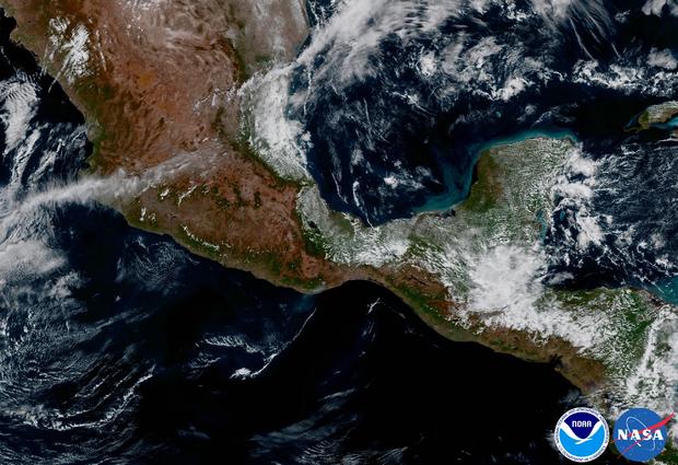
This 16-panel image shows the continental United States in the two visible, four near-infrared and 10 infrared channels on ABI. These channels help forecasters distinguish between differences in the atmosphere like clouds, water vapor, smoke, ice and volcanic ash. GOES-16 has three-times more spectral channels than earlier generations of GOES satellites. (credit: NASA/NOAA)This image clearly shows the significant storm system that crossed North America that caused freezing and ice that resulted in dangerous conditions across the United States on January 15, 2017 resulting in loss of life. GOES-16 will offer 3x more spectral channels with 4x greater resolution, 5x faster than ever before. (credit: NASA/NOAA)The Saharan Dust Layer can be discerned in the far right edge of this image of Earth. This dry air from the coast of Africa can have impacts on tropical cyclone intensity and formation. GOES-16's ability to observe this phenomenon with its 16 spectral channels will enable forecasters to study related hurricane intensification as storms approach North America. These additional channels will also enable forecasters to differentiate between clouds from dust, or snow from clouds. (credit: NOAA/NASA)In May 2017, NOAA will announce the planned location for GOES-16. By November 2017, GOES-16 will be operational as either the GOES-East or GOES-West satellite. At its current check out location the satellite captured this image of the Caribbean and Florida. Here the satellite captures the shallows waters of the Caribbean. (credit: NASA/NOAA)NOAA's GOES-16 satellite captures a view of the entire Western Hemisphere, including our neighbors here in Argentina, South America. Storms are evident in the northeast and mountain wave clouds can be seen in the southwest. (credit: NASA/NOAA)From its central location, GOES-16 captured this image of the west coast of the United States and the Baja Peninsula in Mexico. Once GOES-16 is determined to be operational as either GOES-East or GOES-West, GOES-S, the next spacecraft in the series, which is planned for launch in Spring 2018 will be moved into the other operational position as GOES-17. (credit: NASA/NOAA)On January 15, severe weather moved across the central United States before passing through the Northeast on the 16th and 17th where it resulted in wet and wintry weather for travelers across the region. (credit: NASA/NOAA)This area of Mexico and Central America is seen from GOES-16 with a largely cloud-free view. A fire and its associated smoke are evident over southern Mexico near the coast. (credit: NASA/NOAA)