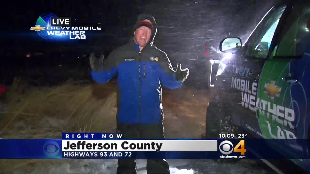
Mobile Weather Lab Finds Howling Winds In West Metro Denver
During our travels and live shots in the Mobile Weather Lab, we've come to set 50mph wind gusts as the benchmark for good TV. Why do I say "good" TV? That's the point where wind is legitimately blowing the snow sideways, you fight to stay on your feet, and, in my experience, speaking volume fights its way into the microphone. It's on these nights that the Lab, Rob McClure, and myself are in our most fundamental element – to broadcast Colorado's most extreme weather conditions.
On Monday night we drove from the CBS4 studio in Denver to Hwy 93 between Golden and Boulder. As we continued west on 6th Avenue, the wind gradually increased the closer we got to our live location. Given the downsloping pattern we had, it's no surprise that the foothills and far western metro suburbs had the fastest winds. American flags were completely slack at about 6th Avenue & Simms, eventually standing straight out by the time we reached Highway 93 at the mouth of Golden Gate Canyon.
A Winter Weather Advisory was posted from Monday night until noon on Tuesday for the Jefferson, Boulder, Larimer, Gilpin, Doulgas, and Park Country foothills. It was specifically issued for blowing snow and poor visibility, rather than accumulating snow. 700 millibar (~11,000-13,000 feet) winds were gusting from the northwest at about 50-70 miles per hour. This was caused by the departing low pressure system that brought Denver its Sunday night snowfall. As the low exited the region on Monday night, a tight "pressure gradient" was left in it's wake along the foothills and Front Range. That means the air pressure changed very quickly over relatively short distances, and the wind was the atmosphere's way of balancing out the pressure contrast.
In addition to the pressure gradient, all canyons oriented east-west created even faster winds due to something called the "Venturi effect." Essentially, air being squeezed between tighter quarters and experiencing higher velocity. Think of a river picking up speed through a narrow canyon. This gave our shot a great visual opportunity at the bottom of Coal Creek Canyon, where the winds made it as high as 54mph.
As for the rest of this week, breezy conditions are still possible in the foothills as the upper level winds continue to skim the Continental Divide. But the further east our weekend low pressure system travels, the more our winds will relax. On the plus side? Metro temperatures jump several degrees by Thursday and Friday.
Watch the latest forecast from Colorado's Weather Center:
Justin McHeffey provides nightly reports from the Mobile Weather Lab. He travels Colorado in search of Mother Nature's most powerful and beautiful conditions. Like his Facebook page Meteorologist Justin McHeffey and follow him on Twitter @WeatherMcHeffey.