Tuesday Storm Still Threatens To Bring Pockets Of Heavy Snow To Colorado
By Chris Spears
DENVER (CBS4) - If you caught our story Friday about the upcoming winter storm we showed you a few different computer forecast models including one that was calling for crazy amounts of snowfall in Denver.
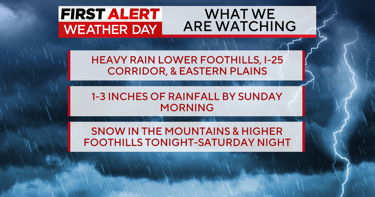
As of Saturday morning that model had backed off on the double digit amounts in the city but it still has high totals for the mountains and portions of the eastern plains.
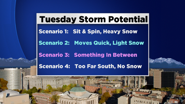
It's pretty common to see a 'flip flopping' of scenarios between computer forecast models 3-5 days before a storm arrives.
But as it draws closer we'll eventually see more of a general consensus in the model data and the forecast picture will become more clear.
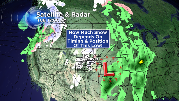
Right now most models agree that the storm will arrive late Sunday and stay in the region through Tuesday.
Where they differ are in the details of the surface low pressure, the eventual track and how long it will stick around.
If you're making plans for early next week we're pretty confident in the big picture details of this next storm, meaning it will enter the region late Sunday with much colder temperatures, rain and snow.
And we're pretty confident it will stick around through Tuesday.
But as far as who gets how much snow? Those details will become more clear over the next 24-30 hours.
Stay with CBS4 and Colorado's Weather Center for the latest forecast information.
Meteorologist Chris Spears writes about stories related to weather and climate in Colorado. Check out his bio, connect with him on Facebook or follow him on Twitter @ChrisCBS4.