Colorado Weather: Watch The Sky Sunday, A Few Severe T-Storms Are Possible North Of I-70 After 1 P.M.
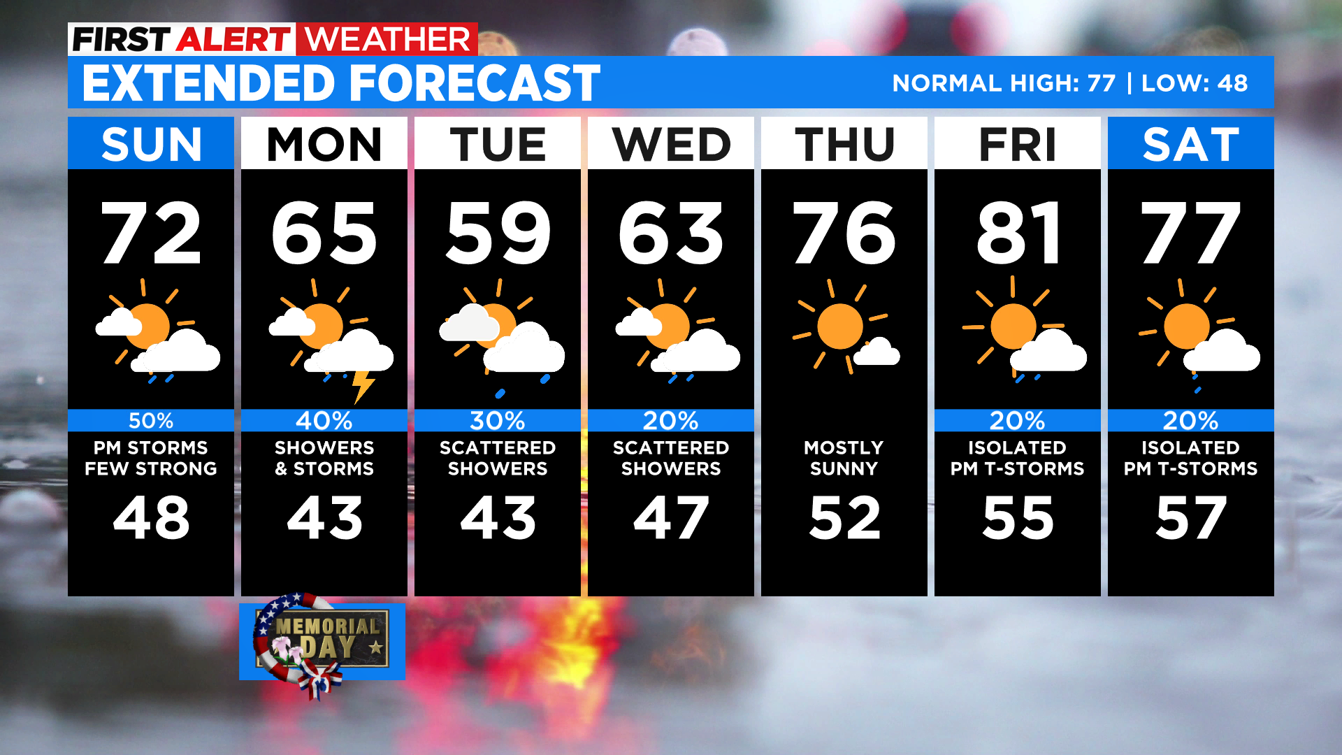
DENVER (CBS4) - A dynamic late spring storm will move into Colorado Saturday night and early Sunday with a cold front that will drop temperatures by several degrees for the last half of the holiday weekend. We'll also see high mountain snow along with lower elevation showers and thunderstorms for the next few days.
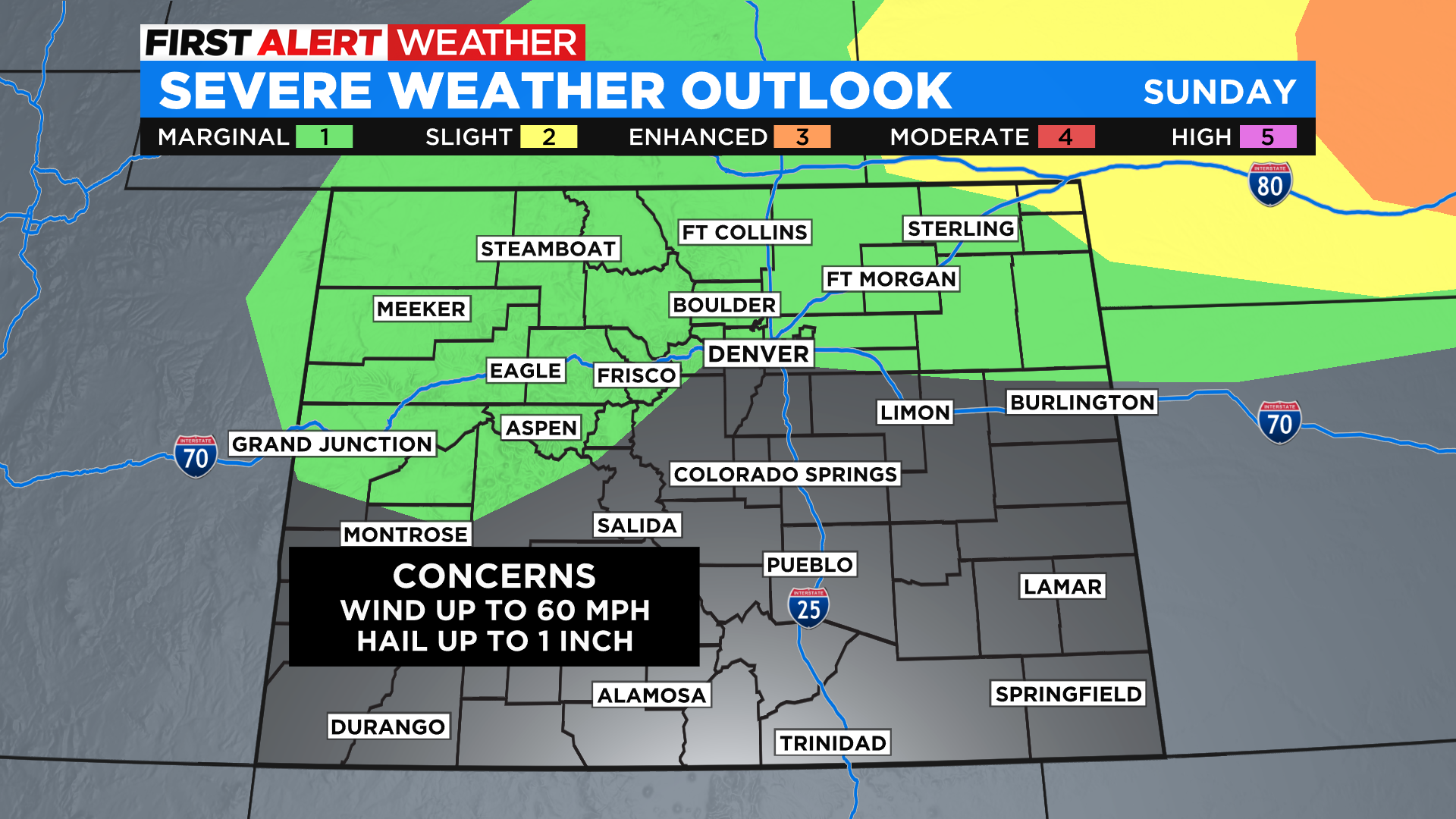
Speaking of storms, there is a marginal chance that we could see a few storms reach severe limits on Sunday. The best chance for that would be anywhere along and north of Interstate 70. If storms become severe the main threats will include wind gusts in excess of 58 mph and hail an inch or larger in diameter. But there is always a chance to see an isolated tornado.
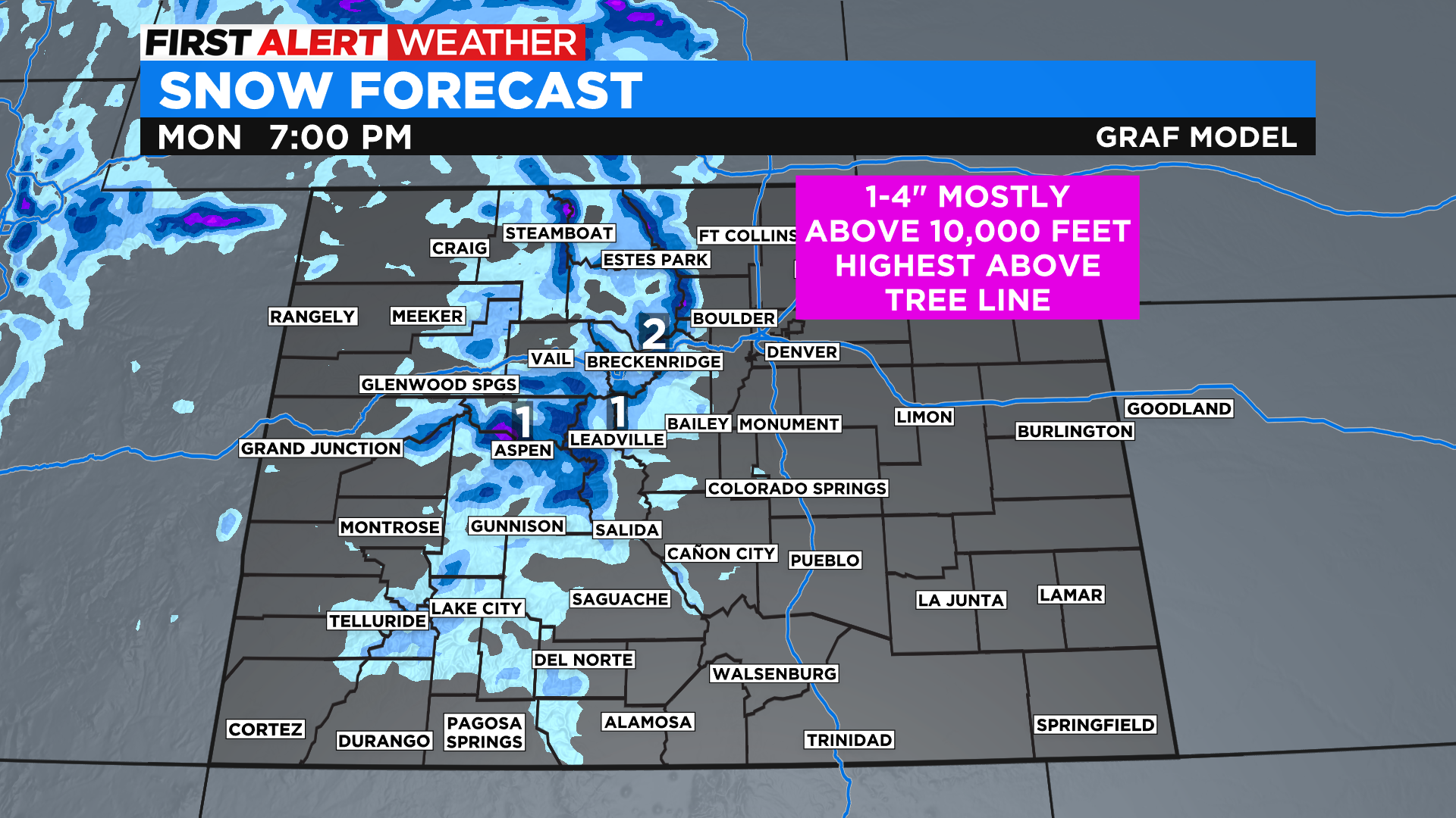
In the higher mountains it will be cold enough to see snow. mainly above 10,000 feet, where a few inches will be possible, including along Trail Ridge Road in Rocky Mountain National Park. The rain could mix with snow at times as low as 9,000 feet by Monday morning.
Memorial Day will feel much like Sunday except it will be even cooler across the state. Showers and thunderstorms will remain in the forecast for the lower elevations along with snow showers in the higher mountains. It won't rain or snow the entire day but it will be cloudy and there may be a few rounds of rain and snow.