Recent Dust Storms Changed The Albedo Of Colorado's Snowpack, Accelerating Spring Melt
DENVER (CBS4) - If you've been to the mountains lately, specifically, to elevations above 9,500 feet with snowpack, you may have noticed the snow looked dirty. In the webcam image below, snapped Tuesday afternoon from Vail's Blue Sky Basin, you can see the brown tint on top of the snow.
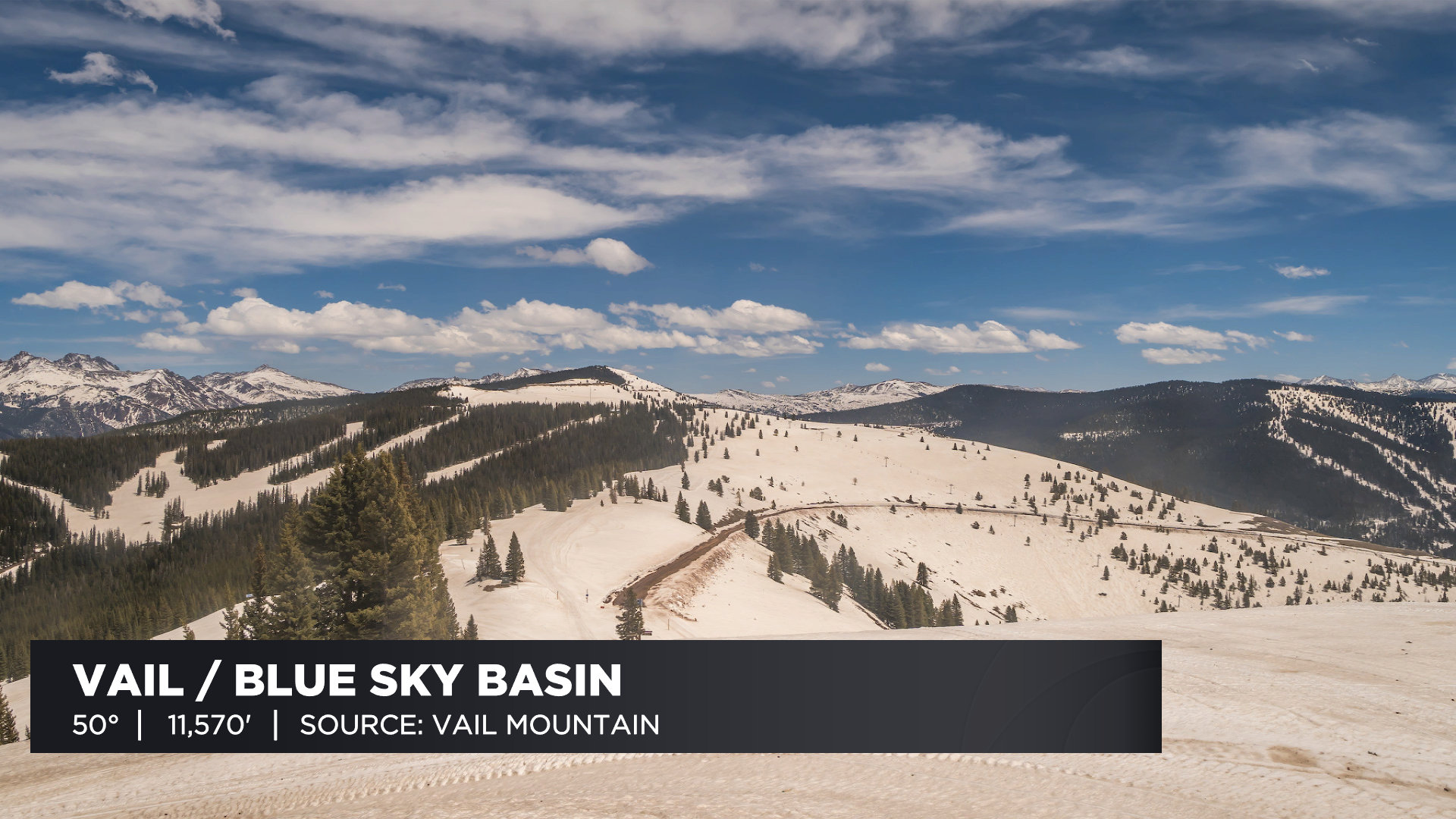
That brown color is a layer of dust that accumulated during recent high wind storms. The dust came from the dry landscape of the southwestern United States. Adding a substance with a darker color to the top of snow isn't good when it comes to the spring melt. To understand this we need to introduce you to the term albedo.
Albedo is a measure of the amount of sunlight reflected back from an object. Fresh snow has one of the highest albedo values of any substance on Earth. It can reflect as much as 95 percent of sunlight. This is why you squint and need sunglasses on a clear morning after a fresh snow.
RELATED: Colorado Snowpack Is Below Normal For Mid-May As Rate Of Snowmelt Increases
But the addition of widespread dust to Colorado's snowpack has changed the albedo considerably. In some cases the albedo is estimated to be more like that of dry soil. The lower albedo means that the snowpack is retaining more of the incoming solar energy, which is helping to speed up the melt.
The changing albedo isn't the only factor working to accelerate the spring melt in Colorado. Both the lack of snowstorms and above normal temperatures are also playing a big role.