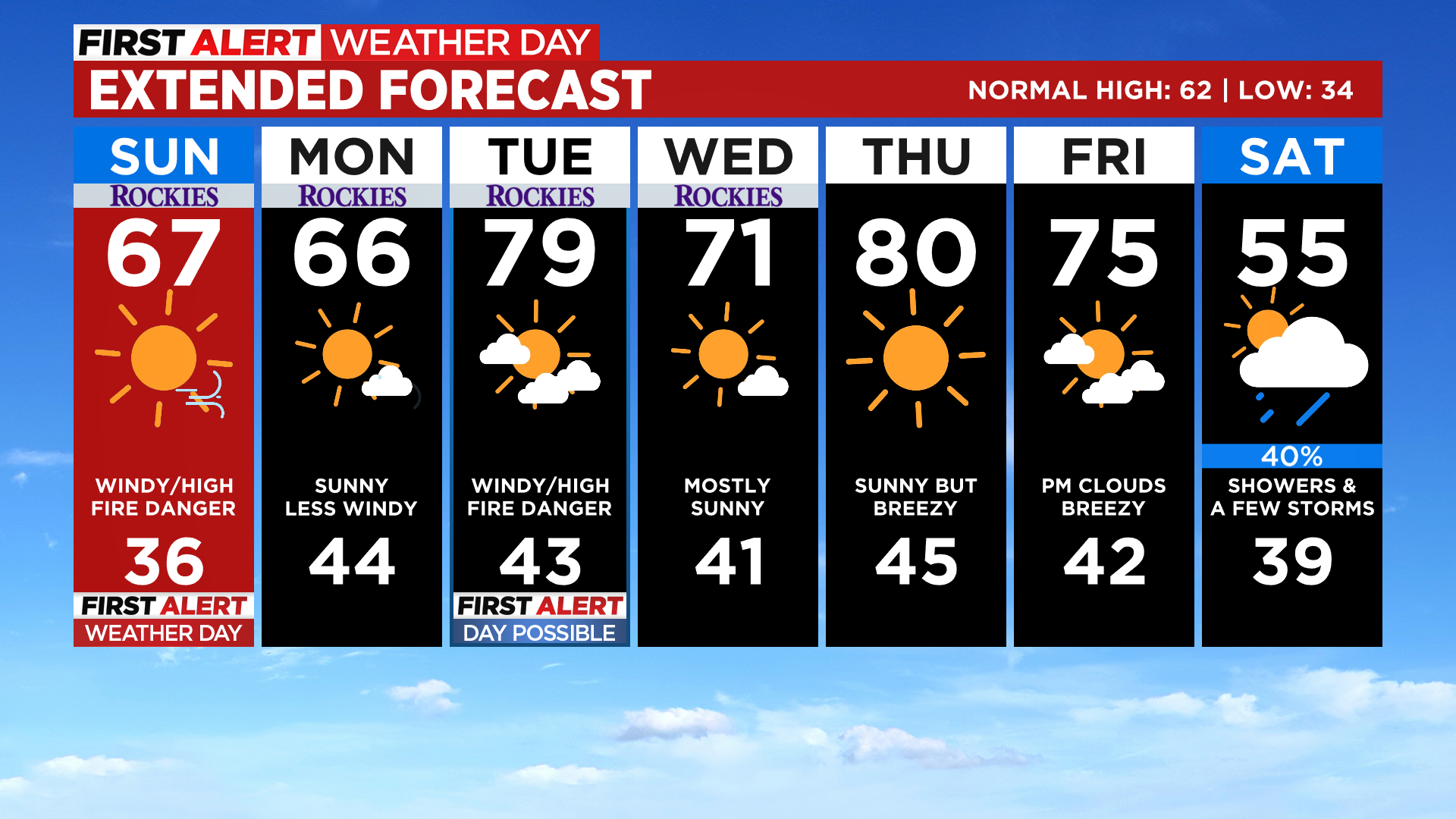
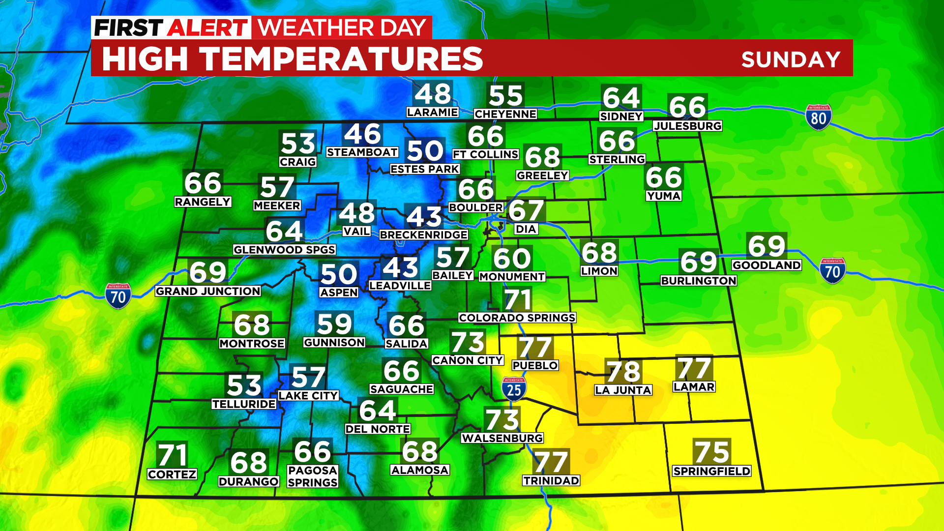
Colorado Weather: Gusty Wind And Warm Temps Will Create High Fire Danger Easter Sunday
DENVER (CBS4) - Happy Sunday and Happy Easter to you! If you have some egg hunts planned for this afternoon get ready for a lot of wind. Thankfully it will be warmer as compared to yesterday.
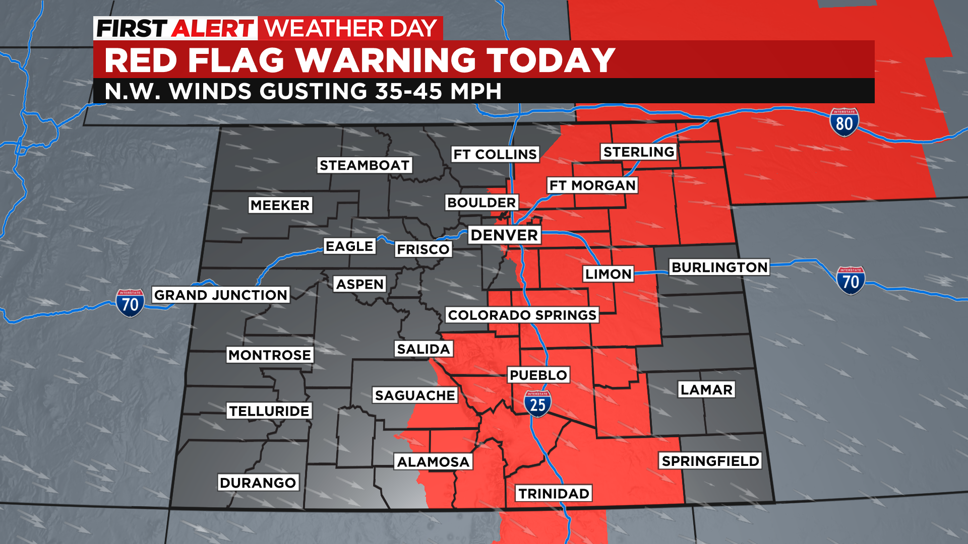
A First Alert Weather Day is in effect Sunday due to another Red Flag Warning for high fire danger for the Denver metro area south along the Interstate 25 corridor including the San Luis Valley into northern New Mexico from noon to 8pm Sunday.
Overnight a weak weather system passed through Colorado and it brought some light snow to the northern and central mountains. Parts of the foothills and the Denver area saw a little light rain.
The trend for the week ahead will be for warmer and drier air to overtake the state. It will also be windy with speeds on both Sunday and Tuesday looking particularly high. This will keep fire danger at the top of our minds for a large part of the state.
Temperatures over the next several days will run anywhere from 10 to 20 degrees above normal for this time of year. In Denver we could see highs approach 80 degrees by Tuesday.
There is the potential to see a storm move across Colorado sometime over the upcoming weekend. It will bring some much cooler air and the potential to see some rain and snow. The details are a little uncertain at this point because it is still so far away, but depending on the exact track and timing, we could even see a round of thunderstorms in some areas. Until then we'll be talking about high fire danger just about each and every day for a large part of the state.