Winter Returns: Denver Experiences Record Cold, The Mountains Get Big Snow
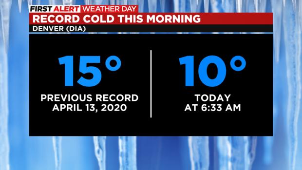
DENVER (CBS4) - The official thermometer for Denver recorded 10 degrees Wednesday morning which breaks the previous record low temperature for April 13 by 5 degrees.
That's unusual. Most record temperatures are broken by 1 or 2 degrees. The fact the record was broken by 5 degrees is further proof how unusual it is to be so cold in mid-April.
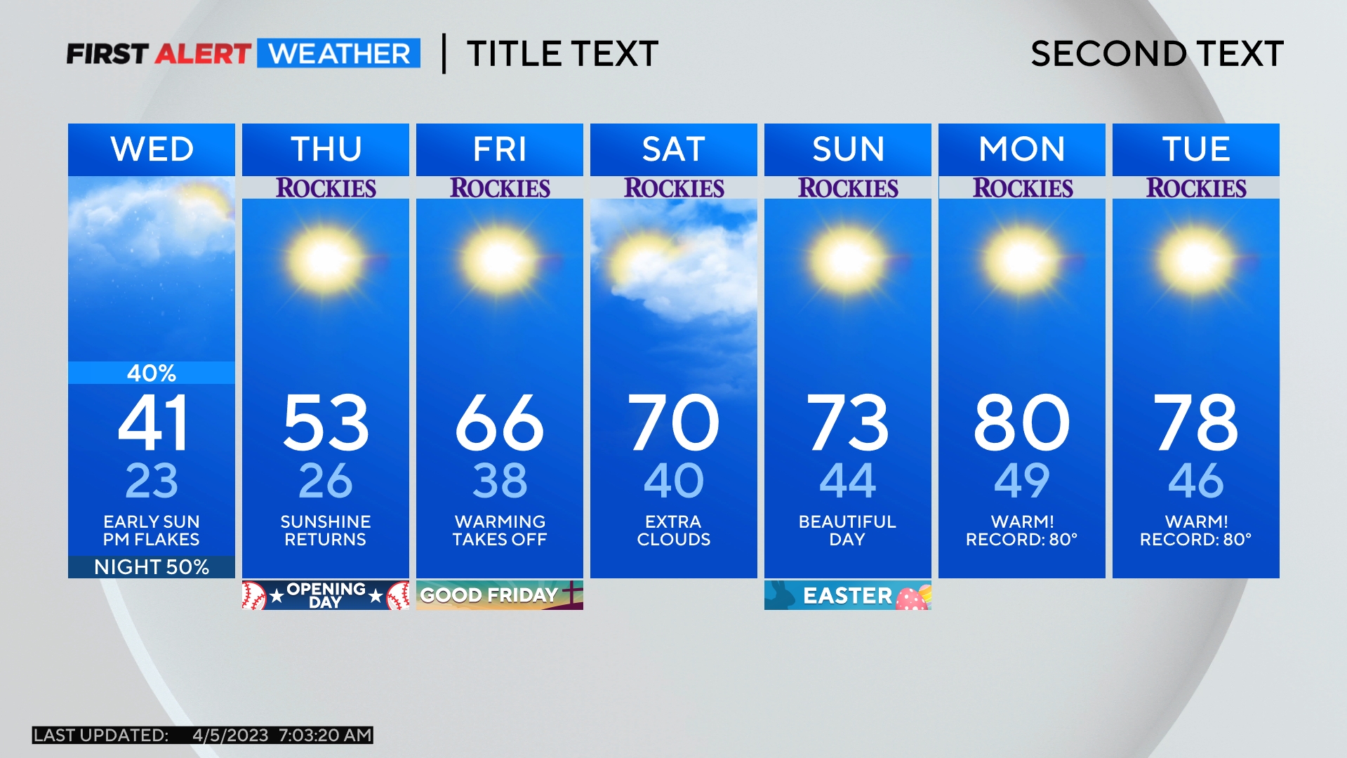
The rest of Wednesday will remain a First Alert Weather Day for Denver and the entire Front Range due to the combination of cold temperatures and gusty northerly winds. Air temperatures will eventually reach the lower 40s around Denver, Boulder, and Fort Collins Wednesday afternoon but the wind chill will be at least 10 degrees colder throughout the day.
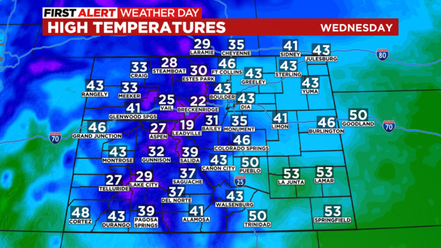
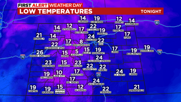
Wednesday night and early Thursday morning will also be cold. Most of Colorado will be in the single digits and teens. With enough cloud cover and wind, the metro area may stay in the lower 20s. But if the wind decreases enough, teens will be more likely.
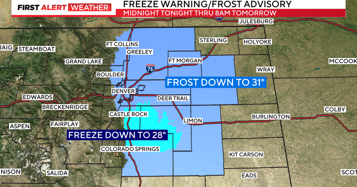
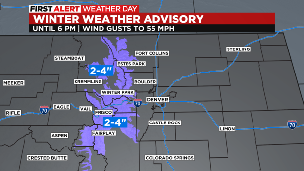
In the mountains, a Winter Weather Advisory continues until 6 p.m. Wednesday for the I-70 corridor between Georgetown and Copper Mountain. The Winter Park area and the mountains of Rocky Mountain National Park are also included. Total additional accumulation will average 2-4 inches along with wind gusts up to 55 mph causing blowing and drifting snow.
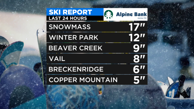
The additional snow on Wednesday will be on top of what fell Tuesday and Tuesday night which was impressive.
Snowmass measured 17 inches just before their closing weekend.
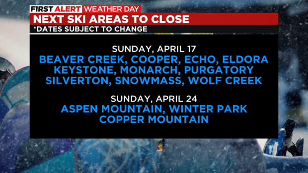
In addition to Snowmass, 9 other ski areas are set to close for the season on Easter Sunday including Keystone, Beaver Creek, and Eldora. A few more will close the following Sunday including Aspen Mountain, Winter Park, and Copper Mountain on April 24.
None of the mountain snow is expected to reach Denver and the Front Range which is unfortunate from a fire danger prospective. With more mostly dry weather through the weekend and a warming trend starting Thursday afternoon, fire danger is likely to be headlines for awhile.
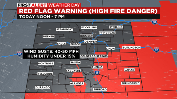
For Wednesday, the highest fire danger will be limited to southeast Colorado again. There is a Red Flag Warning from 12 p.m. until 7 p.m. for cites like Colorado Springs, Pueblo, La Junta, and Lamar.
The next chance for any moisture in the metro area will be Saturday night into Easter Sunday. At this time, the chance is no higher than 10-20%. In order words, don't count on it!