Denver Weather: From Near 80 Degrees To Snow In 24 Hours
DENVER (CBS4) - Monday will be the warmest day of the year so far along the Front Range and throughout most of Colorado. Then a spring storm will bring dramatic change on Tuesday.
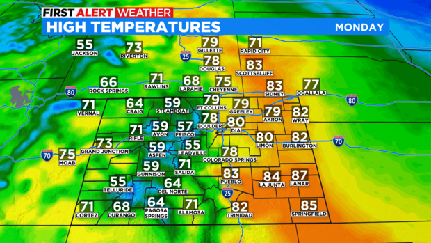
The warmest weather in the state on Monday will be in the southeast Colorado where a few places will come close to 90 degrees. Denver and most of the Front Range will reach the upper 70s to around 80 degrees. It will be the warmest day in Denver since November 6, 2021 when the city reached 80 degrees.
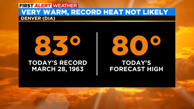
Although it will be warm, record heat is not likely in the metro area. The record high temperatures in Denver for March 28 is 83 degrees from 1963.
Other areas have a better chance of at least tying the daily record. For example, the existing record in Fort Collins is 80 set in 2015 and the record in Boulder is 78 set in 1986.
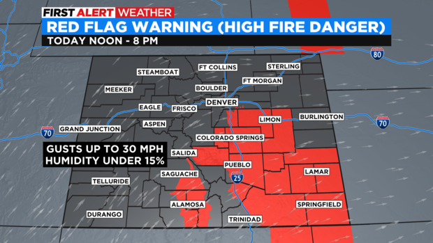
Regardless, Monday will be a very warm day for March and the warm weather will combine with occasionally gusty wind, low humidity, and dry soil to elevate the first danger. The most critical fire danger is across southeast Colorado, in the the San Luis Valley, and along the Palmer Divide including Castle Rock. These areas are under a Red Flag Warning from 12 p.m. until 8 p.m. Monday.
Then a storm system coming from the West Coast will bring significant chance statewide for Tuesday including a 25 degree temperature drop. Because of the abrupt change, the CBS4 Weather Team has declared Tuesday a First Alert Weather Day.
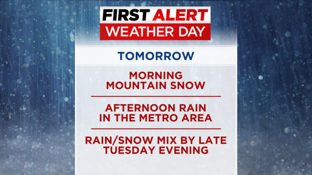
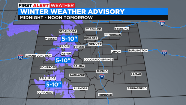
Rain and snow will develop over the Western Slope by midnight Monday night followed by snow spreading across the mountains along and south of I-70 by daybreak on Tuesday. Mountain areas west and southwest of Vail Pass are under a Winter Weather Advisory for 5-10 inches of snow.
The moisture will reach east into the Denver, Boulder, and Fort Collins areas during the day on Tuesday. There is a chance for rain showers in the morning followed by a much better chance for rain during the afternoon and evening. A few rumbles of thunder will also be possible.
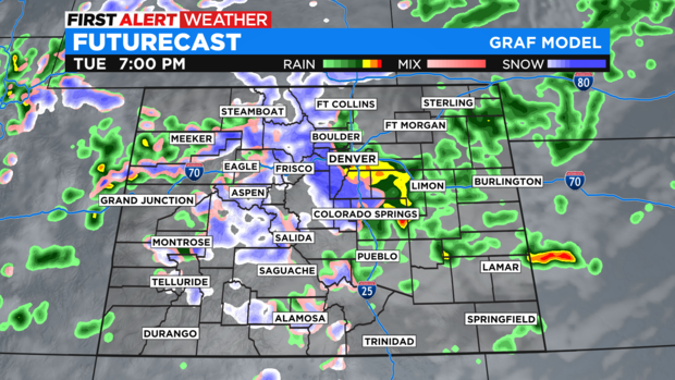
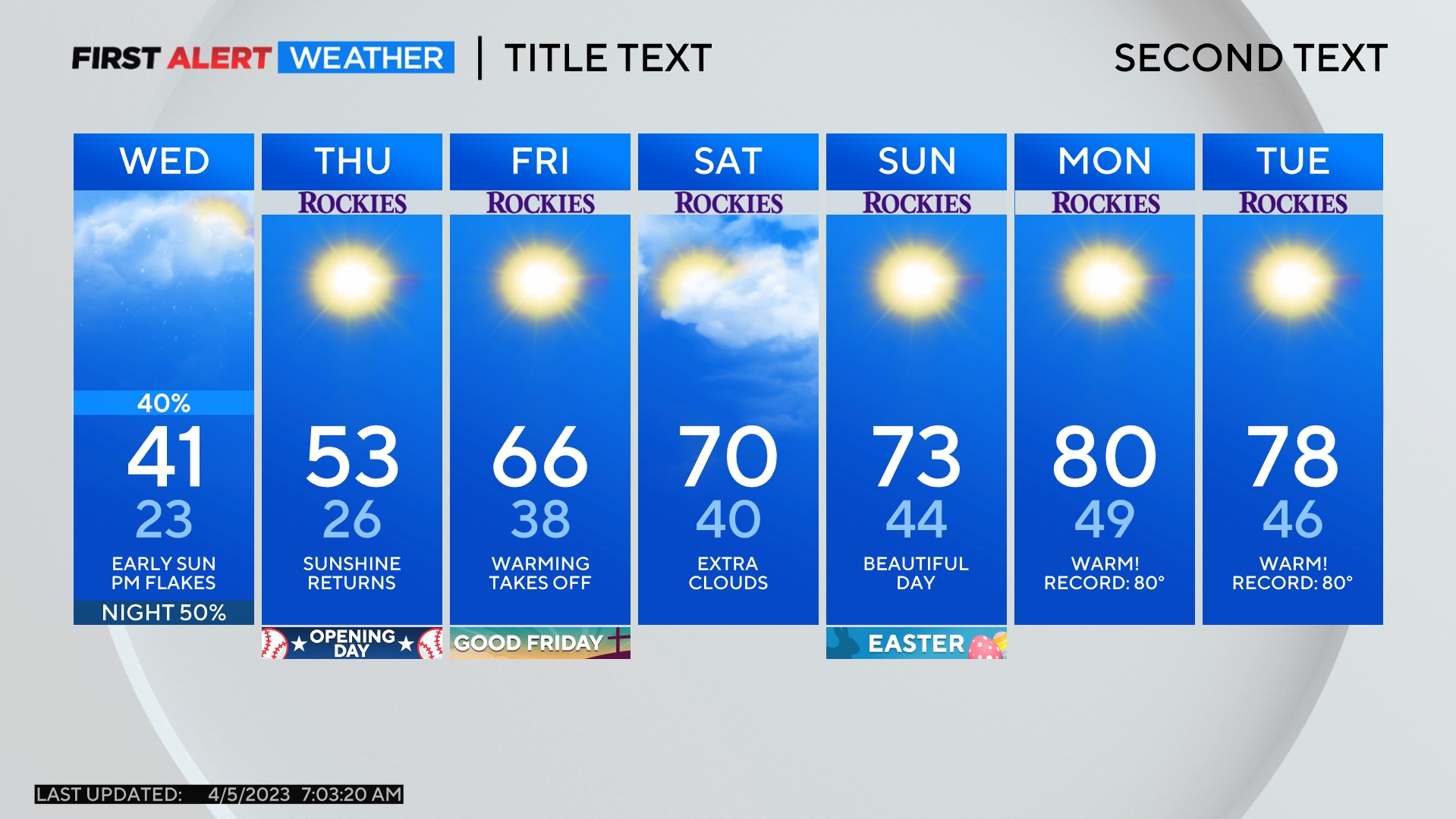
By late Tuesday evening, snow will mix with rain and eventually the precipitation should become all snow along the urban corridor. By that time, moisture will be limited and the CBS4 Weather Team expects no more than 1 inch of snow in the metro area by Wednesday morning mainly on the grass, rooftops, and vehicles - not on most roads.
The remainder of Wednesday should be dry but cool. Thursday should be mainly dry and a bit warmer before another storm arrives Thursday night into Friday. Most of the moisture at the end of the week will be in mountains but there is a 50% chance for rain or snow in the metro area on Friday.