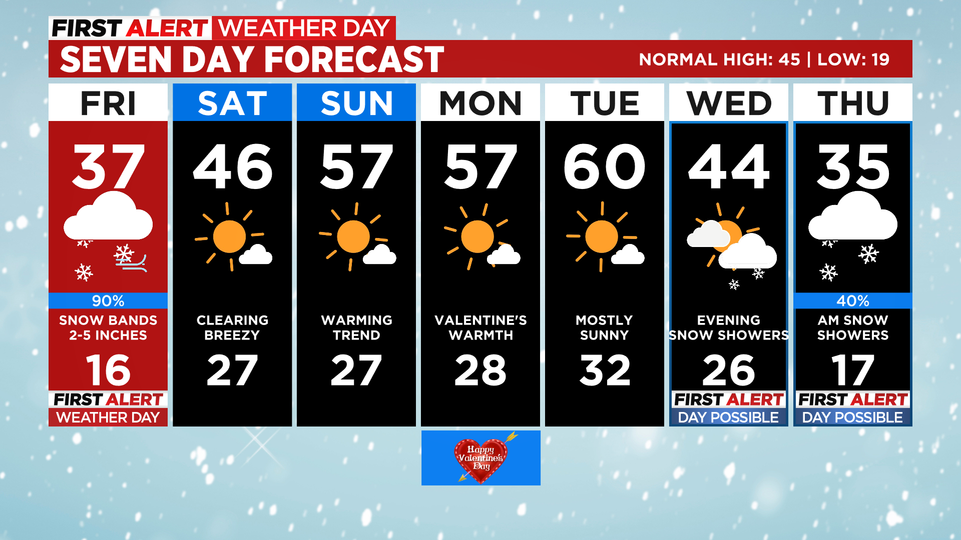
Denver Weather: Snow Bands Into Evening, Heaviest Around Afternoon Rush Hour
DENVER (CBS4) - A strong cold front moved into Colorado early Friday morning with much colder air and gusty north winds. A secondary surge of even colder air will filter into eastern parts of the state over the course of Friday afternoon.
The secondary front fired up snow bands over northern Colorado late Friday morning with accumulation reported on grassy areas in Loveland and Fort Collins as of noon. Those bands will sag into metro Denver by the afternoon rush hour.
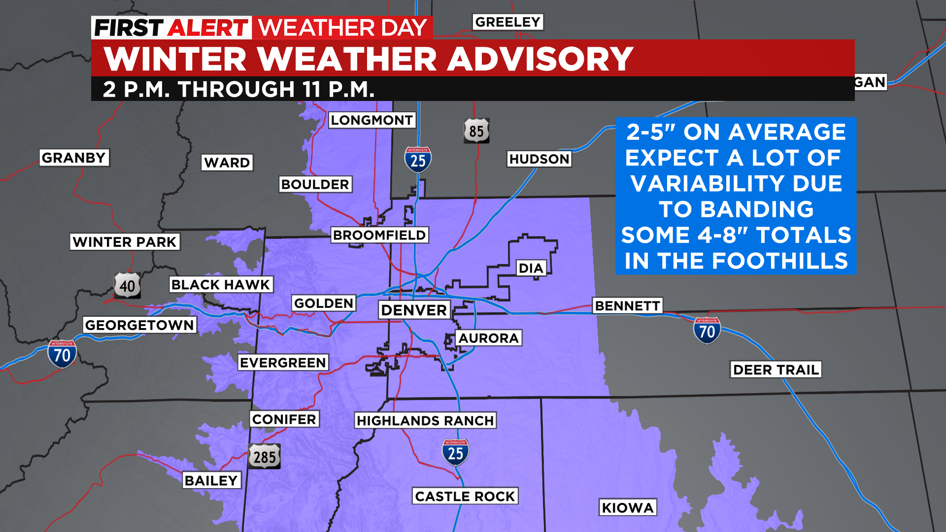
The National Weather Service has issued a Winter Weather Advisory for Denver and the foothills of Boulder County, Jefferson County and Douglas County. The advisory extends down Interstate 25 all the way to New Mexico.
Areas in the advisory should see average snow totals in the 2 to 5 inch range. Some totals in the 4 to 8 inch range will be common in the foothills. There will be some areas in the advisory that get less than 2 inches of snow. A few places in metro Denver could exceed 5 inches if any persistent bands develop.
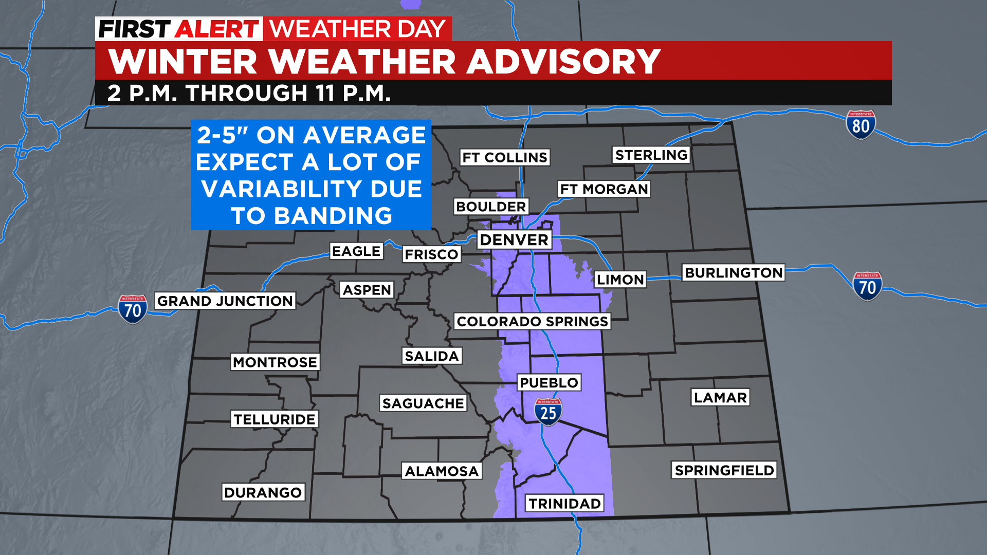
This storm won't really have a lot of impact in the mountains, especially west of the Continental Divide. The bulk of the snow will be along and just west of Interstate 25. We will see some light snow on the far eastern plains, mainly in areas along and south of I-70.
The sun will be back on Saturday along with a warming trend. Highs in Denver will be back into the 40s with 50s likely on Sunday. It will stay dry and mild right through Valentine's Day. Our next storm is expected by Wednesday into Thursday of next week.