Denver Weather: Slick Roads And Sidewalks Possible Wednesday
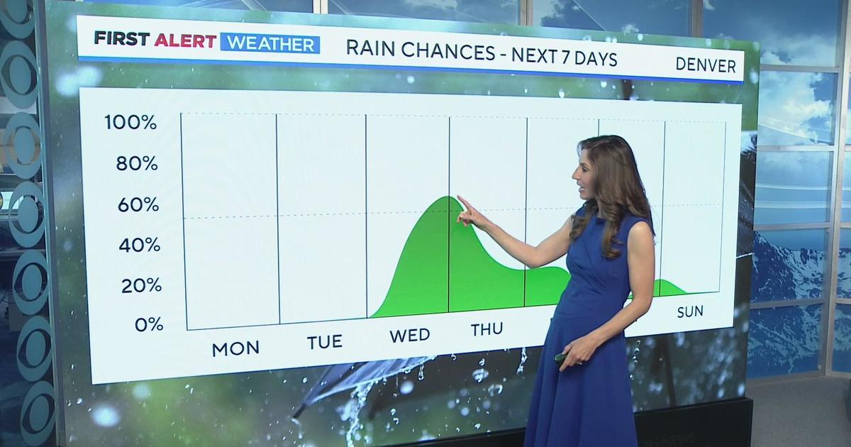
DENVER (CBS4) - After another relatively mild day on Tuesday, wintry weather will quickly return for Wednesday. Temperatures will drop, light snow is possible, and areas of light freezing drizzle will develop causing slick and icy conditions.
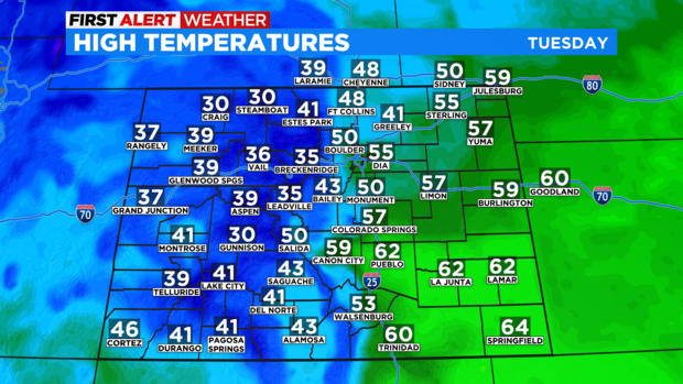
Before the wintry weather arrives, Tuesday will be mostly cloudy, dry, and warmer than normal again for January. It won't be as warm as Monday when Denver reached 62 degrees, but high temperatures in the Denver and Boulder areas will still reach the 50s. Fort Collins, Loveland, and Greeley will be in the 40s.
Dry weather will continue through at least midnight Tuesday night. Then a chance for freezing drizzle will develop through the morning on Wednesday. And while the precipitation will be very light, there could still be enough ice to create slick conditions on roads, sidewalks, and driveways.
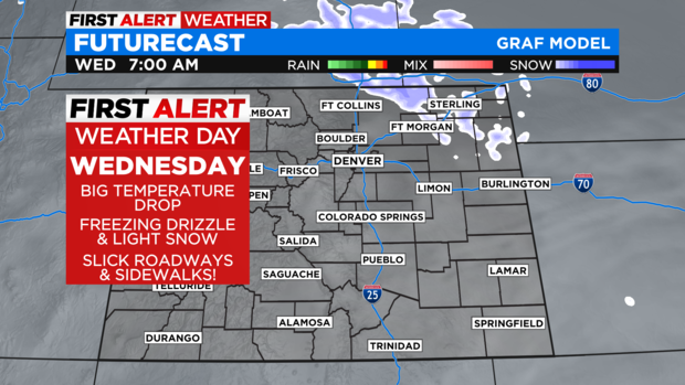
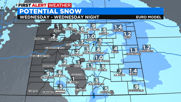
As the day progresses on Wednesday, freezing drizzle should gradually become light snow but any snow accumulation around Denver, Boulder, and Fort Collins will be very light (under 1 inch).
The mountains will get even less snow while the far Eastern Plains (east of Fort Morgan on I-76 and east of Limon on I-70) could get up to 2 inches of snow in some areas.
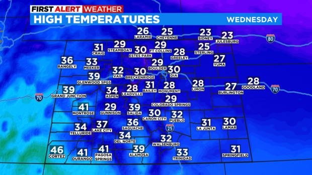
It will also be significantly colder on Wednesday with temperatures staying below freezing for most of the state including in the Denver metro area.
Looking ahead to the end of the week, Thursday will be sunny but chilly followed by another chance for snow on Friday. Just like Wednesday, any accumulation in the metro area on Friday will be very minor but the mountains should do better with at least 2-4 inches of new snow at most Colorado ski areas on Friday.