Colorado Weather: From Wildfire To Snow Storm For New Year's Eve
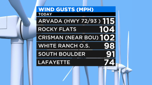
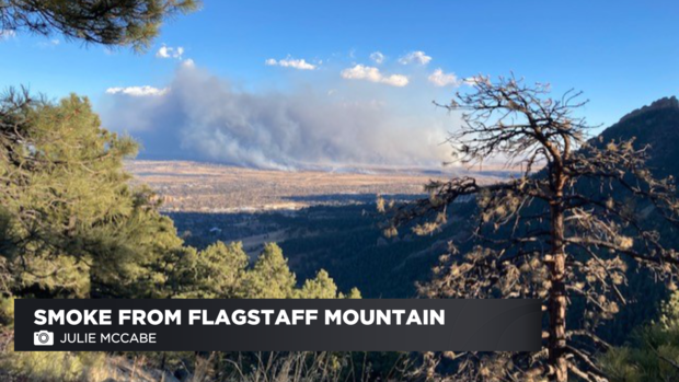
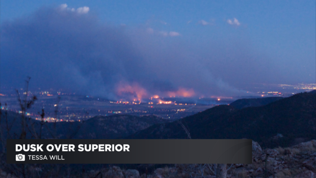
DENVER(CBS)- After hurricane force winds spark historically destructive fires near Boulder, Superior and Louisville, we have a major snow storm set to hit on New Year's Eve. Winds gusted up to the strength of a category 3 hurricane!
That was enough to knock down power lines and spark the days horrible wild fire along the Boulder Turnpike. https://denver.cbslocal.com/2021/12/30/breaking-all-residents-in-town-of-superior-ordered-to-evacuate-due-to-fire-threat/
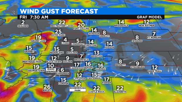
Winds not go away completely overnight Thursday into Friday but, the will weaken considerably more than what we saw earlier in the day Thursday.
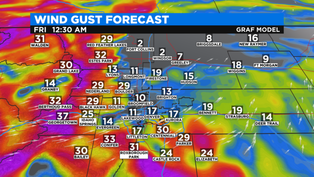
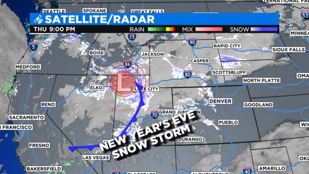
Relief is much too late but, it is on the way. A strong storm system will blast into Colorado on Friday bringing in the biggest snowfall of the season for the Denver metro area on New Year's Eve.
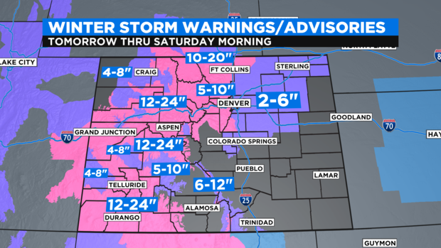
There is Winter Weather Advisory for Denver and a Winter Storm Warning for the Front Range foothills and mountains including the Boulder, Superior and Louisville areas. Those areas may see 5 to 10 inches of snow by Saturday morning with 2 to 6 inches in and around the Denver area.
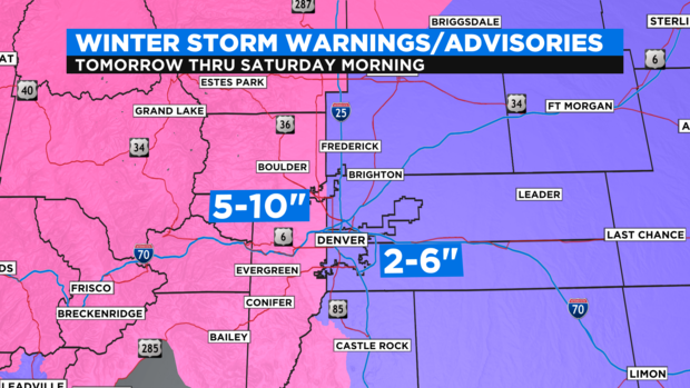
Most mountains of the state have a Winter Storm Warning in place thru New Year's Day as well. Some spots will get buried with 1 to 2 feet of snow!