Colorado Forecast: First Alert For Heavy Mountain Snow
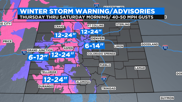
DENVER(CBS)- Get ready to rumble, if you are driving thru or plan to be in the Colorado mountains Thursday thru Saturday morning! We have two waves of snow moving in starting on Thursday morning. A deep low pressure trough and a strong storm from the Gulf of Alaska will team up for a pre-Christmas mountain blast of winter.
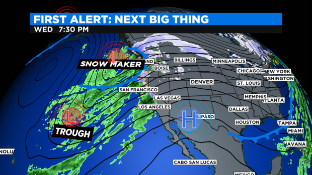
Moisture will push in Thursday and then mix in with an Alaskan snow maker that amps up the snow machine for Friday.
As far as the timing goes, Thursday's bout of snow will be light with gusty winds. At this time it looks like maybe 1 to 3 inches of snow for many of the mountains.
The heavier snow begins Thursday night into Friday when the 2nd storm system blows into the four corners area. And that's when the majority of the snow should fall.
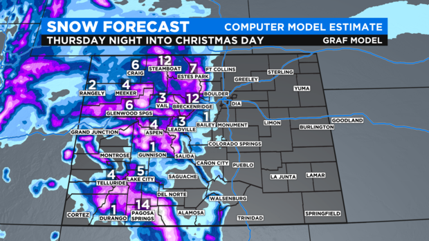
There are Winter Weather Warnings and Advisories in place for Rocky Mountain National Park down thru the mountains north of Granby over to the Steamboat area for 1 to 2 feet of snow possible. Summit County up into the Winter Park area may see 6 to 14 inches of snow by Christmas morning.
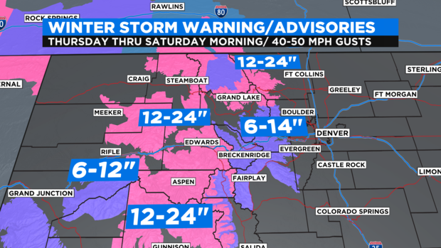
All of the Western mountains of state from Steamboat down thru Telluride may also see 1 to 2 feet of snow over the course of Thursday, Friday and Saturday morning.
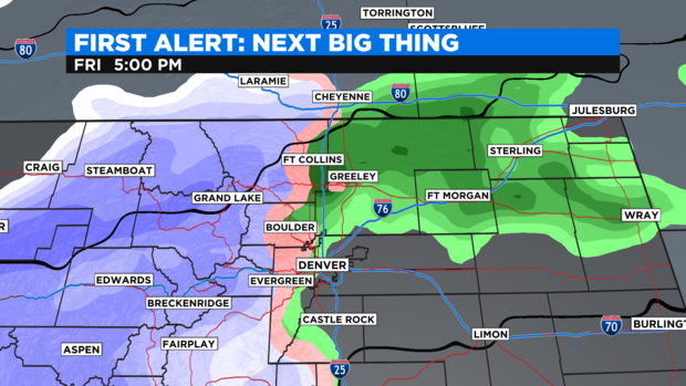
There is also a chance for a few rain showers for Denver, the Front Range and northeastern plains Friday morning and afternoon. Some of our foothill areas like Boulder, Evergreen, Conifer and Bailey might pick up a little rain/snow mix on Friday.
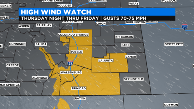
Ahead of the pre-holiday change there will also be a bit of wind kicking up with mild temperatures for the eastern plains including Denver. The strongest winds however, will be in southern Colorado where there is a High Wind Watch from Colorado Springs down to Trinidad and over to La Junta Thursday night into Friday.