Denver Weather: High Fire Danger For The First Day Of Winter
DENVER (CBS4) - The first day of winter along the Front Range will bring critical fire danger to many areas thanks to more unusually mild and dry weather. The highest danger is in the foothills where westerly winds could gust up to 65 mph at times.
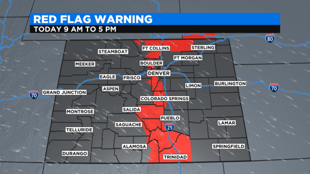
It's no coincidence the foothills are a under a Red Flag Warning until 5 p.m. on Tuesday since that's the region where the strongest wind will be found. The warning includes all areas between 6,000 and 9,000 feet in Jefferson and Boulder Counties. The warning also includes all of Larimer County including Fort Collins and the northern third of Weld County including Briggsdale and Pawnee National Grassland area.
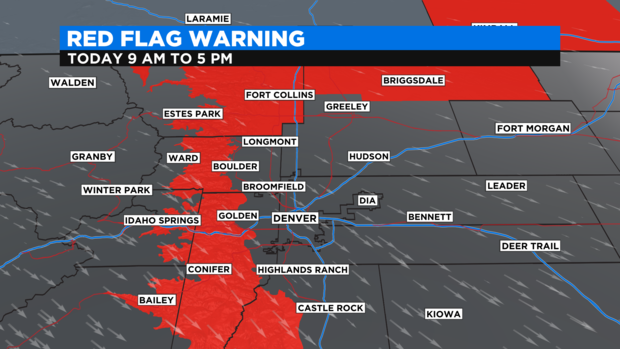
Many areas farther south are also under a Red Flag Warning on Tuesday including the Cripple Creek/Victor, Cañon City, Walsenburg, and Trinidad. If a fire were to start in any of these areas, it could spread very quickly.
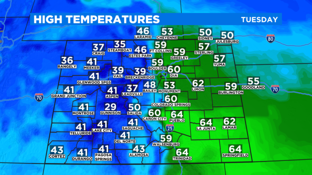
The high fire danger is due to the combination of very dry soil, low relative humidity, gusty winds, and unusually mild temperatures for late December. High temperatures for Denver and most of the I-25 urban corridor in Colorado will be about 15 to 20 degrees above normal on Tuesday.
Similar weather is expected for Wednesday and Thursday with additional Red Flag Warnings likely. Then cooler weather for Christmas Eve and Christmas Day should lower the fire danger but it won't be necessarily wetter at lower elevations. Ample snow in the mountains will have an extremely difficult time moving on the plains and therefore most lower elevations will stay dry through the holiday weekend.