Snowless In Denver: Fingers Crossed We Can Muster Up Some Flakes Tuesday Night
DENVER (CBS4) - It's been more than 200 days since Denver last saw a measurable snowfall at Denver International Airport. The city typically gets the first measurable snow of the season in the middle of October.
The storm track so far this year has been coming from the northwest, which favors the northern and central mountains. Some of Colorado's ski resorts have already picked up over 30 inches of snow since October.
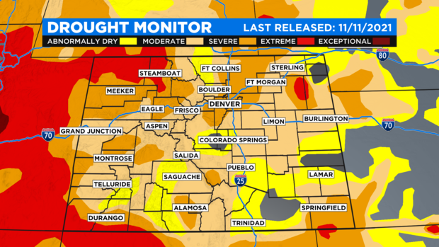
As a result of the very dry weather the drought has expanded across Colorado with some parts of the Front Range back into the severe category. There are a few pockets of extreme drought developing on the eastern plains.
Our next hope for a little rain or snow will arrive on Tuesday as a strong cold front moves into the state. It will bring a 20 degree drop in the temperature and a good chance for more snow in the mountains.
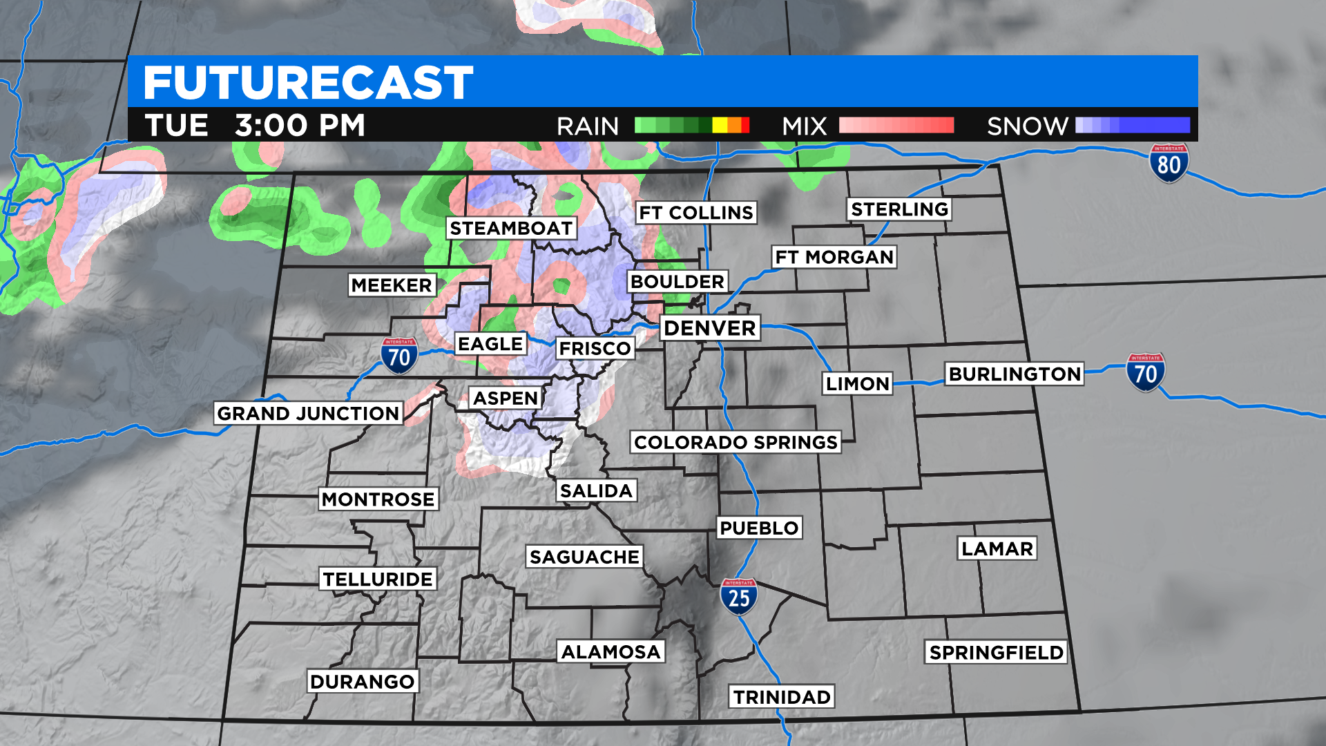
Storms that move into the state from the northwest typically don't bring much moisture to Denver, the Front Range or the eastern plains. Some computer forecast models show we have a small chance to pick up some precipitation after dark on Tuesday.
If any rain showers form they could mix with or change to snow by early Wednesday morning. Denver would need to pick up a tenth of an inch of snow at Denver International Airport for it to count as the first measurable snow of the season.
The current record for latest first snow is Nov. 21, 1934, when an inch fell at the city's weather station, which at that time was located at 19th and Stout.