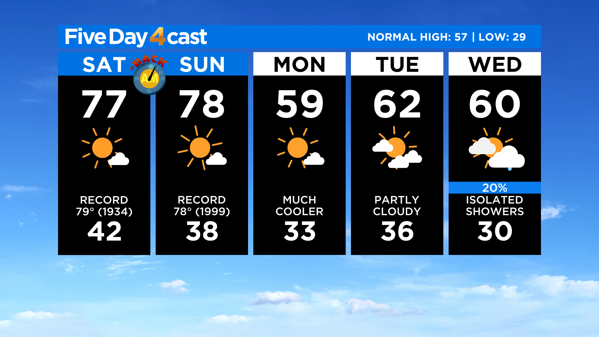
Colorado Weather: High Fire Danger This Weekend Due To Record Warmth And Gusty Wind
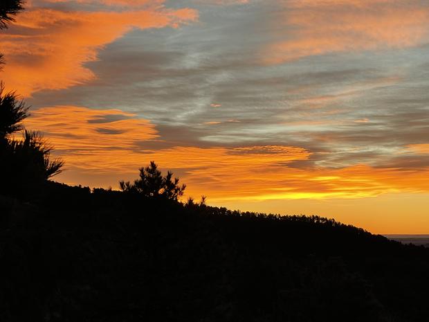
DENVER (CBS4) - It was a beautiful start to the day on Saturday around Colorado with some stunning colors just before sunrise along the Front Range. A light wind overnight kept temperatures above normal for this time of year.
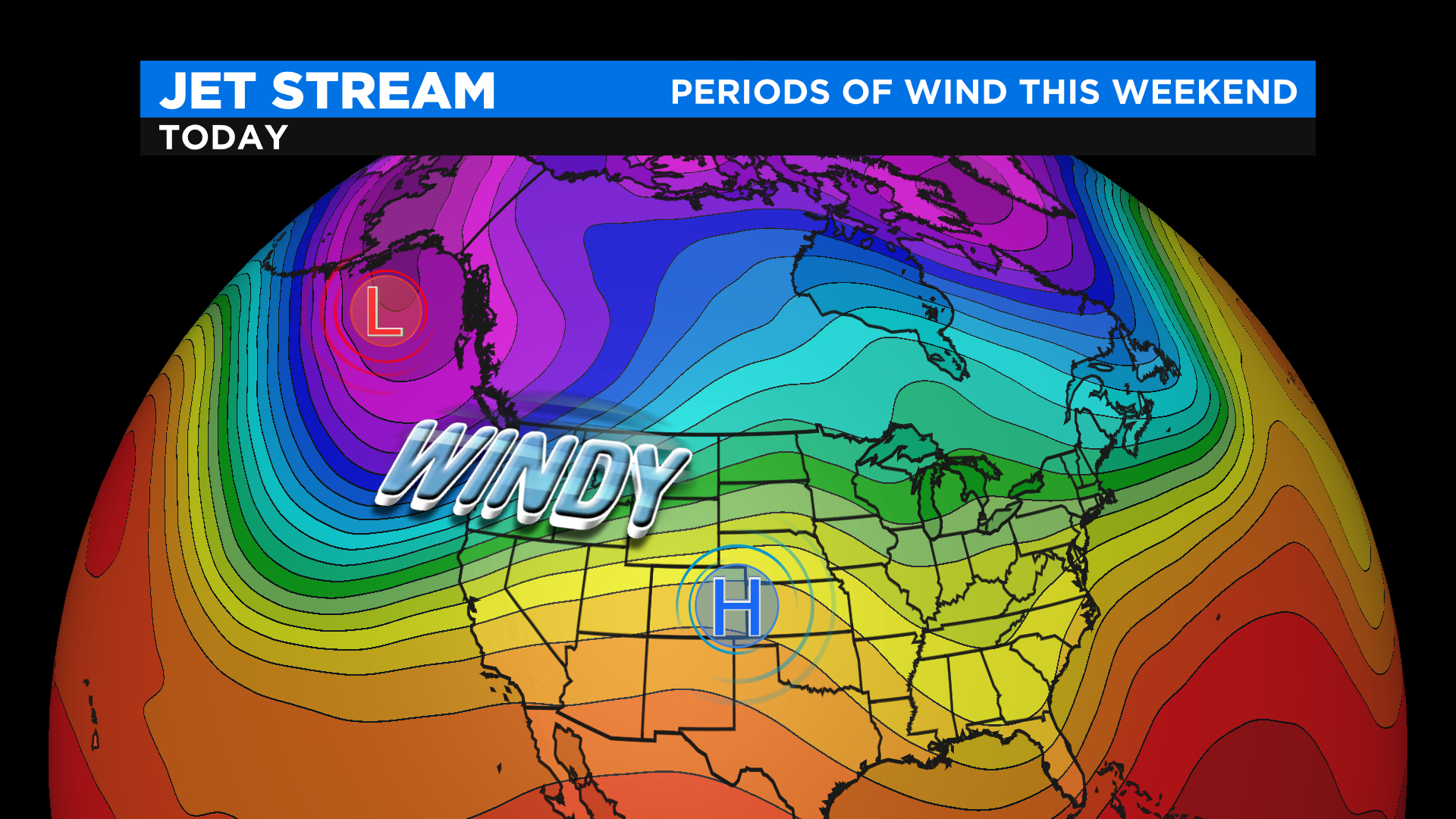
High pressure over Colorado and a powerful low pressure in the Gulf of Alaska will stir up a lot of wind this weekend. The pressure gradient in between these two systems will produce southwesterly wind gusts as high as 30 mph at times.
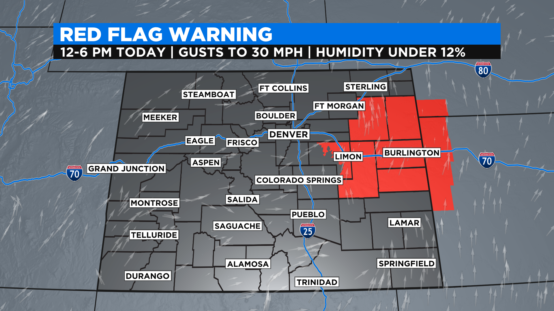
The wind will combine with the unusually warm temperatures and our ongoing drought to elevate the fire danger around Colorado both today and tomorrow. Conditions will be most extreme on the east-central plains where the National Weather Service has issued a Red Flag Warning for Saturday afternoon. We could see additional alerts issued for Sunday.
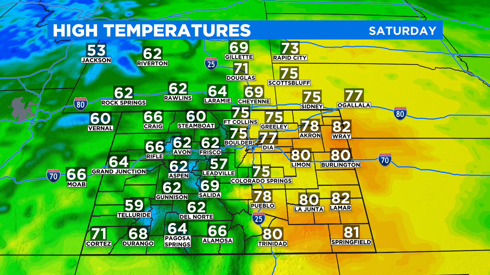
A big cool down will arrive with a cold front by late Sunday or early Monday. It will drop temperatures around Colorado by 15 to 25 degrees next week along with a slight chance for some mountain snow showers. But until then expect near record highs, and in some cases, a few new records are possible.
After the cold front on Monday we'll be tracking another storm system that should arrive around Wednesday. It looks like it will bring a better chance for some mountain snow and maybe even a few rain or snow showers to the lower elevations, including Denver!