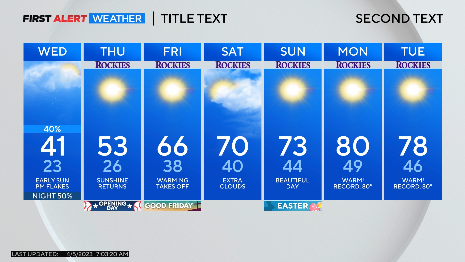
Denver Weather: Next Storm Arrives Monday Night And Looks To Be A Whimper
UPDATE: Another Disappointing Storm Considering The Drought Situation
DENVER (CBS4) - A storm moving out of the Lake Tahoe area on Monday morning will reach Colorado late Monday night. Mountain snow is likely but accumulation will be minimal. Any moisture in the Denver metro area will also be very limited.
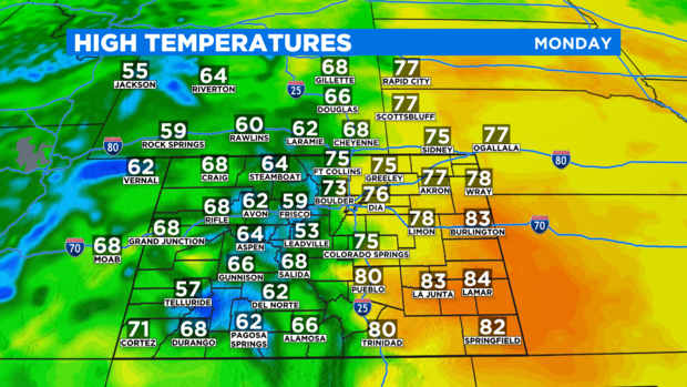
Before the storm arrives, most of Colorado will enjoy another beautiful day on Monday. It will be breezy at times but otherwise very pleasant with high temperatures in the 70s around Denver, Boulder, and Fort Collins.

Lower 80s are likely in southeast Colorado around Burlington, La Junta, Lamar, and Springfield.
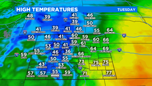
A cold front ahead of the storm will pass over Denver and the Front Range after midnight and will cause temperatures to drop about 15 degrees for Tuesday. So high temperatrure in the metro area will be slightly below normal for the third week in October with upper 50s and lower 60s.
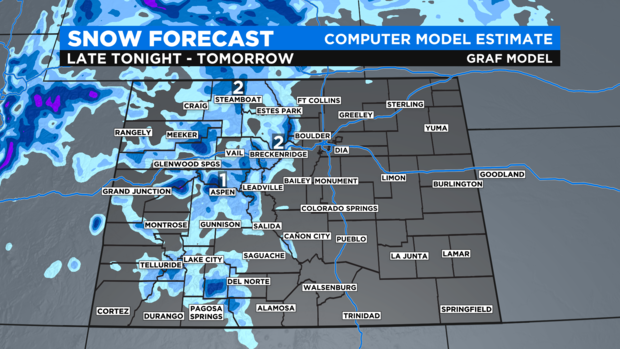
In terms of moisture, snow will spread from west to east across the mountains overnight. By early Tuesday morning, snow should be falling along sections of the I-70 mountain corridor above Georgetown but accumulation will be minor. Total snowfall by Tuesday evening will range from 1 to 4 inches with highest amounts near Rabbit Ears Pass and the Rocky Mountain National Park region.
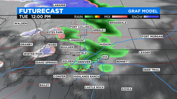
For Denver and the Front Range, a few sprinkles or very light rain showers are possible starting in the late morning on Tuesday but no measurable precipitation is expected.
The storm will quickly depart Colorado Tuesday night and the rest of the week should be mostly clear and dry. Temperatures will also return to the lower 70s on Friday and will likely stay there for at least Saturday (maybe Sunday as well!).