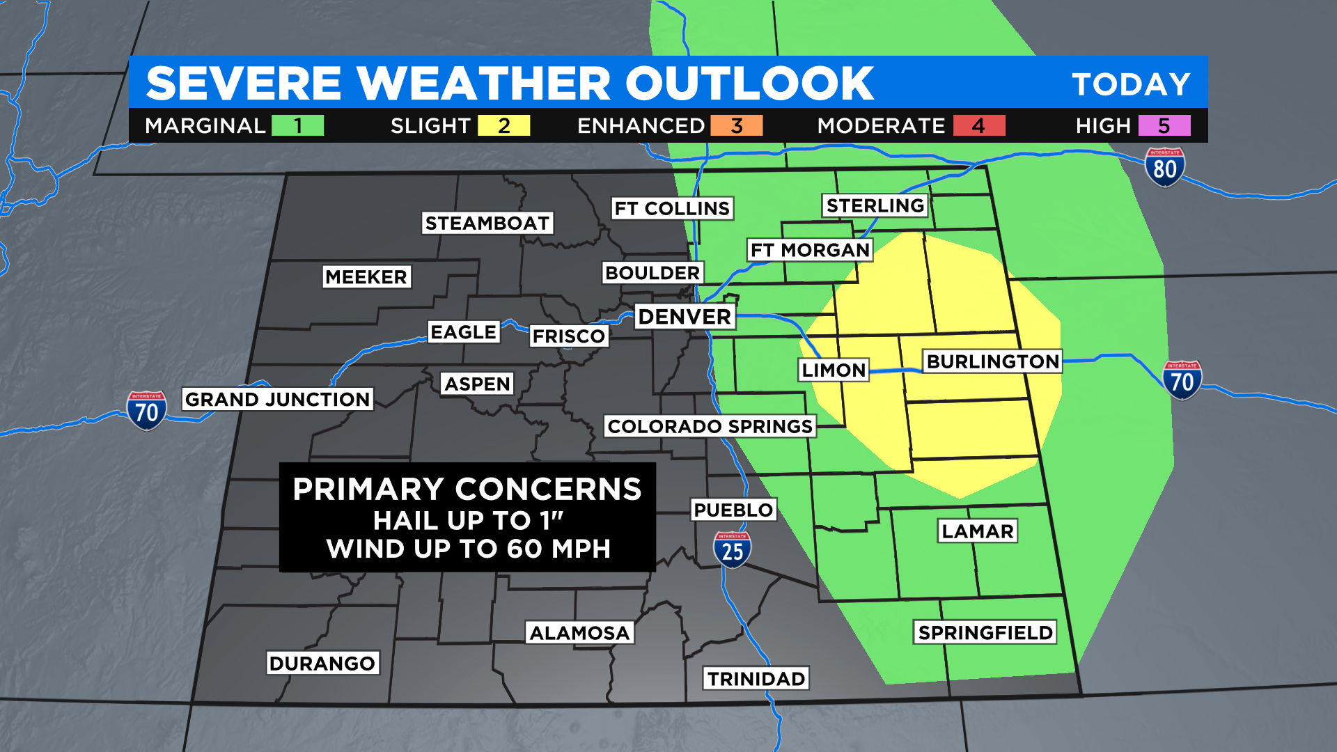
Colorado Weather: Few Severe Storms Possible Sunday, Mainly East Of I-25
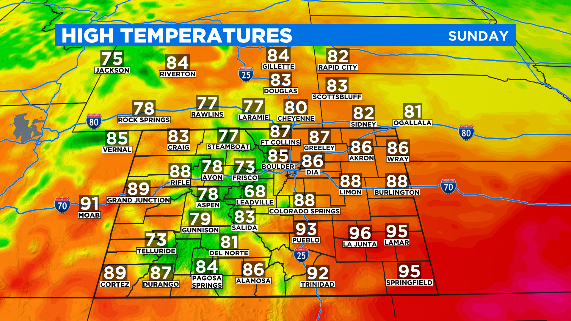
DENVER (CBS4) - The new week will start off with a little bit of active weather across the region thanks to a cool front at the surface and an area of disturbed weather in the upper atmosphere. Behind the front it'll be up to 10 degrees cooler today in Denver and on the northeast plains compared to the highs we saw on Saturday.
Low-level moisture has increased today between Denver and the northeast corner of the state. That will help trigger some showers and thunderstorms with daytime heating.
We don't talk about severe weather in September too often in Colorado, but today there is a risk for a few rowdy storms. The strongest storms will have the potential to produce hail up to an inch in diameter and wind gusts around 60 mph.
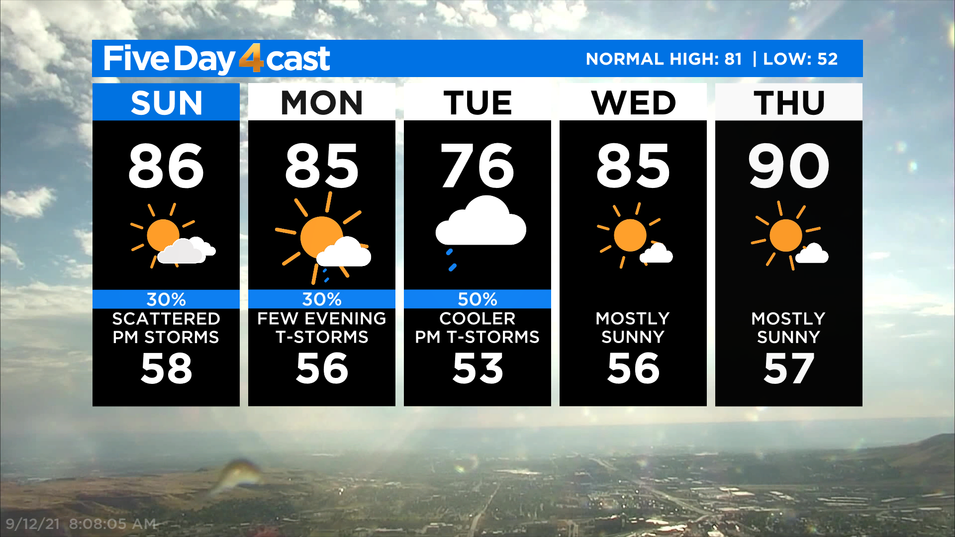
We will see another cold front approach the state sometime Monday or early Tuesday and it will bring another chance for showers and thunderstorms, along with some cooler air. But it won't last long. We are right back into dry and hot weather starting Wednesday and that trend will carry us into the upcoming weekend.