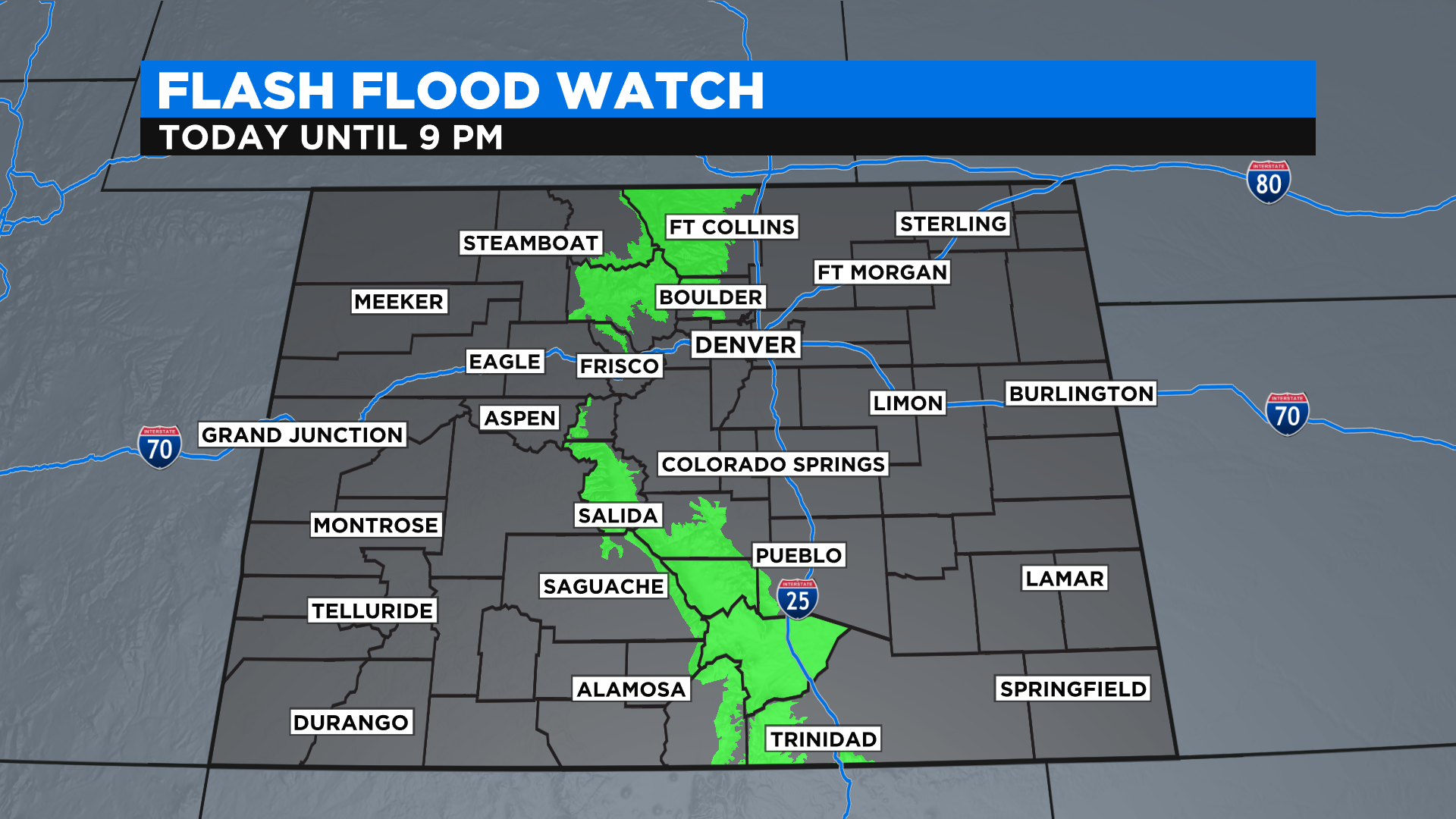
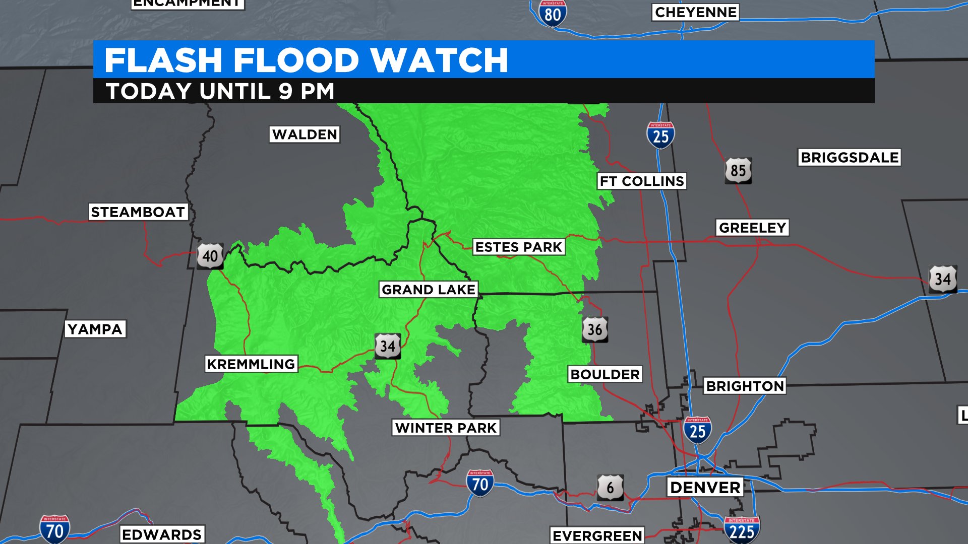
Flash Flood Watches Include Several Colorado Burn Scars Through Monday Evening
DENVER (CBS4) - A moist air mass over Colorado will combine with daytime heating on Monday to produce widespread showers and thunderstorms. When combined with light upper-level wind speeds over the state the storms will have potential to produce locally heavy rain which could lead to flash flooding.
Any location could see a problem develop, such as what happened in Greeley last Thursday when over three inches of rain fell in a short period of time. But the concern is highest over burns scars, in particular those from the past few years.
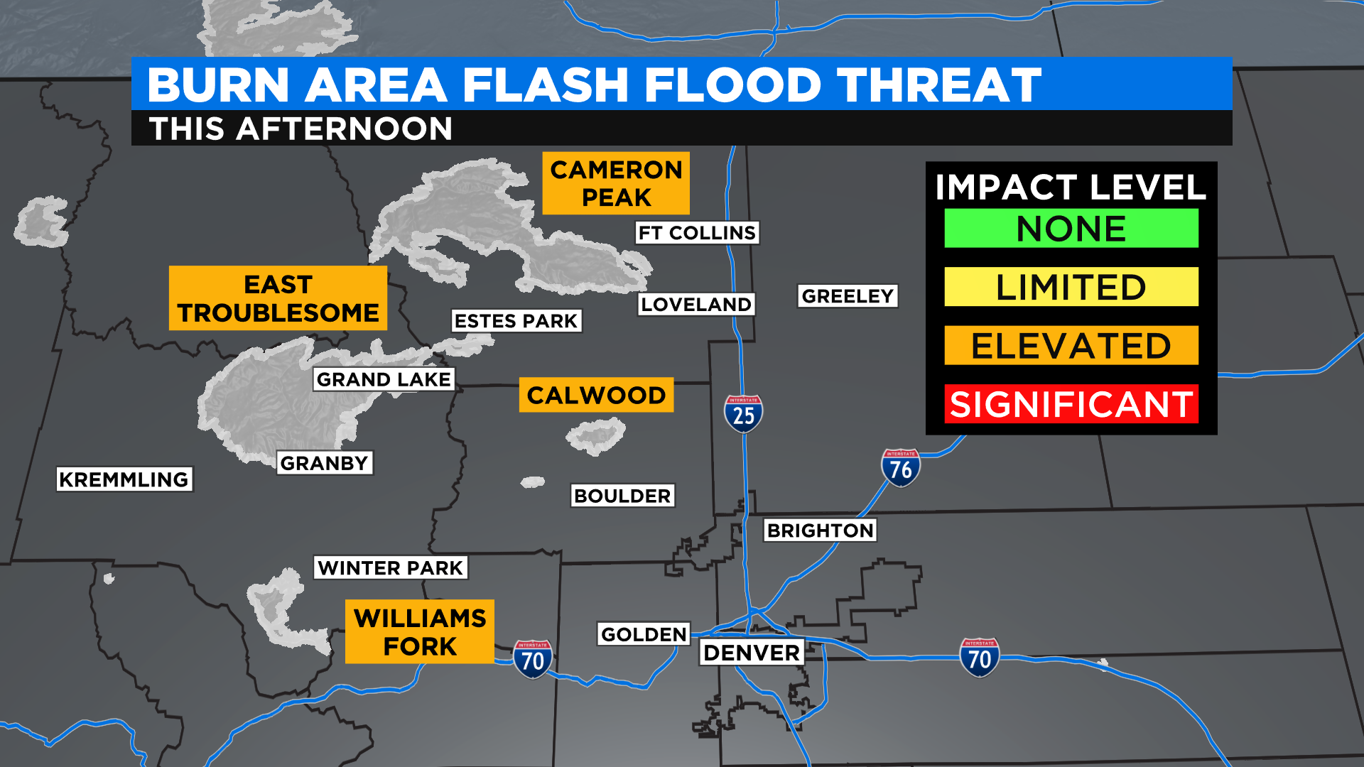
In the Front Range we're most worried about the Calwood, Cameron Peak, Williams Fork and East Troublesome fire zones. A thunderstorm produced some flash flooding Sunday afternoon just outside of Estes Park in the vicinity of Glen Haven.
As of this post on Monday morning there is not a Flash Flood Watch in effect for the vicinity of the Grizzly Creek Fire but one could be issued later in the day if a threat develops for heavy rain around Glenwood Canyon. If you have travel plans along I-70 through this part of the state we suggest getting them done early just to be safe.