Denver Weather: Earliest Stretch Of 100 Degree Heat On Record
DENVER (CBS4) - Triple digit heat is not uncommon during a Denver summer, but rarely does it happen two days in a row and it has never happened on consecutive days so early in the season until this year.
The previous record for back-to-back 100 degrees days was June 22-23, 2012. That was also the start of a 5 day stretch of 100 degree heat in 2012 which is the longest consecutive stretch on record.
This latest heat wave in Denver started last weekend and ramped up on Monday with an official high temperature of 98 degrees. Then the city reached 101 on Tuesday which shattered the previous record high for June 15 by 4 degrees. Wednesday was almost equally as hot with a record-breaking 100 degrees. The pervious record for June 16 was 96 degrees set in 2020.
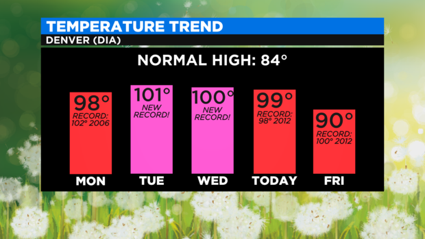
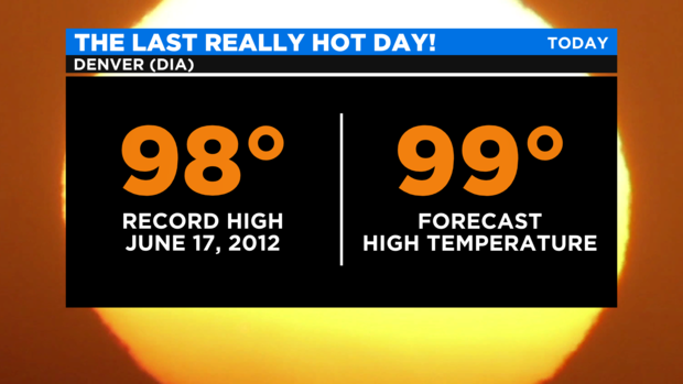
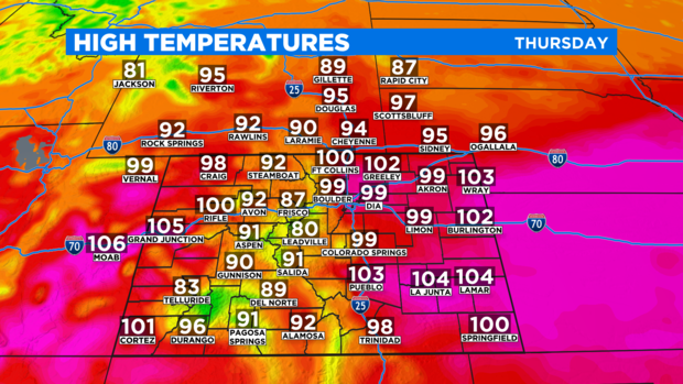
Looking ahead to Thursday, the current record high temperature for June 17 is 98 degrees from 2012. It seems more than likely that Denver will break the record by at least a degree.
And should Denver reach at least 100 degrees Thursday afternoon, it would tie a 3-day stretch in July 2012 for the fifth longest streak of 100 degree days.
Thankfully for many Coloradans, Thursday will be final day with scorching heat. Most lower elevations both east and west of the mountains will reach within a couple degrees of 100 degrees on Thursday.
Then a shift in the weather pattern will occur for Friday. The large ridge of high pressure responsible for the record heat this week will move from the Four Corners region to southern Arizona. This will allow a weak cold front to drop south across the state which will drop temperatures about 10 degrees almost statewide.
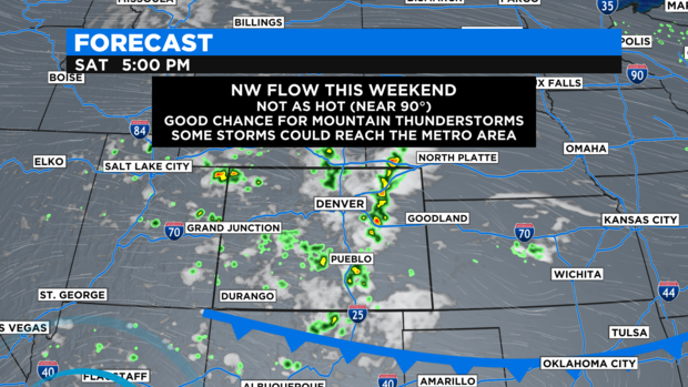
That means temperatures closer to 90 degrees than 100 degrees through the Father's Day weekend for the Denver, Boulder, and Fort Collins areas.
It also means a much better chance for afternoon and early evening showers and thunderstorms in the mountains which will dry to move east onto the urban corridor late in the day on Friday and again on Saturday. Therefore, the chance for thunderstorms has been increased to 30% in the metro area both days.
Another cold front is expected late Sunday into early Monday which could bring the coolest weather in weeks to much of Colorado. The latest weather models have temperatures staying in the 60s and 70s which would be quite the change! And ironically, Monday is the first full day of summer!