Potential For 110 Degree Weather Next Week Prompts Rare Excessive Heat Watch In Colorado
DENVER (CBS4) - A cold front brought a little relief to Colorado on Friday after several days with widespread 90s across the lower elevations of the western slope and eastern plains. But the cooler weather will only last about 24 hours.
Starting on Saturday a massive ridge of high pressure will begin to build into the southern and central Rockies. By the middle of next week it will dominate most of the western United States with a center of high pressure projected to sit right on top of western Colorado.
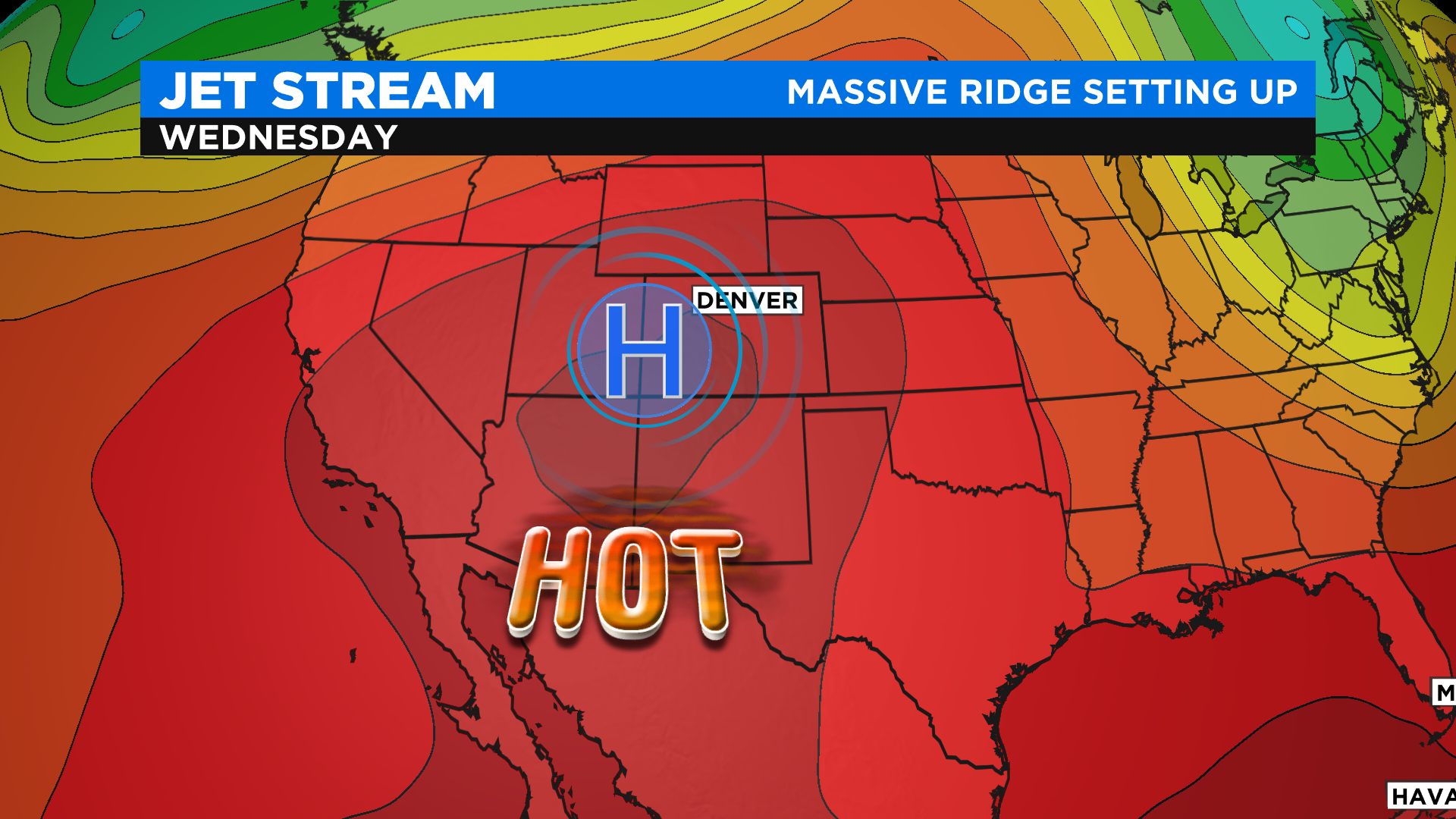
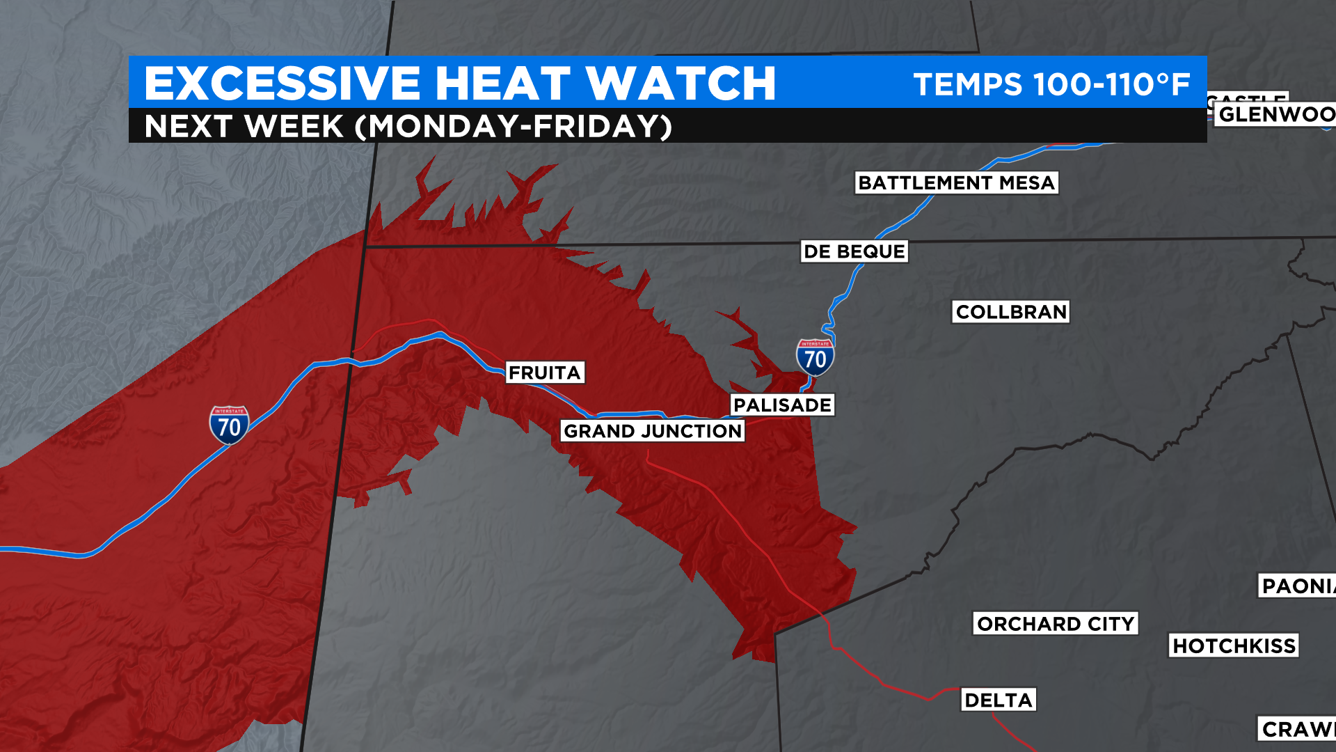
This pattern will bring the potential for afternoon high temperatures between 100 and 110 degrees each day next week in the Grand Valley, which includes the cities of Grand Junction, Fruita and Palisade. The forecast has prompted the National Weather Service to issue an Excessive Heat Watch for the area starting next Monday and lasting through Friday.
An Excessive Heat Watch is issued when conditions are favorable for an excessive heat event to begin sometime in the next 72 hours. It means the risk of a heat wave has increased but its occurrence and timing is still a bit uncertain.
It will be hot on the eastern side of the state too with widespread 90s and low 100s expected. Denver could hit 100 degrees for the first time this year by the middle of next week.
It would be one of the earliest 100 degree readings on record in the Mile High City. The top three earliest are listed below.
June 11, 2013 - 100 degrees
June 14, 2006 - 102 degrees
June 18, 2012 - 100 degrees