Colorado Weather: Widespread Rain, Thunderstorms Sunday With Some Mountain Snow
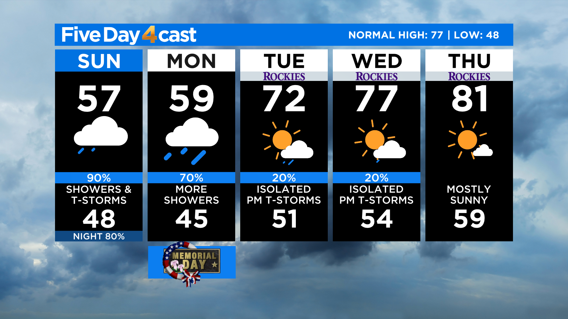
DENVER (CBS4) - A slow-moving area of low pressure will keep the weather across Colorado cool and unsettled for the rest of your Memorial Day Weekend. Most locations from the mountains to the plains will only see highs in the 50s and 60s with some 40s in the mountains today. Only the far western counties of Colorado will see enough sunshine to warm temps into the 70s and 80s.
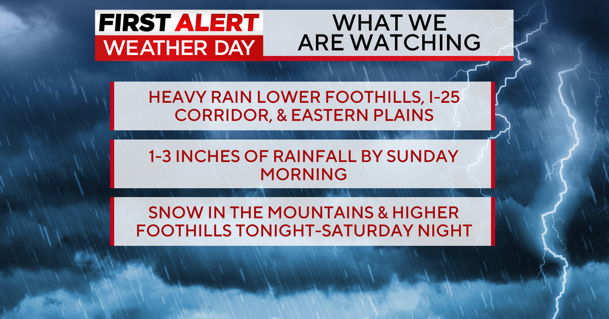
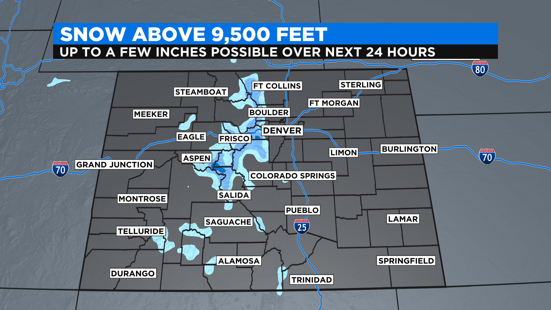
By the afternoon on Sunday we expect to see widespread showers and thunderstorms on the radar with the potential to see some locally heavy rain at times. In the mountains we'll see some light snow above 11,000 feet initially, but the snow level could drop as low as 9,500 feet by early Monday.
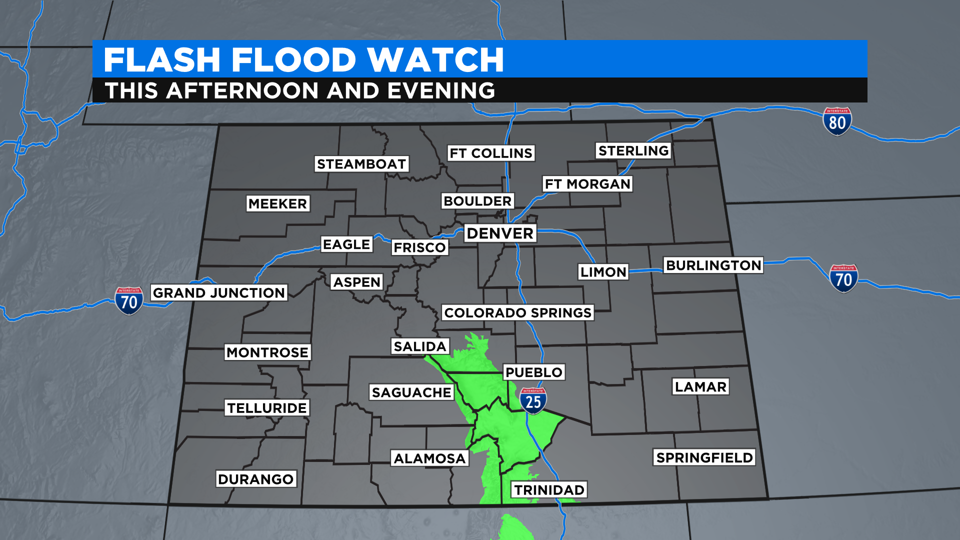
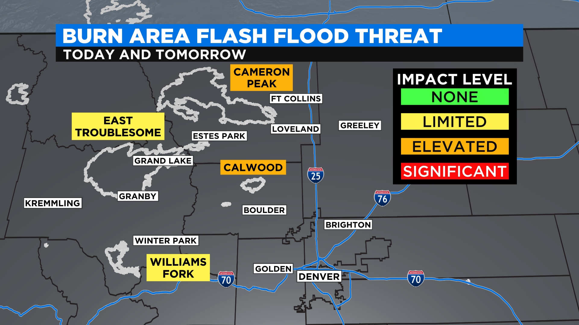
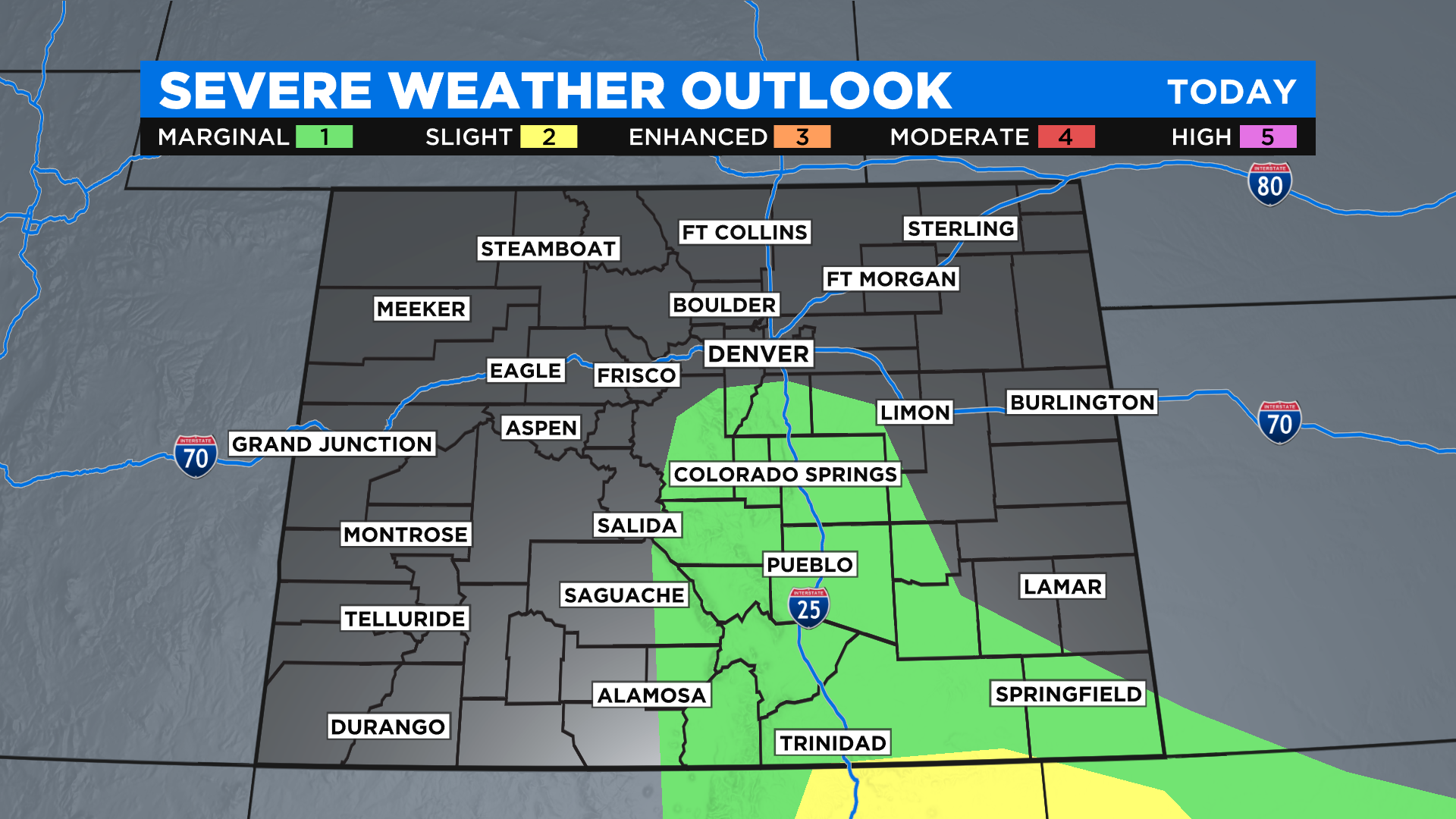
The National Weather Service has issued a Flash Flood Watch for the mountains and foothills west of Interstate 25 in southern Colorado. And while there is no official flood watch in effect over the burn scars from last year in northern Colorado, we do have a slight to elevated flood threat there too.
The threat for strong to severe thunderstorms has mostly shifted south into New Mexico today but there is still a very small chance to see a strong storm or two south of Denver. If any do pop up the main threat will be for hail up to an inch in diameter.
Monday will feature more of the same across the state with another good chance for showers and storms. Once again the mountains could pick up a little more light snow.
A warming and drying trend will settle into the state on Tuesday with only a slight chance for a few afternoon thunderstorms. Then by next weekend we should be mostly dry just about statewide with highs back into the 80s in Denver.