Denver Weather: Rain, Snow, Severe Storms, High Fire Danger All In One Day
DENVER (CBS4) - One of the strongest storms of the season will cross Colorado on Tuesday and Wednesday bringing 1-2 inches of rain to lower elevations and more than a foot of snow to some mountain areas.
Rain showers will start in Denver and along most of the Front Range no later than early Tuesday afternoon. Eventually the chance for rain will reach 100% with the heaviest, most widespread rain likely holding off until Tuesday evening. A few embedded thunderstorms are also expected in the metro area Tuesday afternoon but severe weather is not expected around Denver, Boulder, and Fort Collins.

It's a different story on the Eastern Plains where thunderstorms could produce hail up to 2 inches in diameter. There is also a smaller threat for damaging wind up to 60 mph, and perhaps an isolated tornado. The National Weather Service has issued a Severe Thunderstorm Watch for the northeast quadrant of the state through 7pm. The watch does not include Denver.

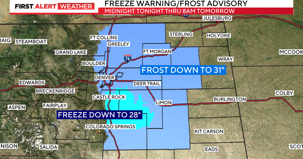
Meanwhile, this storm will produce a lot of snow in the mountains as well as the higher foothills above 7,500 feet. A Winter Storm Warning starts as early as 12 p.m. Tuesday and continues through 12 p.m. Wednesday. The warning includes the I-70 mountain corridor between Georgetown and Vail Pass as well as the Winter Park and Rocky Mountain National Park regions. The foothills of Boulder and Larimer Counties including Red Feather Lakes, Nederland, and Ward are also included. Some locations within the warned area will see as much as 12-14 inches of snow.

Travelers are advised to avoid I-70 above Georgetown from Tuesday afternoon through Wednesday morning if possible.
The snow level will drop as low as 6,000 feet by Wednesday morning so the far western and southern suburbs of Denver will likely see some snow by daybreak.

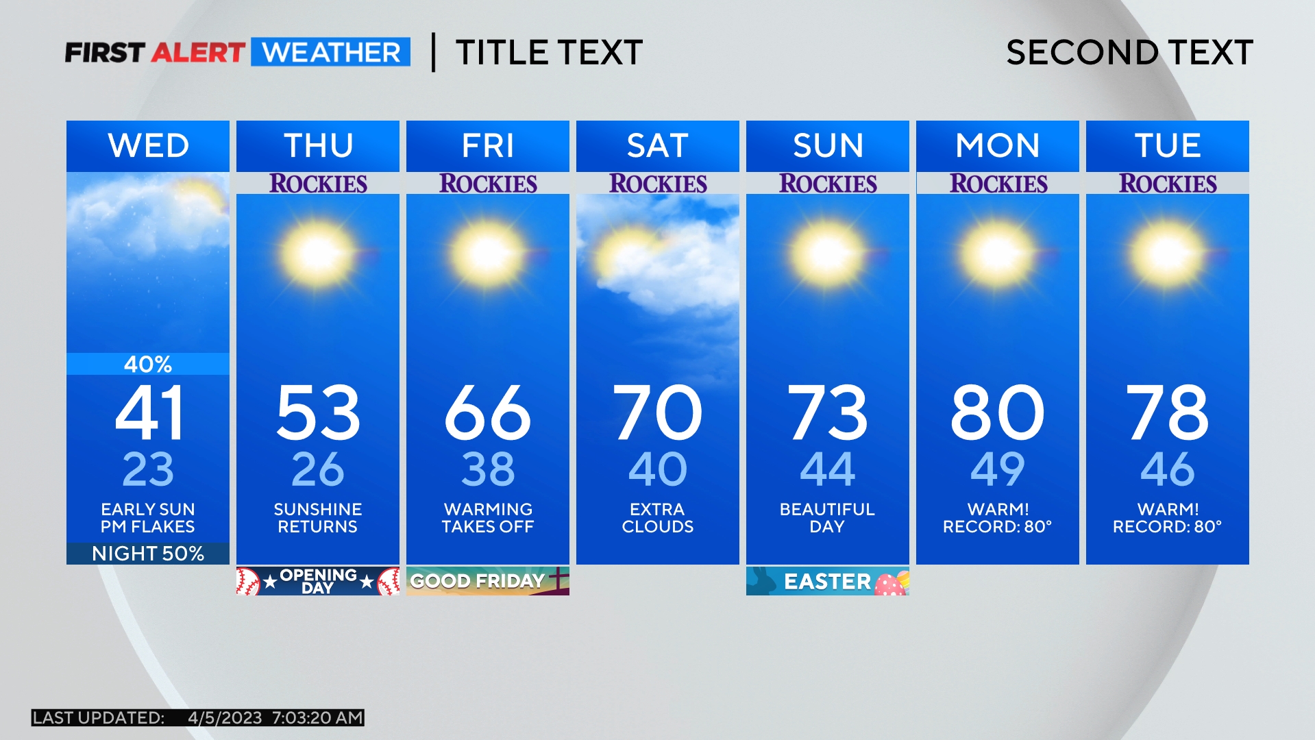
Even elevations below 6,000 feet including much of the Denver metro area could experience a few wet snowflake during the Wednesday morning drive but no measurable accumulation.

Temperatures will also be significant cooler across Colorado on Tuesday compared to Sunday and Monday when Denver reached 80 degrees both days. The metro area will be about 25 degrees cooler temperatures staying in the 50s most of the day.

It will stay warmer in southeast Colorado because the cold front won't reach that region until late in the day Tuesday. Therefore another Red Flag Warning has been issued for the southeast quadrant of the state for high fire danger through 8 p.m. Pueblo, Lamar, La Junta, and Springfield area included in the warning.

The storm responsible for rain, snow, and thunderstorm activity will move away from Colorado Wednesday night allowing for a return to sunny skies and warmer temperatures for the end of the weekend. Temperatures will be back in summer territory for the weekend with 80s in Denver on Saturday and upper 70s on Sunday.