Colorado Weather: Wave Of Rain And Snow Showers Expected Overnight
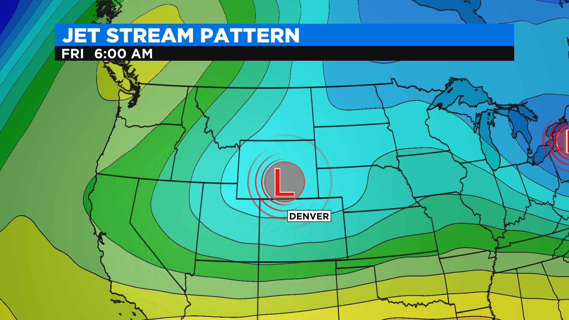
DENVER (CBS4) - A big trough of low pressure will hang around the western United States over the next several days. That means the forecast will stay unusually cool and unsettled with several chances for rain and snow.
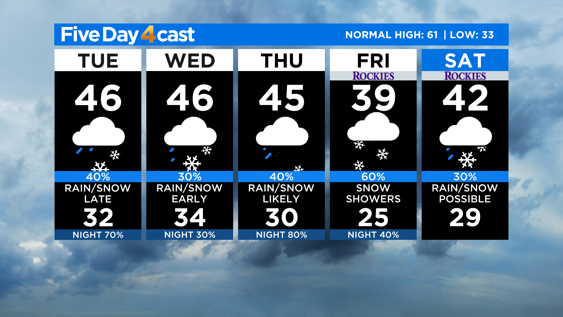
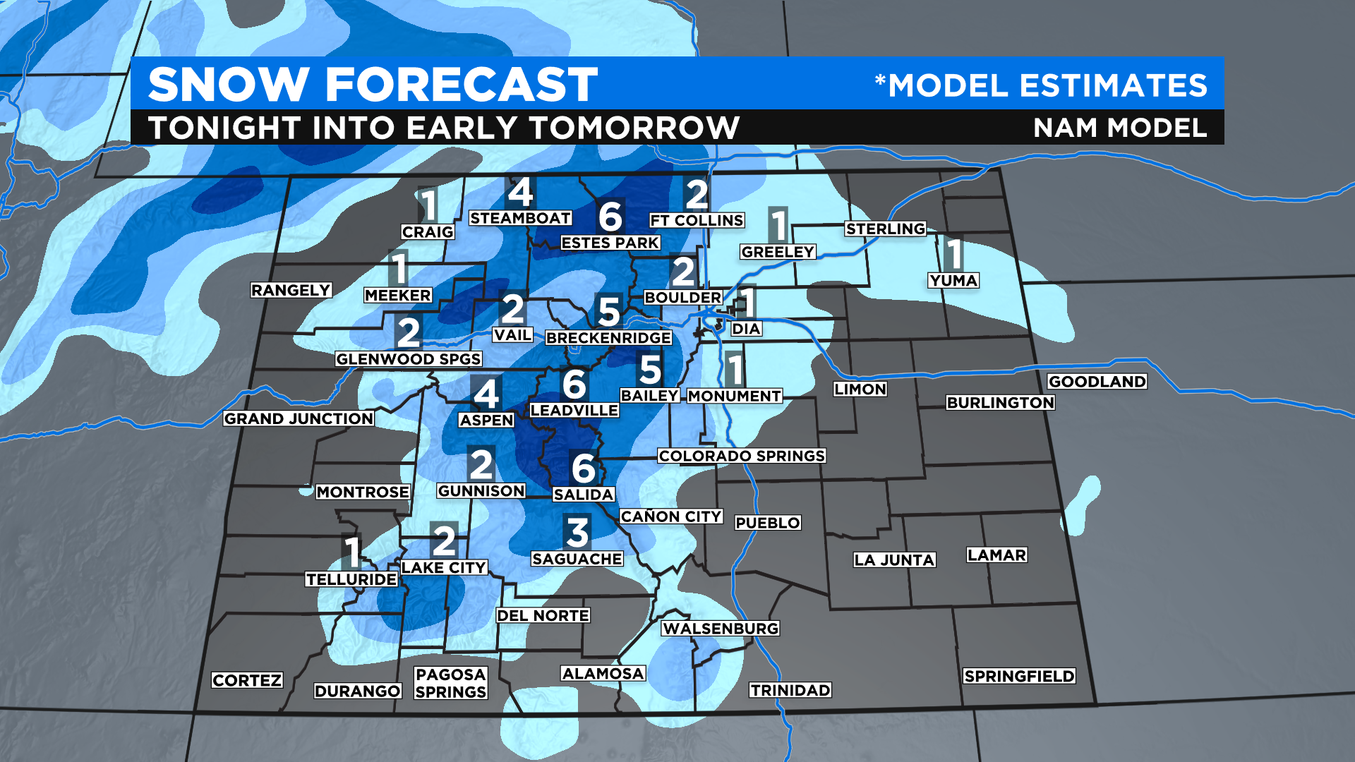
After a few bursts of morning snow in the foothills and northern Denver metro area we'll see another round of showers move in by this evening. In some areas it will stick around through Wednesday morning so your drive to work and school could be sloppy.
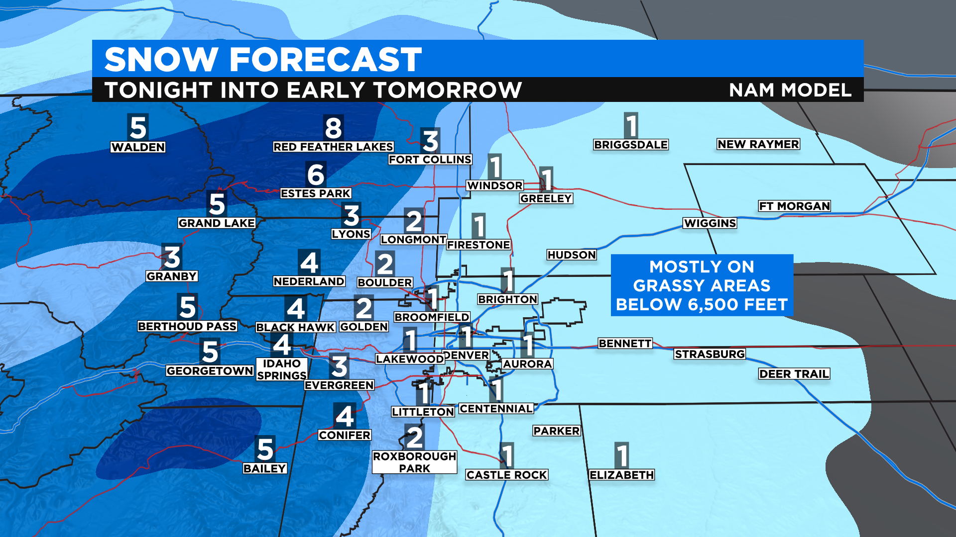
The highest totals from tonight's snowfall will be in the higher foothills and along the Continental Divide. Places there could see 4-8 inches by tomorrow morning. A few spots could see 10 inches or more, especially in the higher foothills of Boulder County.
In Denver we except most places to see just an inch or two, but higher amounts are possible from Boulder to Longmont, Loveland and Fort Collins. Roads below 7,000 feet could become slushy and slick, especially bridges and overpasses. Snowpacked driving conditions are likely tonight above 7,000 feet.
Wednesday will start off with rain and snow in the area but we should see a little break later in the day before another wave of moisture crosses the state for Thursday into Friday. Some of that may linger into Saturday. We'll start a slow warming and drying trend by early next week.
While the extended forecast looks gloomy it will not rain and snow the entire time. We will have breaks in between each wave of moisture. It will be cloudy and cool for most of the period but this is excellent news for the drought and preserving our mountain snowpack.