Colorado Weather: Chilly Week Ahead With Several Chances For Rain And Snow
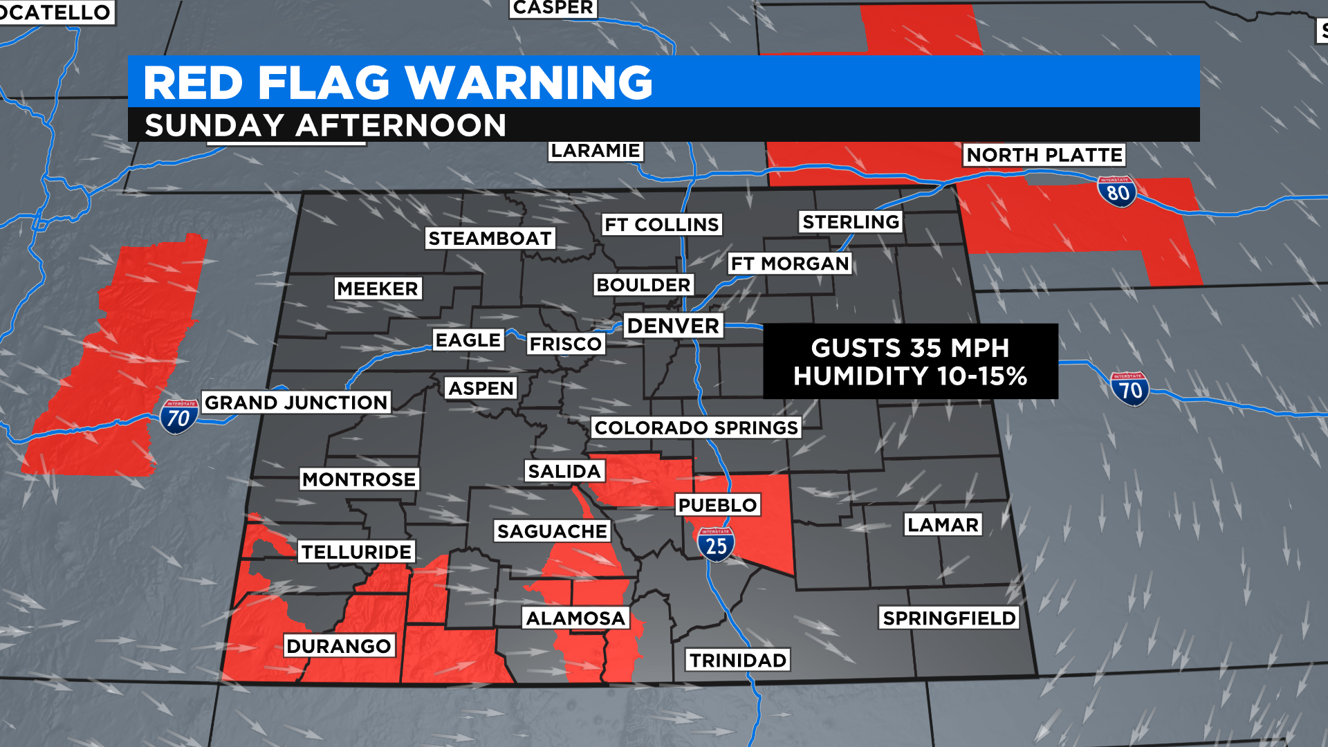
DENVER (CBS4) - A busy weather week is unfolding for Colorado starting today with the passage of a dry cold front. Along and behind it the wind will blow between 15-25 mph with gusts as high as 40 mph on the plains.
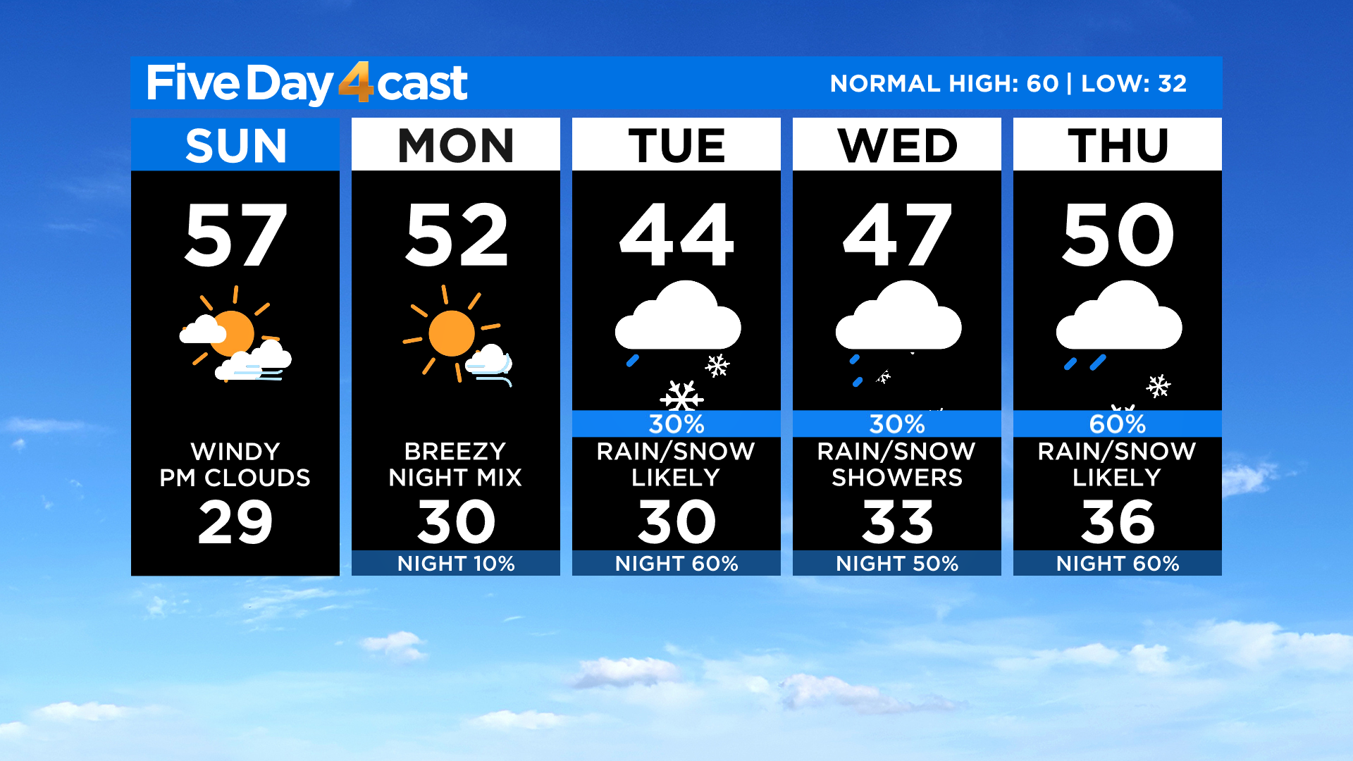
We'll see a wide variety of temperatures by this afternoon as this front passes through. Denver and the northeast plains will mostly be in the 50s, which is 10-15 degrees cooler than it was on Saturday.
The mountains will see 40s and 50s today with 60s on the western slope. Southern Colorado will be the warmest ahead of the front with highs in the 70s. Fire danger will be high through this evening for areas in red on the map below.
By tonight the clouds will be increasing for areas along and east of Interstate 25. It should remain dry although a few stray snow showers are possible tonight in the mountains.
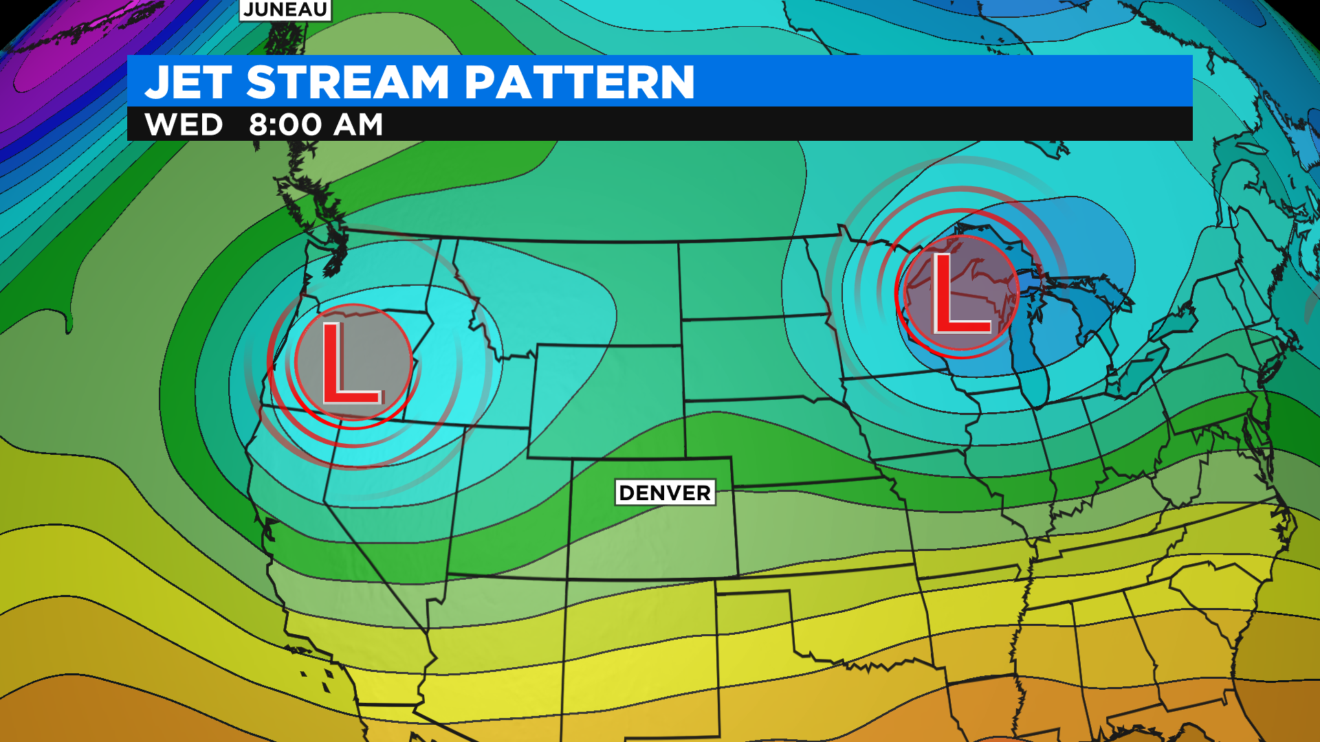
For the week ahead we'll be watching a messy upper level jet stream pattern evolve. We're expecting an area of low pressure to drop out of Canada and sit over the western United States for several days.
It's final position will determine the exact details of the extended forecast but as we see it right now, the weather will be cool and wet at times starting Tuesday and lasting through Saturday.
The first round of moisture arrives by Tuesday and it will stick around into early Wednesday. It will be cold enough at times for snow to fall in Denver but right now we expect any accumulation to be confined to grassy surfaces. The mountains and foothills could see enough snow to shovel.