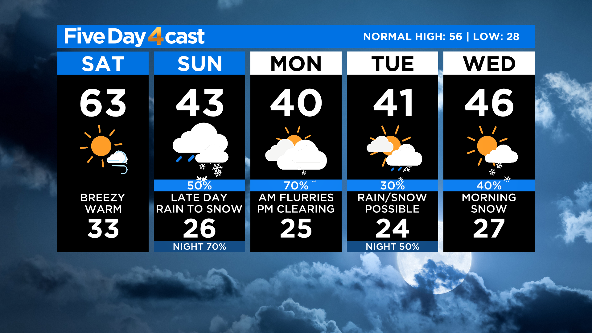
Colorado Weather: Windy, Warm Saturday Ahead Of Spring Snowstorm To End Weekend
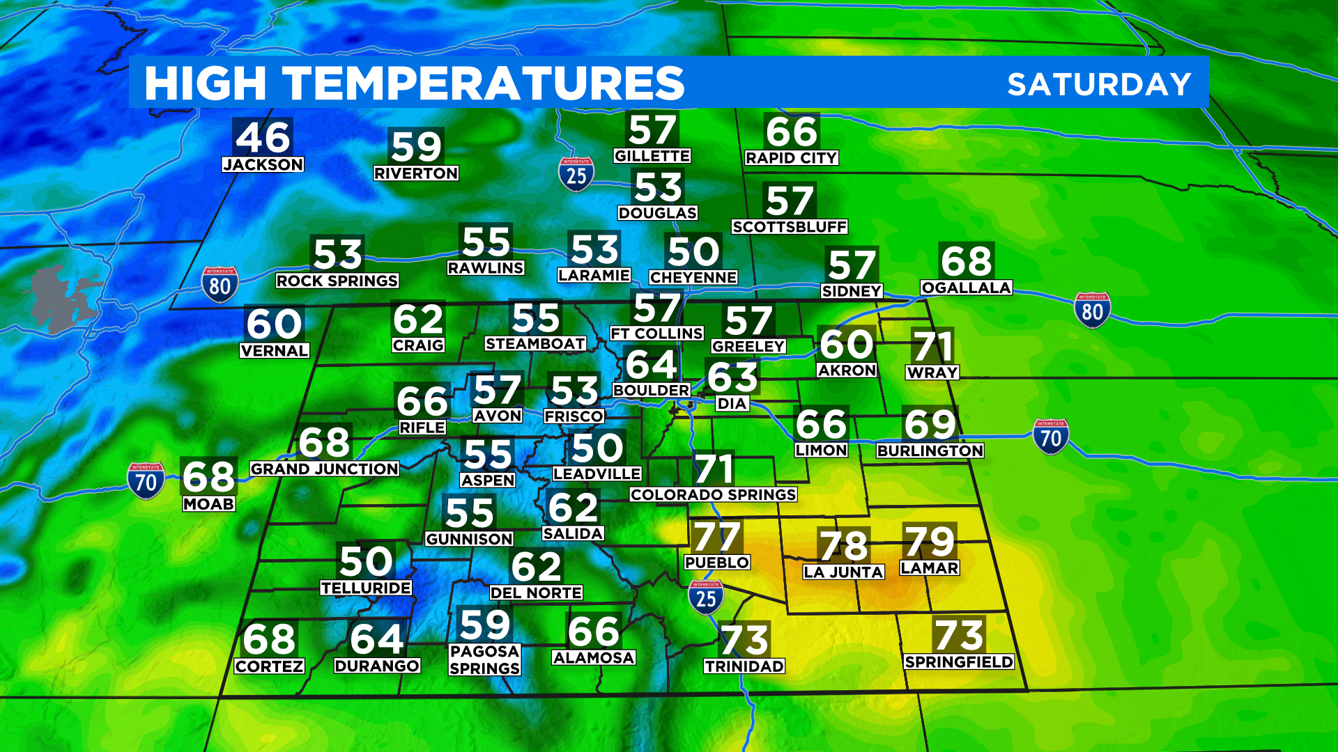
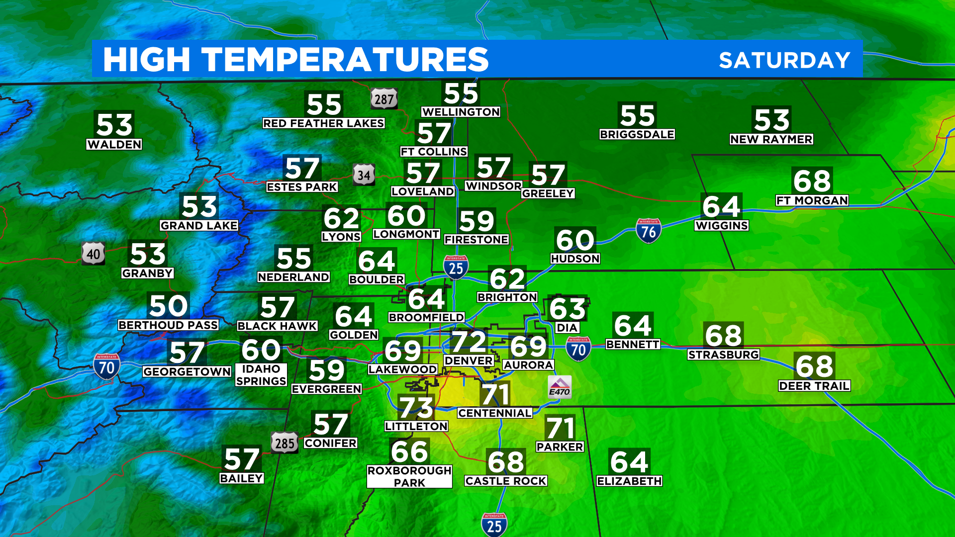
DENVER (CBS4) - Spring officially arrived at 3:37 a.m. today and it will feel like it around Colorado with partly to mostly sunny skies this afternoon and highs in the 50s and 60s. We could even see a few low 70s around Denver and on the plains.
It will be windy at times today because a weather change is brewing. Some places could see wind speeds in the 20-35 mph range. The primary direction should be out of the west or southwest.
By tonight changes will quickly materialize as a strong Pacific cold front moves into the state. Behind it we'll see a quick burst of snow in the mountains and maybe even a few rain showers in the valleys.
Sunday will be much colder with a continued chance for snow in the mountains. In Denver and on the eastern plains it will be partly to mostly cloudy with a chance for rain showers in the afternoon as an area of low pressure develops at the surface.
By Sunday night the rain should change to all snow. The snow will linger into Monday morning as temperatures hover around the freezing mark.
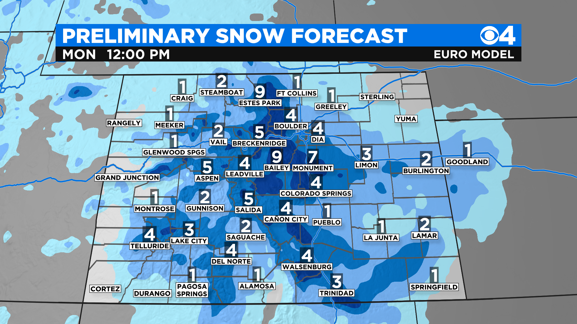
The map above shows preliminary snow totals. This storm is moving too fast for there to be much change to the current thinking.
Another factor we are concerned about is this system isn't very cold. That means we will see some melting on contact initially. In addition there will be some compaction as the snow accumulates because it will be a high water content snowfall.
The week ahead will feature two more weather systems and each one will bring another chance for some rain and snow. Temperatures will run below normal for the entire time.