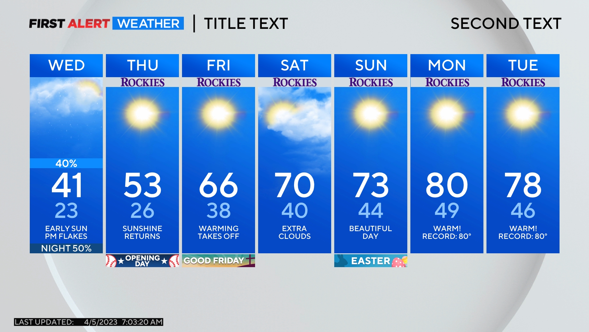
Denver Weather: Entire Front Range Gets Heavy Snow This Weekend, Some Areas Will Get More Than Others
DENVER (CBS4) -A storm bringing rain and snow to Arizona and Utah on Friday will slowly move into Colorado Friday night into Saturday. The storm is set to slam the Front Range with the most snow in years with the highest snow totals expected in the foothills and mountains.
While all areas along the I-25 urban corridor will get heavy snow, locations in the foothills of Boulder, Larimer, and northern Jefferson Counties as well as mountain areas as far west as Vail Pass should easily get more than 2 feet of accumulation. Lower elevations in Boulder and Larimer Counties including Fort Collins, Loveland, Berthoud, and Boulder could also get more snow than Denver. These areas could get up to 30 inches of snow.
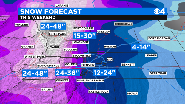
For most other areas along the I-25 urban corridor including Denver, Aurora, Lakewood, Littleton, Westminster Thornton, Highlands Ranch, Parker, and others, snow totals between 12 and 24 inches are expected between Saturday morning and early Monday morning.
A Winter Storm Warning starts by midnight Friday night for the I-70 mountain corridor between Georgetown and Avon. Then a warning starts east of the mountains including for the entire Denver metro area at 5 a.m. Saturday and continues through 6 a.m. Monday.
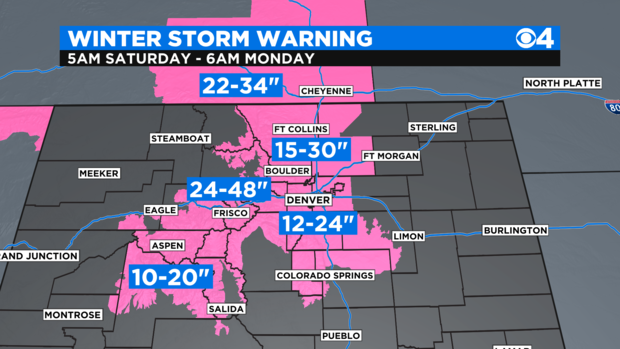
The mountains of Summit County, the Winter Park area, and the Rocky Mountain National Park region should get 24 to 48 inches of snow. Mountain areas farther west including the Vail/Beaver, Aspen/Snowmass, and Crested Butte area should get 10 to 20 inches of snow over the weekend.
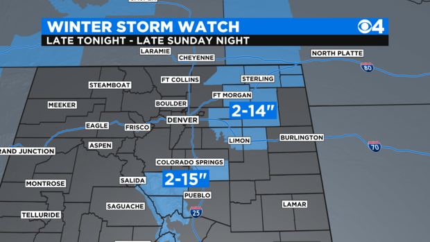
Meanwhile, there is less certainty about snow amounts on the Eastern Plains as well as in the Colorado Springs area because temperatures may be too warm to support all snow. Therefore there is still a Winter Storm Watch (instead of a warning) for these areas as of Friday morning. There are also enormous forecast snow ranges for these areas because it's not clear how much of the precipitation will be rain versus snow.
The fact there is a chance for rain proves this is a "warm storm" coming from the southwest instead of the north. And since there will be no big surge of cold air, high temperatures on Saturday and Sunday will hover near freezing in the Denver metro area and could stay above freezing on much of the Eastern Plains. This is why much of the precipitation could stay mainly rain especially east of Fort Morgan, Limon, and La Junta.
RELATED: What Would It Take For Monster Weekend Snowstorm Headed For Colorado To Become A 'Blizzard'?
A total of up to 5 inches of liquid precipitation will fall with this storm. Therefore the snow will be heavy and wet. It will be excellent snow for building snowmen but it will also be the type of snow that tends to break branches and causes power outages.
RELATED: Colorado Is Known For Heavy March Snow, One Storm Ended Record Drought In 2003
Most of the snow is expected to end in the Denver metro area by sunrise on Monday with only lingering flurries for the morning commute. Another storm is likely to reach Colorado on Tuesday with a chance for more accumulating snow for at least the foothills and Palmer Divide by Wednesday.