Denver Weather: Big Storm Aiming For Colorado By End Of The Week
(CBS4) - A potential big storm is heading for Colorado by the end of the week. There is still much uncertainty with this storm on highest impact areas, a good snow potential range, and exactly when this storm will move out. What we do know for certain, is that a big storm is heading our and snow could really start ramping up on Friday.
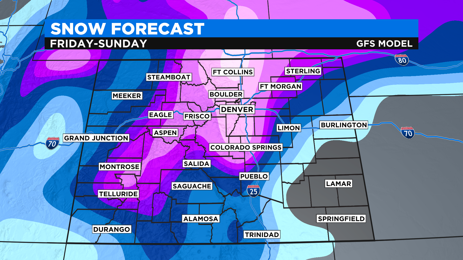
Models are starting to come together a little better, so it's not out of the question that the potential for 10-20 inches or more of snow is possible. There may be localized areas that see much more than that, especially in the foothills and Palmer Divide. The Front Range does look to get the bulk of the snow. The mountains will get in on the action too, but eastern Colorado is more of the bullseye.
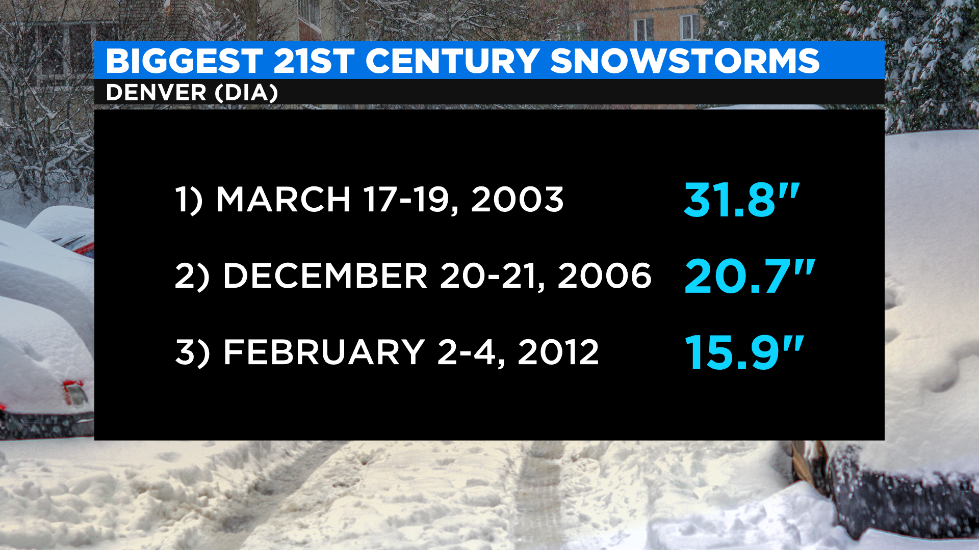
In terms of recent memory historical storms, this could bring us the most snow in about nine years. Here is a look at the biggest snow storms in the last 21 years.
As this storm gets closer, much more will become clear. We will keep updating on our website, CBSN, and our news programs throughout the day.
Until this storm, we do have snow overnight tonight into Wednesday for the high country. Rabbit Ears Pass and northwestern Colorado locations could see 4 to 7 inches of snow, while most other mountain areas could see 1 to 4 inches. Denver has the chance for a little light snow or rain on Wednesday morning, with a little more possible in the afternoon.
We may start seeing snow from our big system on Thursday night, with Saturday being the potential biggest day for snow.