Denver Weather: Weekend Snow Likely As Temperatures Remain Chilly
DENVER (CBS4) - This weekend won't be nearly as cold as last weekend, but temperatures will remain below normal through Sunday and most of the Front Range will see more snow Saturday evening.
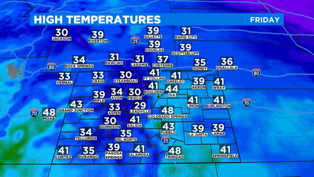
Friday will be the twelfth consecutive day with below normal temperatures in the Denver area. That said, it will easily be the warmest day of the week with highs in the lower and mid 40s along the Front Range.
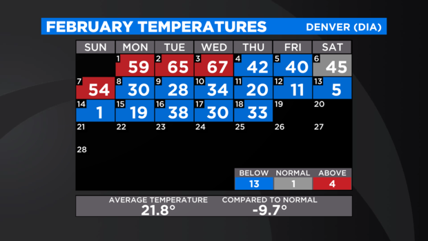
This month is currently tied with February 1913 for the second coldest February on record in the city. The average temperature so far this month has been only 21.8 degrees.
In terms of snow, a storm coming from Oregon and Washington will approach Colorado on Friday causing snow to return to the mountains. Most ski areas will be lucky to get an inch or two through Saturday morning. Then more significant snow will develop in the high country as the storm arrives Saturday afternoon. Most ski areas will up to 6 inches but some could get more.
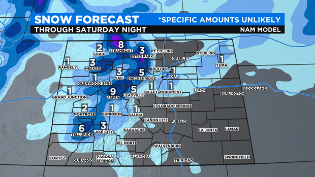
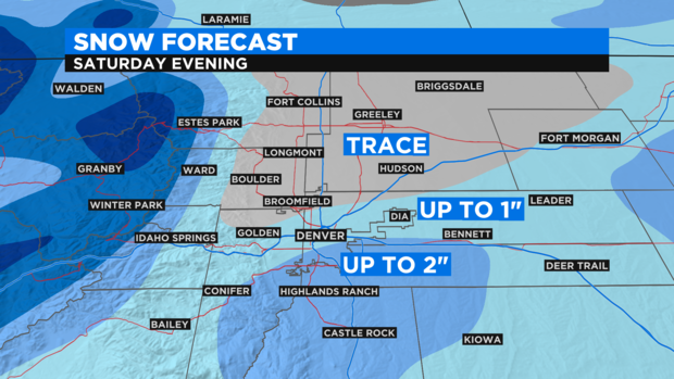
The cold front associated with the storm will reach the Denver, Boulder, and Fort Collins areas around 5pm Saturday. Once the front arrives, the metro area should get a quick shot of snow with minor accumulation. Most neighborhoods will get no more than 1-2 inches of light, fluffy snow. Many may only get a dusting while a few spots mainly along the Palmer Divide could get slightly more than 2 inches.
Looking ahead to Sunday, it should be mostly sunny, dry, and chilly across most of Colorado. Denver may not reach out of the 30s. That changes Monday and Tuesday with a significant warming trend before another winter storm arrives Tuesday night into Wednesday. More snow will be possible in Denver.