Colorado Weather: More Wind, Snow, Tough Travel For Northern Mountains
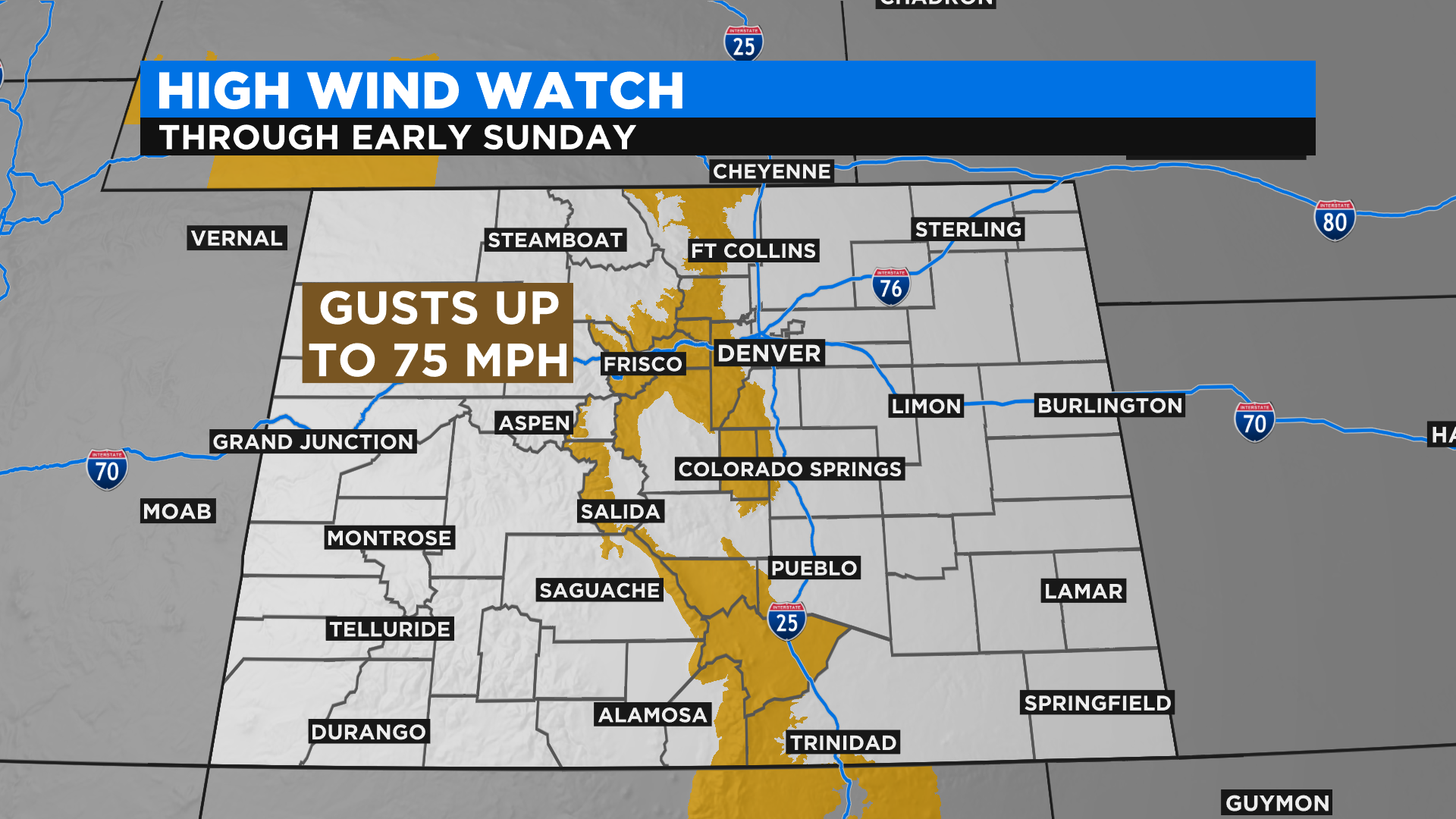
DENVER (CBS4) - Colorado sits under a strong jet stream this weekend and that means we will have some active weather to deal with, especially in the form of wind. Gusts from the west and northwest could approach 75 miles per hour by late tonight and early Sunday along and near the Continental Divide, including in the foothills west of Denver.
The strong wind will create white-out conditions at times (with or without new snow falling) on highly traveled mountain roads such as Highway 285 over Kenosha Pass. Other roads where we could see problems include Interstate 70 west of Denver and Highway 40 outside of Steamboat Springs.
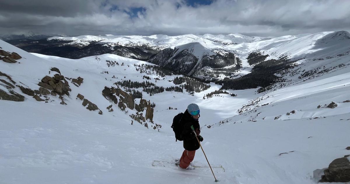
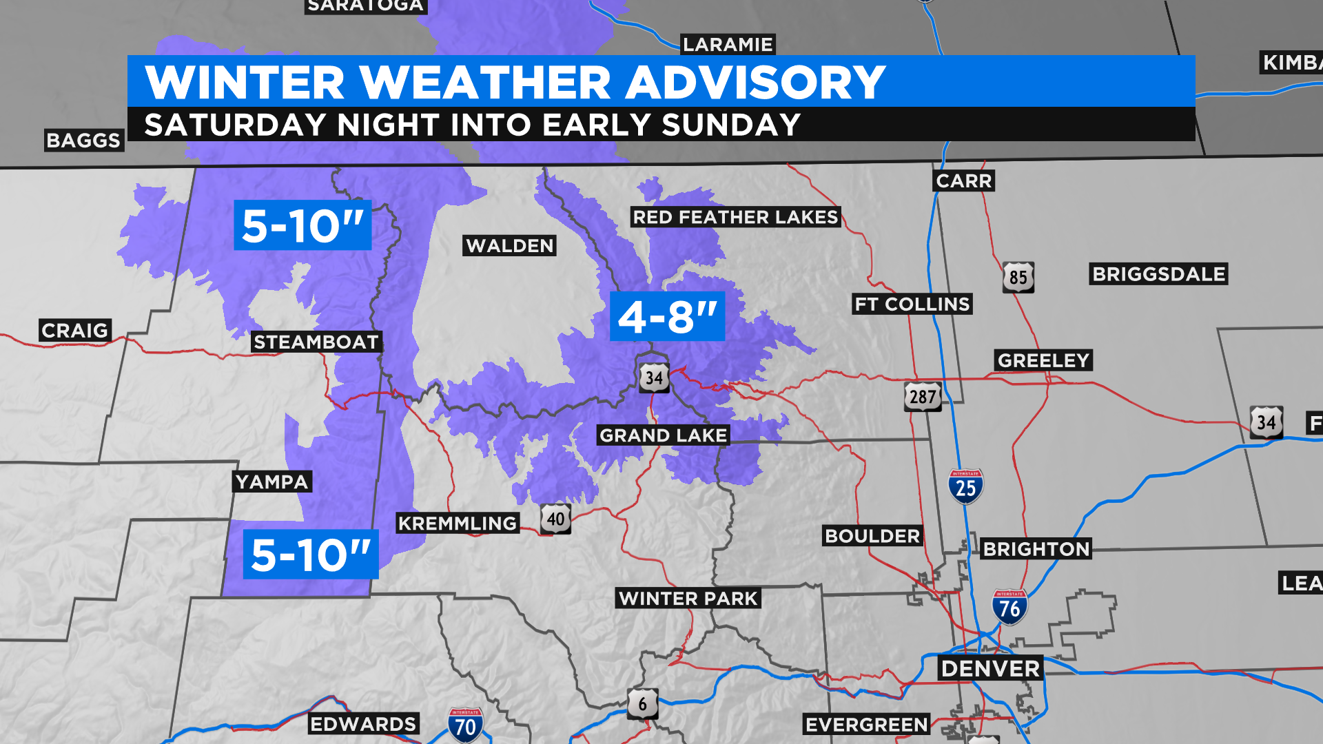
There will also be some more mountain snow for areas along and north of Highway 50 this weekend. The National Weather Service has issued a Winter Weather Advisory for up to 10 inches of snow in places around Rocky Mountain National Park and the peaks around Steamboat Springs. The heaviest snow should fall along and north of Highway 40 starting late tonight and lasting through the overnight hours.
With more wind and snow the avalanche danger will remain very high through Sunday. The Colorado Avalanche Information Center has reissued their avalanche warning for all of the backcountry in the northern and central mountains. If you know someone planning to play in this part of the state please discourage them from doing so until the danger subsides.

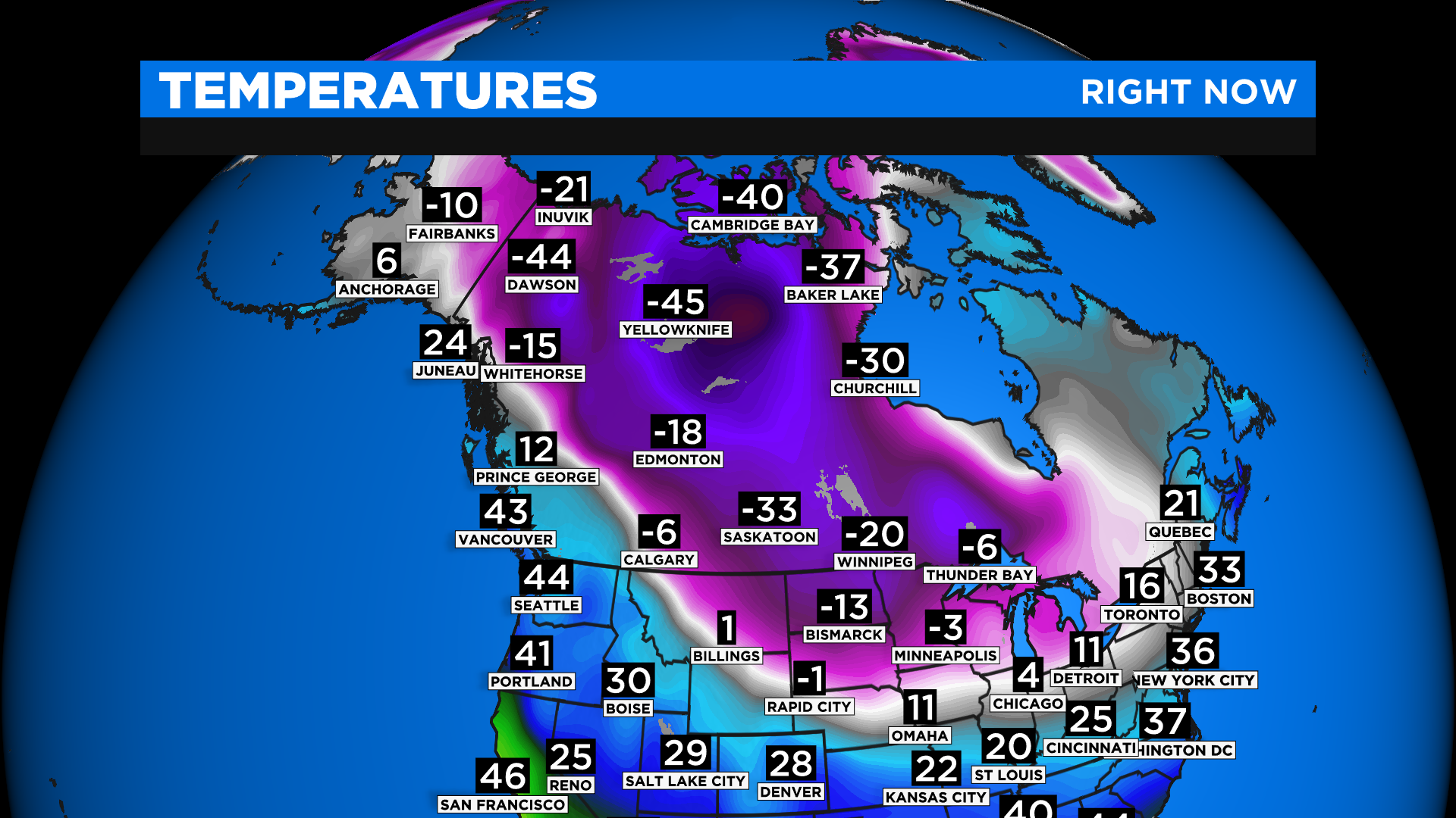
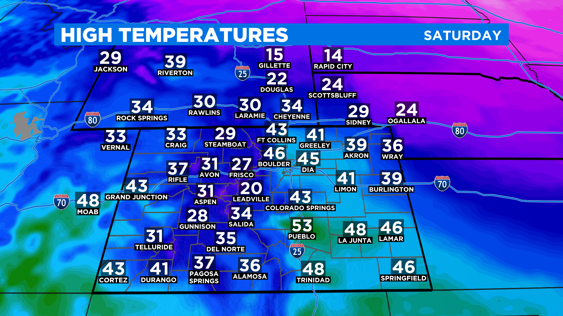
Meanwhile if you go less than 100 miles outside of the state, via I-25 to the north or I-76 to the east, you will run into a bitter cold arctic air mass. Some of that air could potentially seep into the far northeast corner of the state today so if you live up there you may encounter large temperature swings over very short distances.
The following temperature map was from 7 a.m. today and you can see just how large the cold air mass is and how close it was to the northeast corner of our state. This cold is expected to stick around for several days.
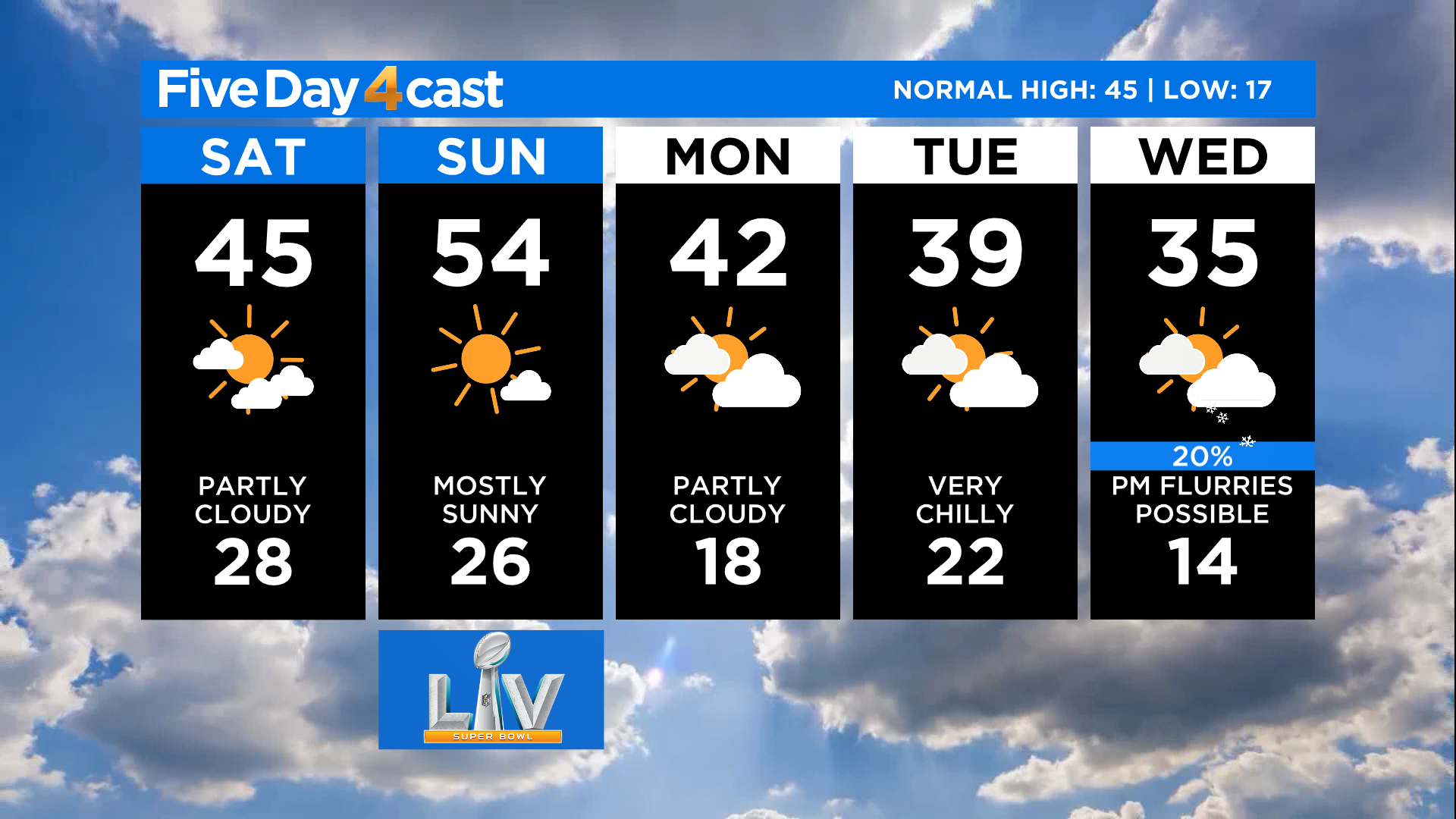
High temperatures today will be coldest in the northeast near that arctic air, but we will also see some chilly temps in the northern and central mountains due to the extensive cloud cover, wind and snow. Denver should end up close to normal for this time of year which is in the 40s.
Looking ahead we may get into some of the cold air by the middle of the upcoming week in Denver and along the Front Range. It will all depend on subtle shifts in the current jet stream pattern. Stay tuned to see how it evolves!