Denver Weather: Snow Expected Monday With Next Storm Moving Into State
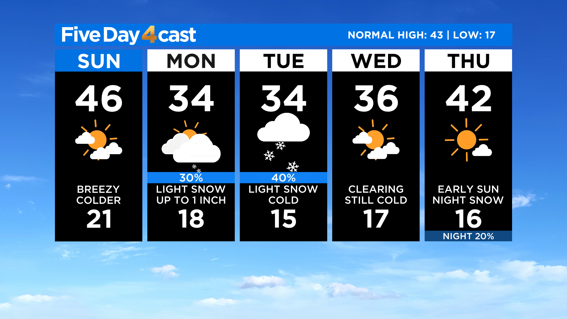
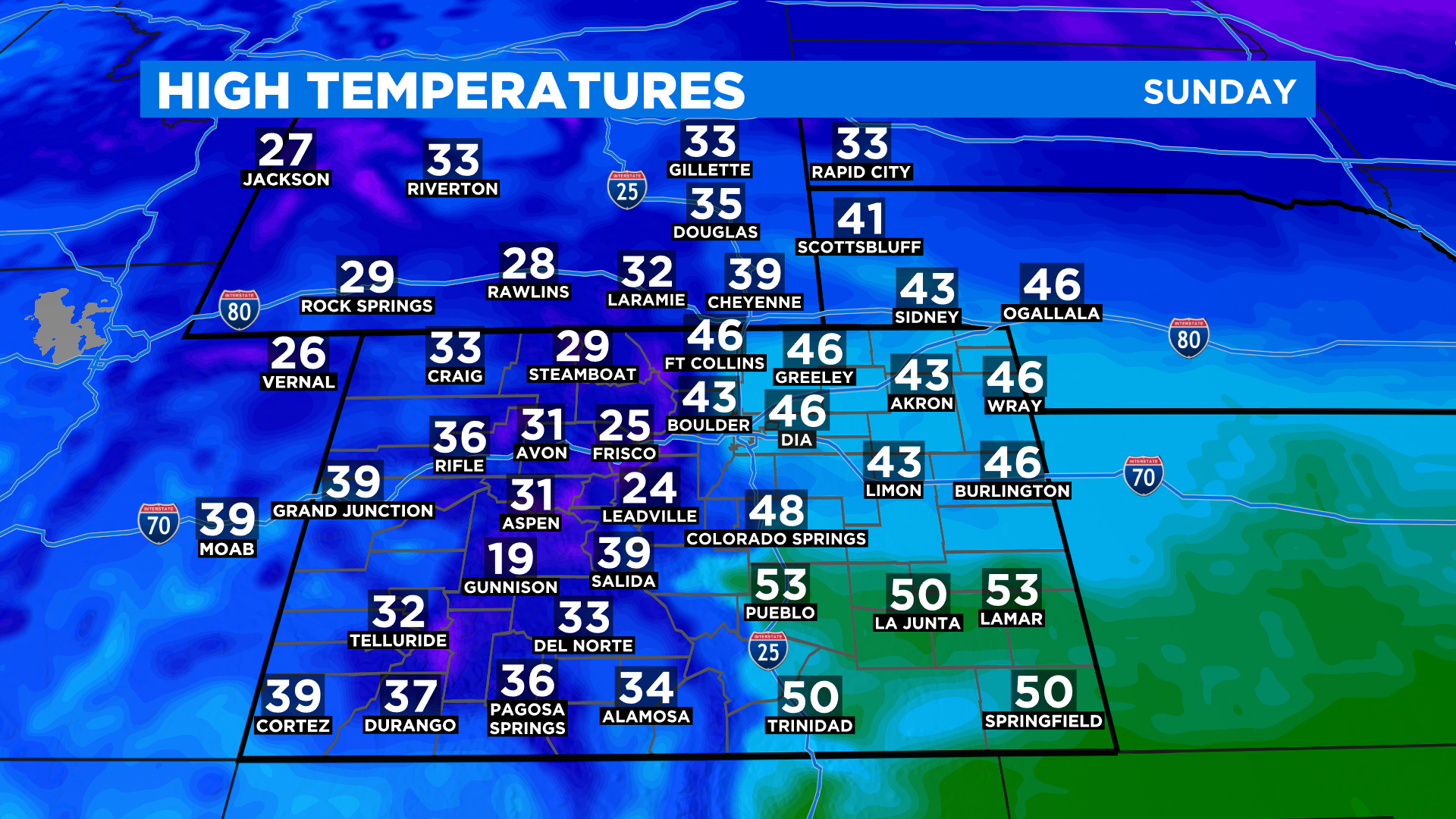
DENVER (CBS4) - A cold front moved through Colorado overnight with windy conditions and much colder temperatures. After a high in the low 60s around Denver on Saturday it will be at least 15 degrees colder today.
A new storm will move into Colorado Sunday night with widespread snow developing in the mountains. Some places in the southwest could see totals exceed a foot by Tuesday.
RELATED: Colorado Weather: Mountain Snow Returns By Sunday Night, Lasts Into Tuesday
Light snow showers should develop in metro Denver and along the Front Range sometime Monday morning. The snow will become more widespread by Monday evening as an area of low pressure develops on the eastern plains.
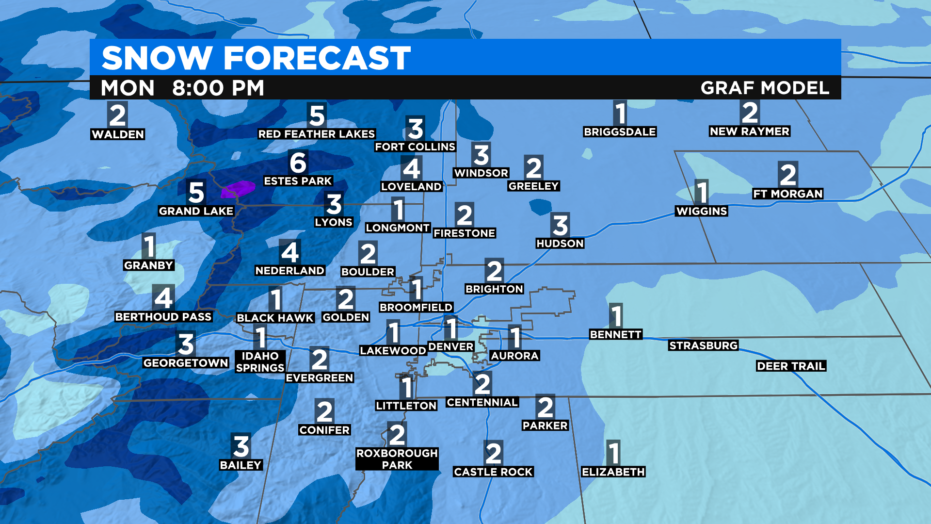
As far as potential accumulation in the I-25 urban corridor, it looks like the heaviest snow from this storm will fall in the northern part of the region, in places such as Loveland and Fort Collins. But the forecast is subject to change based on where an area of low pressure develops on the eastern plains during the day on Monday.
Light snow will linger into Tuesday for many areas before some clearing arrives on Wednesday. Then another storm system will approach the state around New Year's Day with more cold and snow.