Colorado Weather: Storm Is On The Way But Our Region Is Dry. Really Dry!
DENVER (CBS4) - Extremely dry air will cover all of Colorado on Monday and moisture won't increase much as a storm system moves into the state on Tuesday. But even if moisture is minimal, much colder air will plentiful.
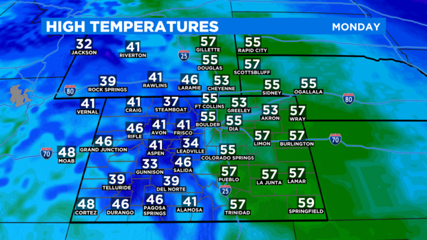
Until the storm arrives starting Tuesday morning, crystal clear skies will dominate Colorado. The result will be much warmer temperatures compared to Sunday with highs in the 50s around Denver, Boulder, and Fort Collins Monday afternoon. Most neighborhoods will be at least 10 to 15 degrees above normal for the final day of November.
And not only will it be sunny and dry on Monday. It will be extremely dry even for Colorado standards. Keep some lip balm handy!
Colder air will start to invade the Front Range starting early Tuesday. High temperatures will drop closer to normal near 40 degrees in the Denver metro area.
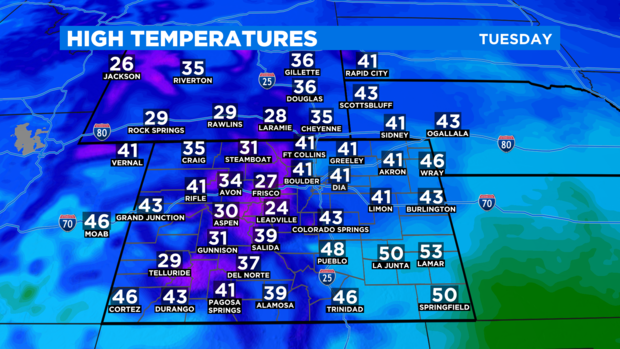
Clouds will also be on the increase on Tuesday but most areas will be dry except for a few flurries in the afternoon. A chance for flurries or light snow showers will continue in the metro area through Tuesday night, Wednesday, and Wednesday night. Any accumulation should be very minor.
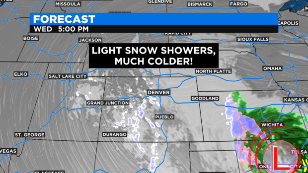
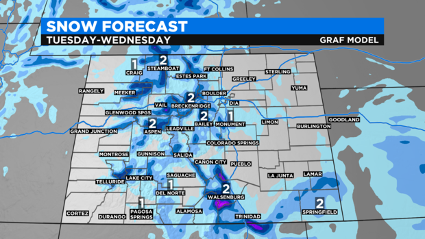
It's a somewhat different story in the mountains with a better chance for snow on Tuesday and Wednesday but accumulation will still be minor. Most mountain areas including the ski areas should get no more than 1-4 inches of snow. Slightly higher amounts are possible in the Sangre de Cristo Mountains in southern Colorado.
A slow warming trend will start Thursday with high temperatures back into the 50s for the Front Range by the weekend.