Denver Weather: Late Rain Showers Will Turn To Snow By Tuesday Morning Drive
DENVER (CBS4) - A storm system moving into Colorado will bring some much needed precipitation to the state over the next 24 hours. In Denver and on the northeast plains rain showers are expected to develop after sunset on Monday and change into snow during the overnight hours, potentially making for a slow commute Tuesday morning.
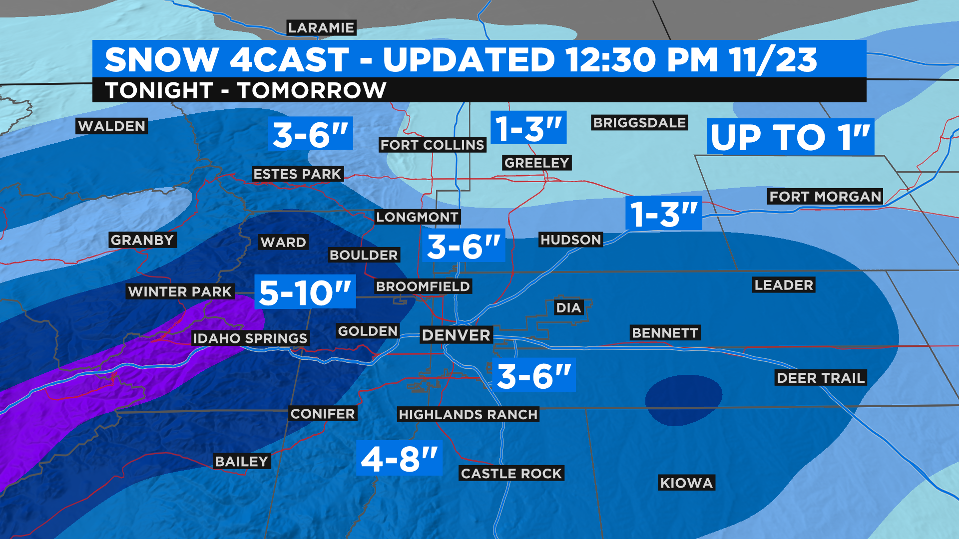
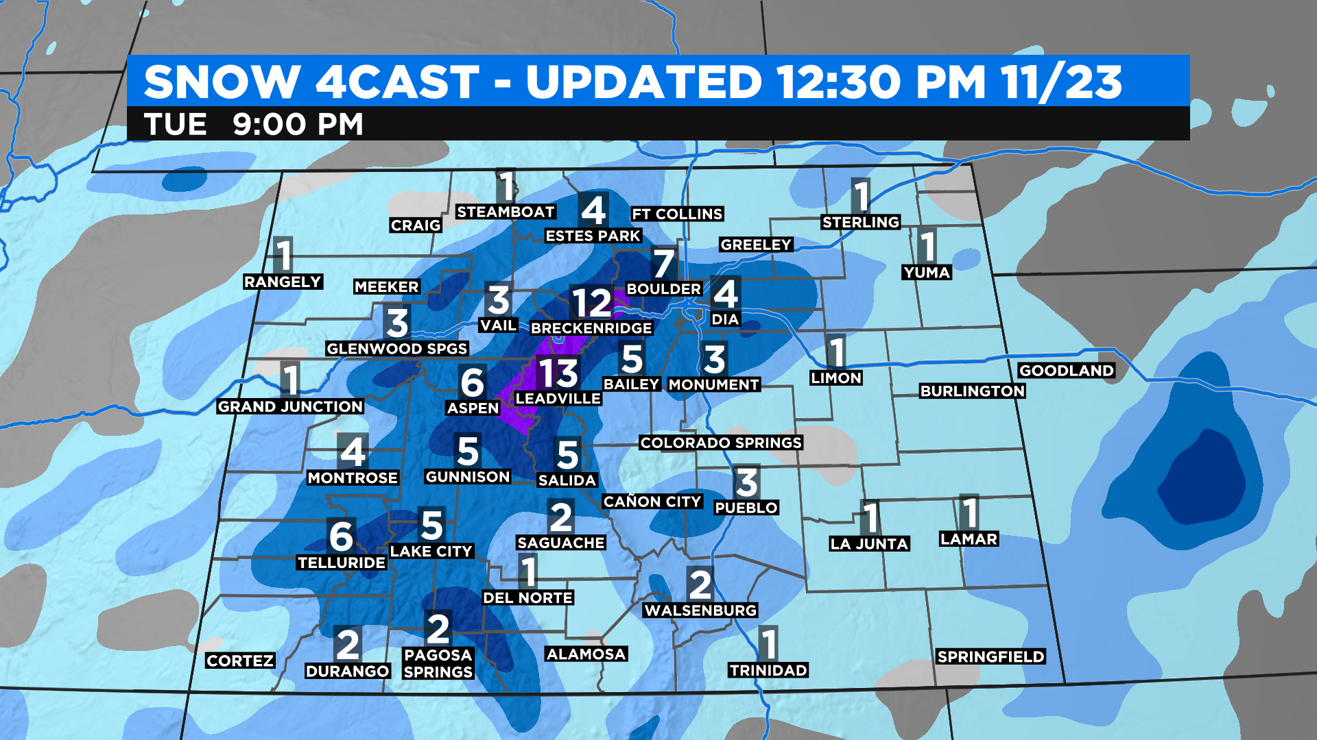
As of 12:30 p.m. Monday our current thoughts for snow amounts in Denver and surrounding areas can be seen on the map below. We expect a sharp snowfall gradient from this storm right along Interstate 25. That means from north to south and west to east one spot could see just an inch while a place only a few miles away sees up to 6 inches or more.
And as we see with most storm systems the highest snowfall totals are expected to come from the higher elevations west and south of the city. At this time it looks like areas right along and south of Interstate 70 will see the most benefit from this storm.
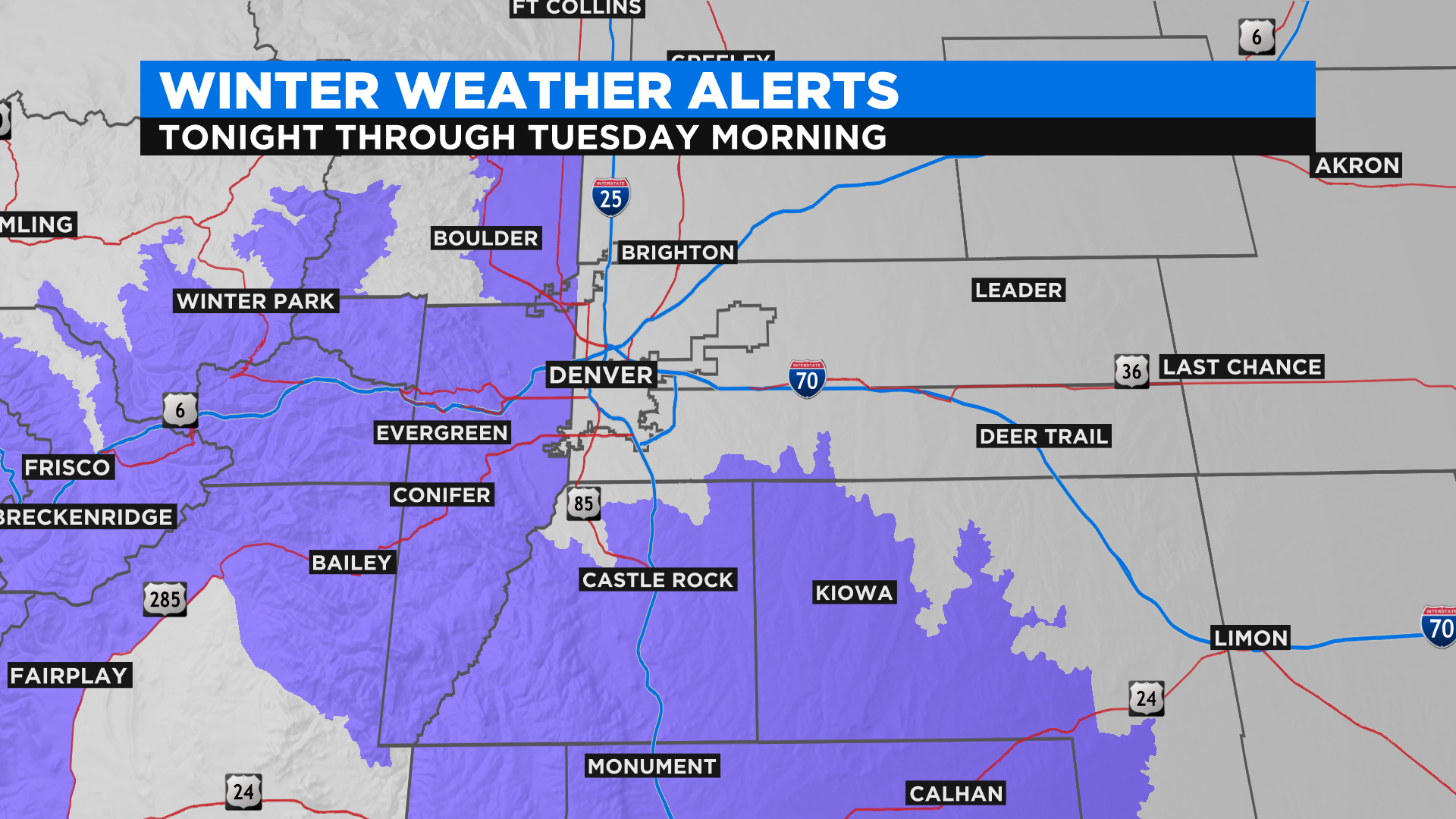
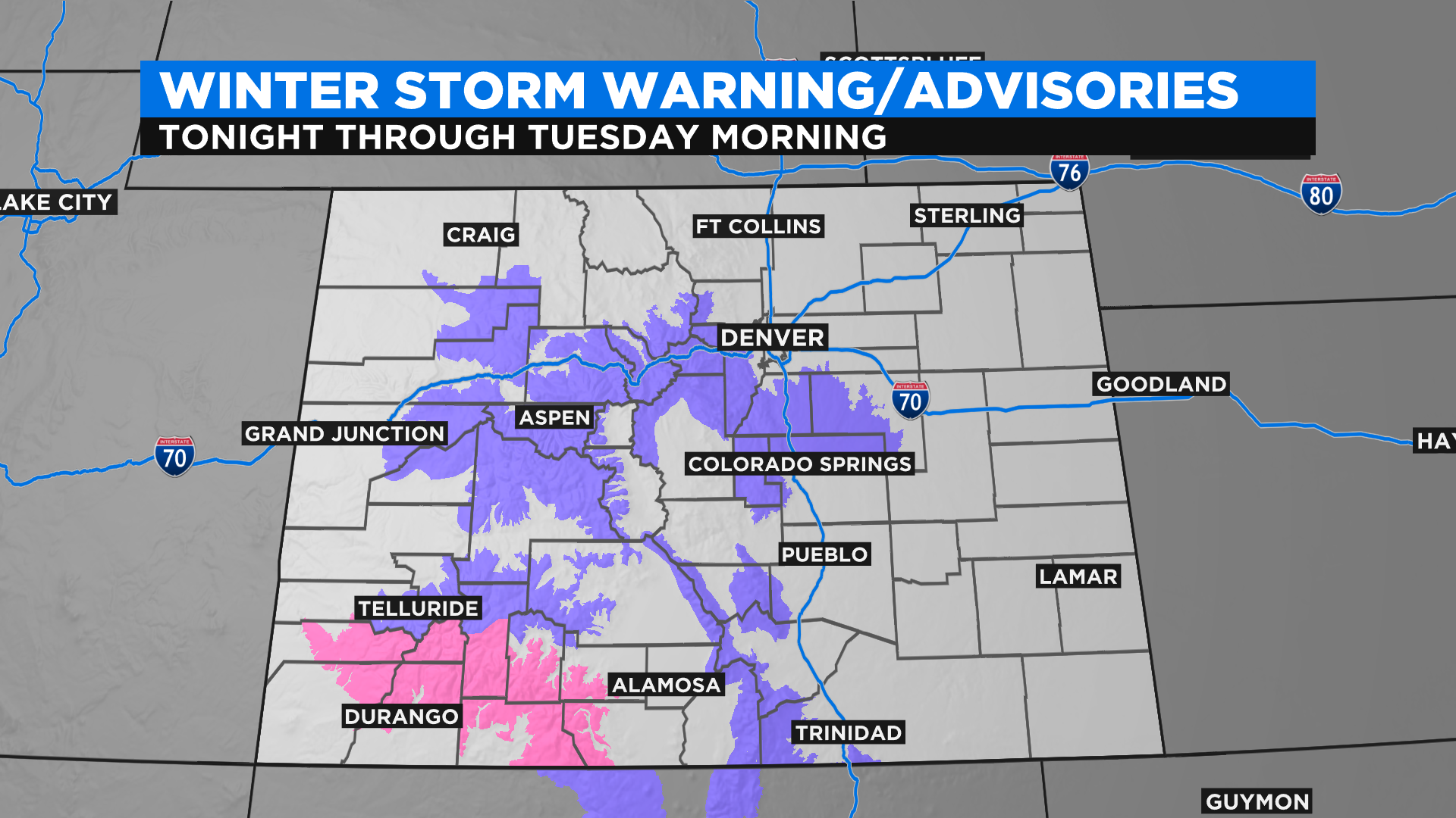
The National Weather Service has issued Winter Weather Advisories for a large part of Colorado's higher elevations, including the foothills west of Denver and the Palmer Divide south of the city. A Winter Storm Warning continues for portions of the San Juan Mountains in the southwest. All of the winter weather alerts last through Tuesday morning.
RELATED: 24 Hours Of Winter Driving Expected In Colorado Mountains Starting Monday
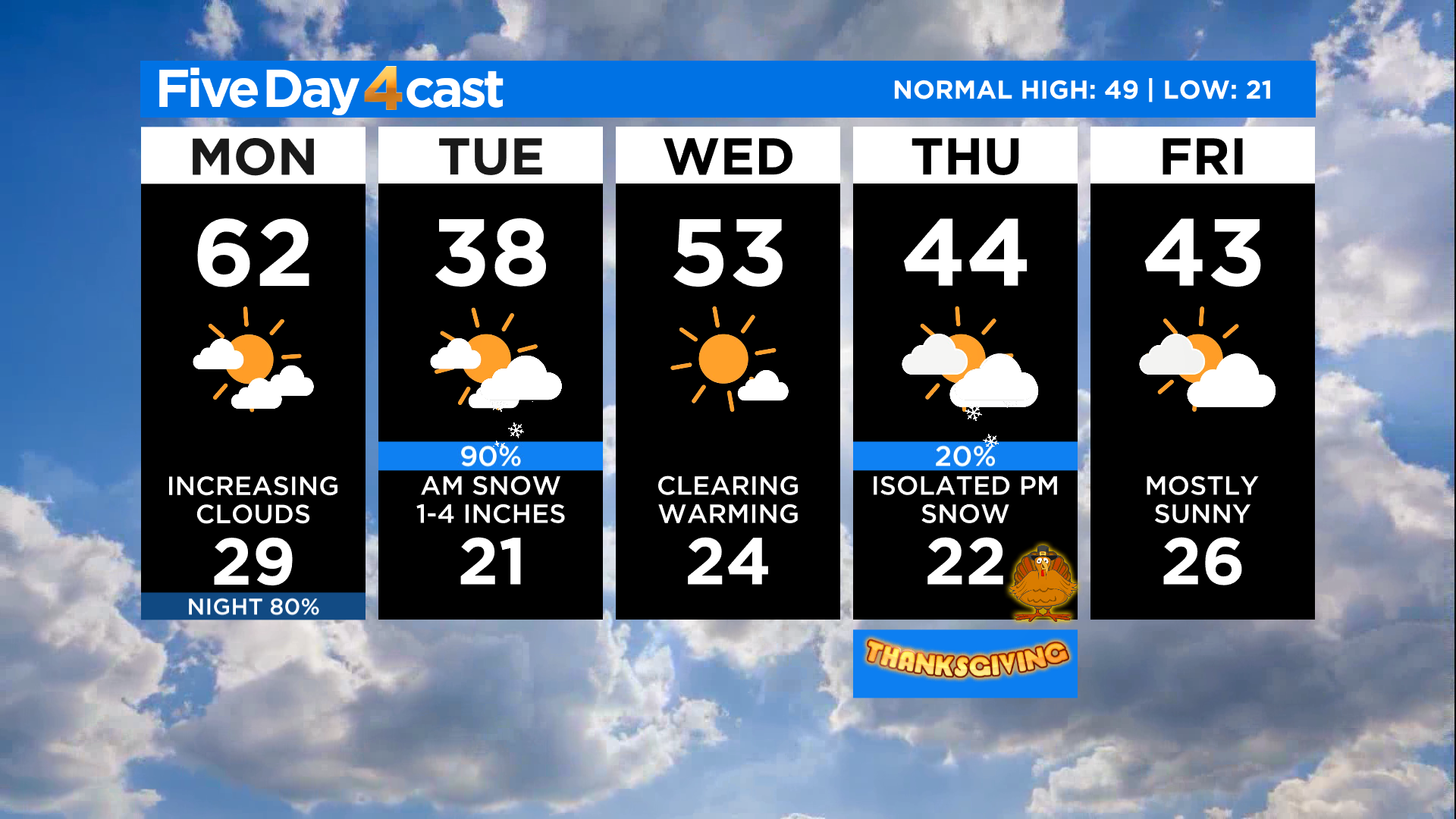
This is a fast-moving storm system with some clearing taking place as early as Tuesday evening. Wednesday looks to be a quiet weather day for Colorado with partly to mostly sunny skies. A second storm will arrive on Thanksgiving Day and it will bring more snow to the mountains and potentially some light snow showers to Denver by the evening.