Denver Weather: More Wind Before Our Snow Storm
Colorado's wildfires continue to rage and grow, thanks to strong wind and dry conditions. A cold front backed into Colorado on Thursday, bringing terribly gusty wind to our state. We also saw quite a bit of fog and cooler temperatures for the eastern side of the state.
Our much anticipated snow storm arrives on Saturday night into Sunday, but ahead of that we aren't clear from more fire danger. We need this snow desperately to help in these fire areas, but the wind we'll have ahead of it could make the fire worse.
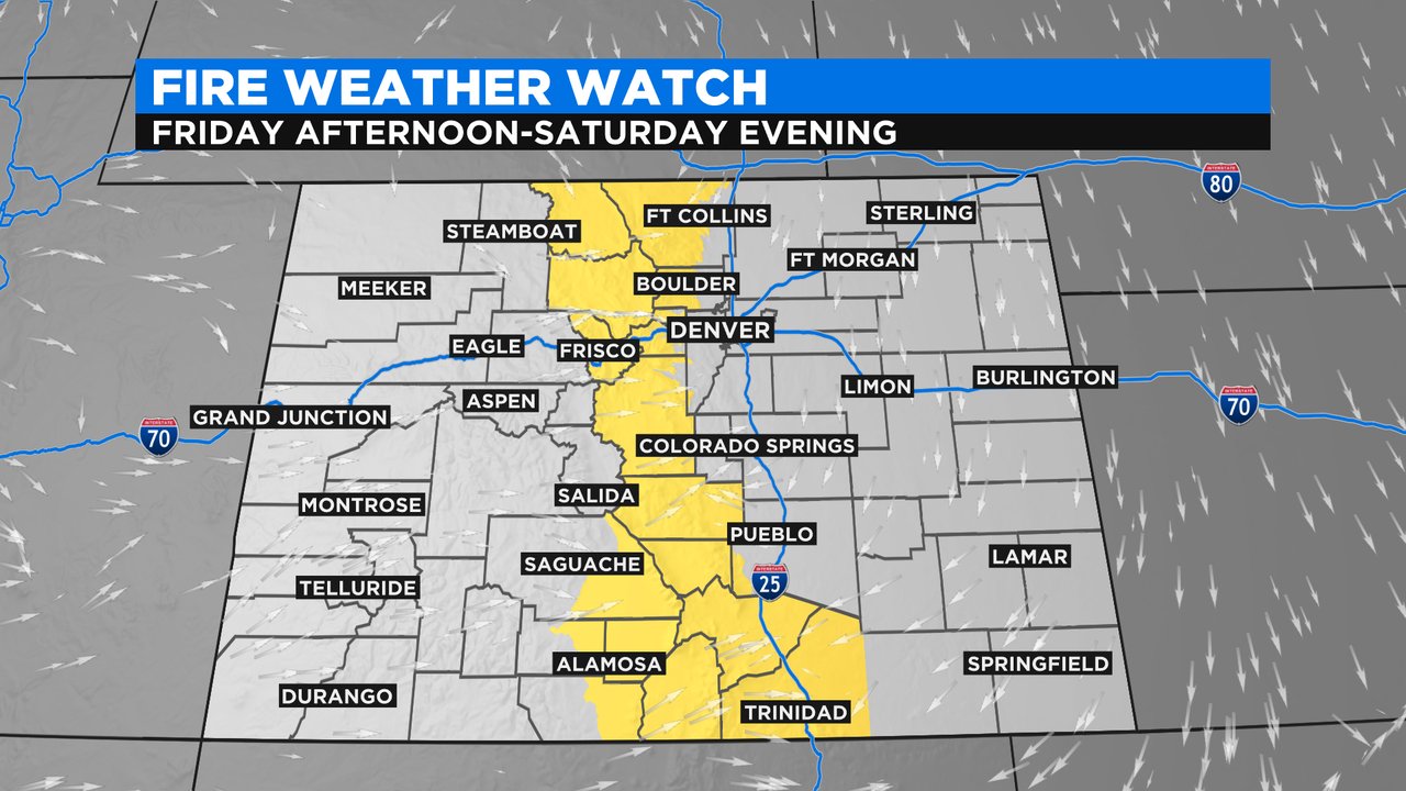
We have a Fire Weather Watch for the central part of the state from Friday afternoon to Saturday evening. Gusts could top around 50 mph, which could help these fires continue to grow.
Snow will start on Saturday night and stick with us through Monday morning. Here in Denver the models are showing anywhere from 3 to 7 inches of snow, but much more is anticipated in the northern mountains. It won't be out of the question to get well over a foot in some areas.
The other part of this storm will be the cold. We'll be in the low 20s on Sunday and Monday, with lows in the single digits for the Front Range. Areas near the Cameron Peak and East Troublesome Fires could get subzero temperatures.