Colorado Weather: Gusty Winds Keep Fire Danger High, Storms Possible North
DENVER (CBS) - The fire danger will remain high across the majority of Colorado through Wednesday evening. A Red Flag Warning that includes most of Jefferson, Douglas, and Elbert Counties is set to expire at 9 p.m.
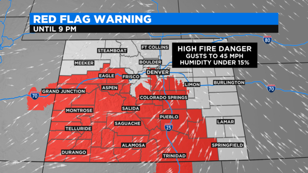
Wind gusts are expected to continue gusting over 30 mph across the Denver metro area through the evening hours. Elsewhere the gusts could be even stronger. The strong winds combined with dry soil, very low relative humidity, and the unusually warm temperatures is causing the high fire danager.
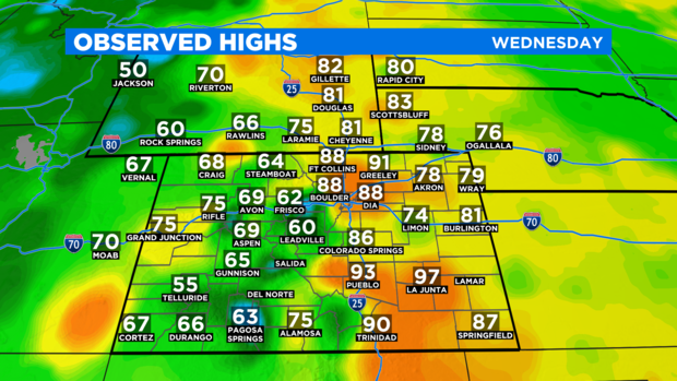
Temperatures have not been as hot as Tuesday but most areas have reached the mid and upper 80s. Denver's official high temperature as of 3:30 p.m. was 88 degrees. Denver's normal high temperature on May 20 is 73 degrees.
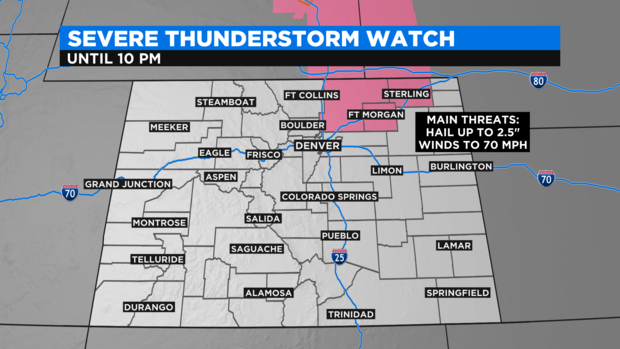
Thursday will be cooler with much lower fire danger as a cold front arrives from Wyoming to Colorado. Thunderstorms are possible along the front but the vast majority of them will stay in Wyoming and Nebraska Wednesday evening. A few could develop just south of the state line in Weld, Morgan and Logan Counties. These areas are included in a Severe Thunderstorm Watch until 10 p.m. Wednesday that covers mainly eastern Wyoming and western Nebraska.
With the cooler air on Thursday will also come a very slight chance for late day thunderstorms. One or two could be severe on the southeast plains of Colorado. Severe weather is not expected in the Denver metro area.