Colorado Weather: Omega Block In Jet Stream Sends State Into April Deep Freeze
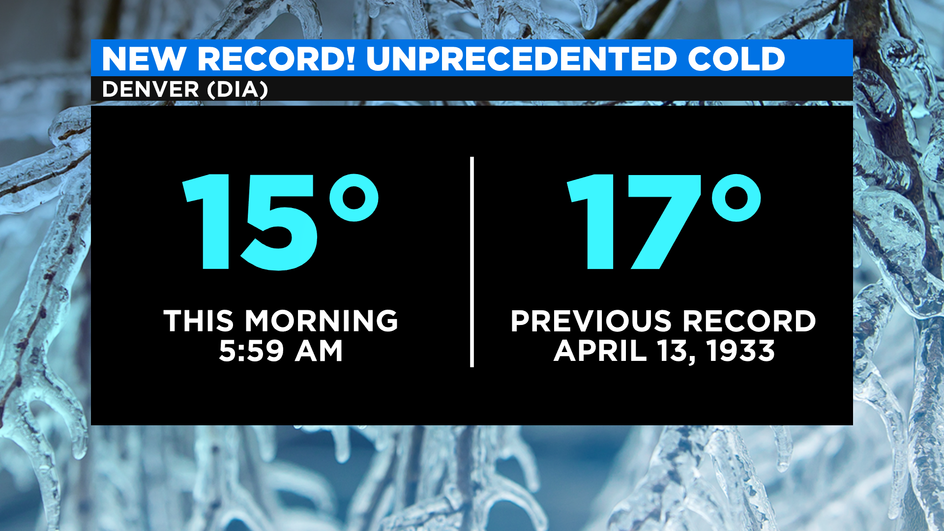
DENVER (CBS4) - Mother Nature is making it easy for the people of Colorado to stay home and social distance this week with a snowy and unusually cold weather pattern. In fact it was so cold Monday morning at Denver International Airport that a record low from 1933 was broken by two degrees. The city could also set a new record low high temperature for April 13 if we do not hit 27 degrees before midnight.
The unusual cold is being caused by a jet stream pattern known as an Omega Block. It gets this name because the flow of air looks like the greek letter Omega.
An Omega Block consists of a large ridge of high pressure, or warm air, that is surrounded on each side by a large trough of low pressure, or cold air. Those under the ridge of high pressure are experiencing several warm and fairly dry days. In each trough of low pressure it is cold and at times, even wet.
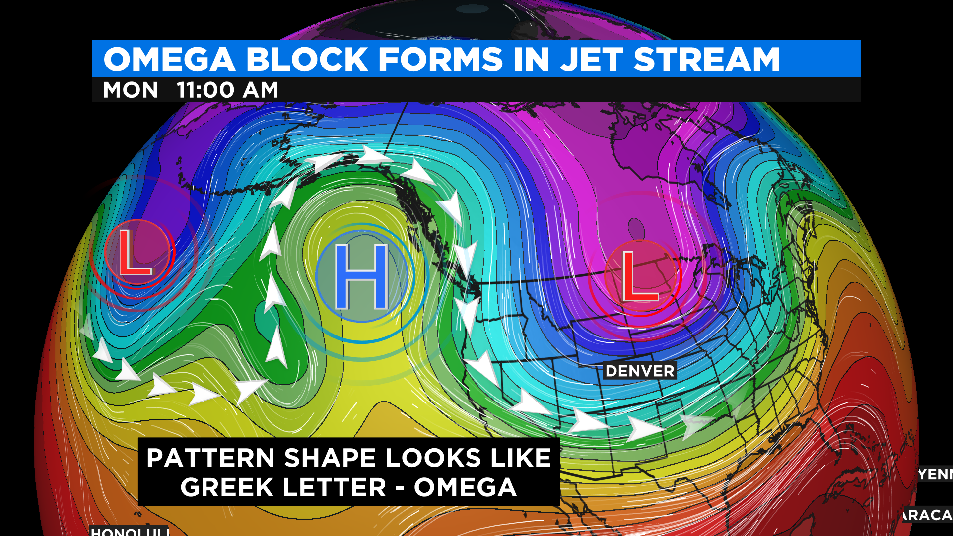
For Colorado and much of the lower 48 United States we sit inside a large trough of low pressure with plenty of cold air spilling due south from the arctic. Within the flow of air moving through the trough there are several disturbances, each one creating intermittent rounds of light snow as they go by.
While snow in April is pretty common for Colorado this type of cold is not. Temperatures are running anywhere from 25 to 40 degrees below normal for many areas, including Denver.
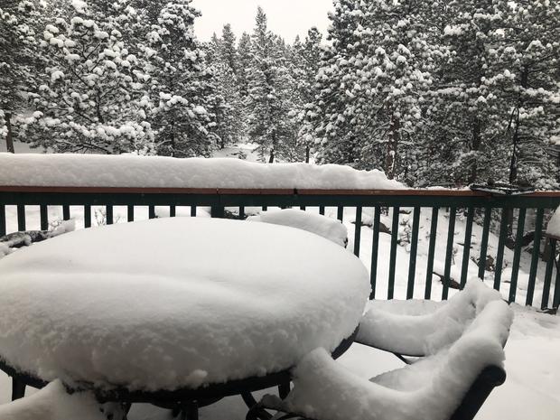
And let's talk about the snow! April is known for wet, heavy snowfall events. But because it is so cold the snow has been light and fluffy. That's because the colder the air, the less water vapor it can hold, resulting in a dry, mid-winter like snow.