Can You Name Major Terrain Features That Drive Colorado's Weather?
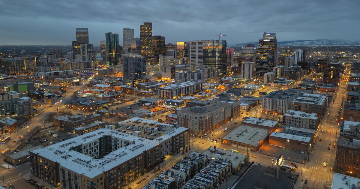
DENVER (CBS4) - If you've lived in Colorado for any period of time then you know that weather can be extreme with a lot of variation over just a few miles. A big reason for this is the extremely complex terrain.
There are numerous geographic features that play a role in the state's diverse weather and climate, ranging from large valleys that run down the center of the state to numerous mountain ranges and peaks to the hogback on the southwest side of Denver.
The state can be divided into four main geographic regions that most people associate with the local climate. Along Interstate 25 there are three additional features that dictate why Colorado's highest population centers see such a wide variety of weather conditions each time a storm passes through the region.
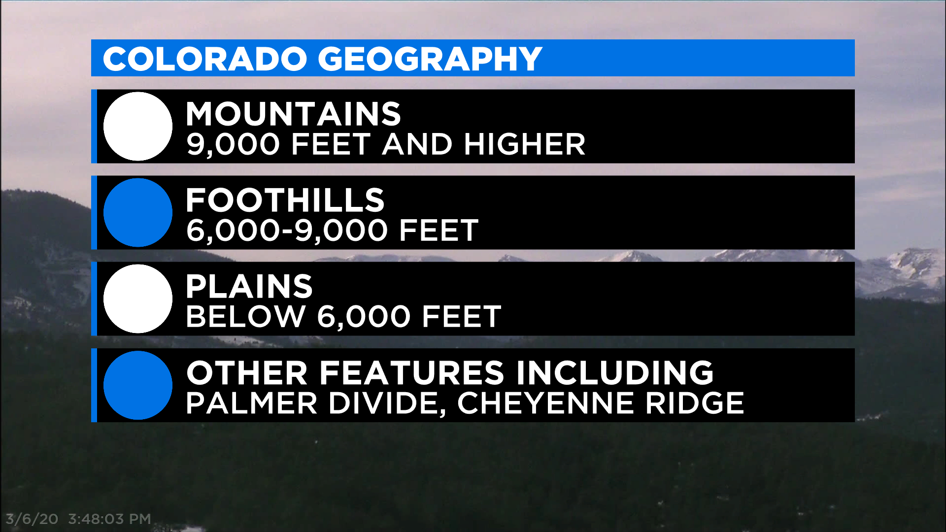
Colorado's 4 Main Geographic Regions
Mountains - this describes locations with an altitude of roughly 9,000 feet or higher and typically includes well-known cities and towns within the mountains such as Aspen, Vail, Durango and Steamboat Springs. Because weather varies so much with elevation you will often hear meteorologists use the treeline, found between 11,000 and 12,000 feet as a way to break up the mountain forecast zone.
Foothills - this is an area of transition found east of the Continental Divide between the Rocky Mountains and the eastern plains. It describes places with an altitude between 6,000 and 9,000 feet. Because the weather can vary so much within that range you may sometimes hear meteorologists make a further distinction between the lower foothills (6,000-7,500 feet) and higher foothills (7,500-9,000 feet).
Eastern Plains - areas below 6,000 feet in elevation that extend from the base of the foothills to the eastern border. Interstate 25 lies along the western edge of the plains.
Western Slope - this area typically includes all locations west of the Continental Divide and isn't really assigned a specific elevation range.
Note: elevation ranges used to distinguish between mountains, foothills and plains are specific to Colorado because the state has such a high average elevation.
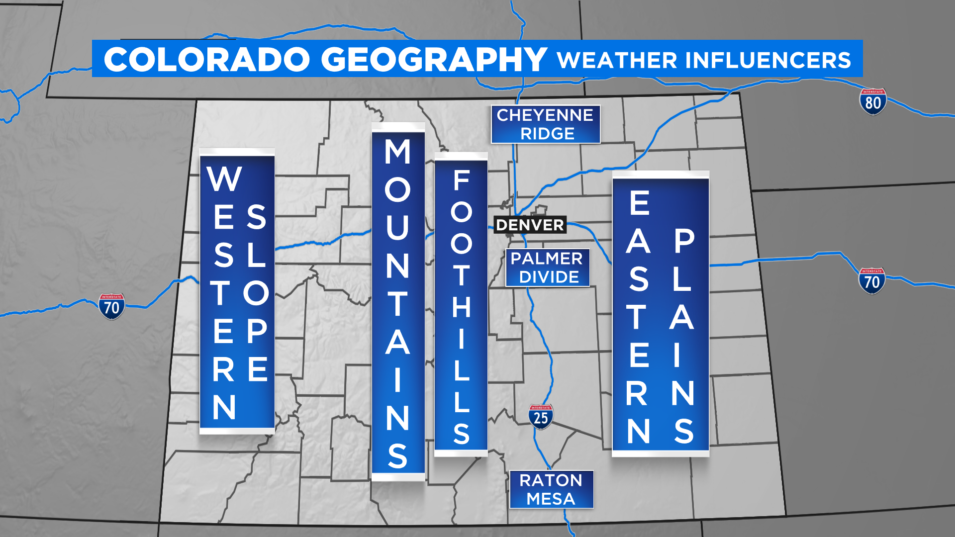
Along the heavily populated Interstate 25 corridor there are three distinct pieces of land jutting out from the foothills that create highly localized weather patterns. All three features are basically oriented in a west to east fashion and tend to have weather that is most similar to the foothills because of the higher elevation.
Cheyenne Ridge - this is an elevated area of land between Fort Collins and Cheyenne that separates the South Platte River basin in northeast Colorado from the North Platte River basin in southeast Wyoming. The elevation averages between 6,000 and 7,500 feet. When storms approach from the north the ridge can create a downslope wind that keeps places like Fort Collins, Greeley, Loveland and Longmont significantly drier. If a storm has a flow of wind from the south the Cheyenne Ridge can enhance precipitation with an upslope, giving counties like Larimer and Weld more precipitation than others. In the summertime this land feature can help to enhance thunderstorms by interacting with daytime wind patterns in the area.
Palmer Divide - an area of elevated land between Denver and Colorado Springs that stretches across Douglas and Elbert Counties. It extends as far east as Limon and parts of Lincoln County. Cities and towns on the Palmer Divide include Parker, Castle Rock, Elizabeth, Kiowa, Black Forest, and Monument. But some parts of metro Denver, including southeast Aurora and Highlands Ranch, see a huge influence from the Palmer Divide, especially during winter storms. The Palmer Divide plays a major role in the daily thunderstorm cycle each spring and summer.
Raton Mesa - an elevated piece of land along the New Mexico and Colorado state line with an average elevation between 6,000 and 7,500 feet. It has a climate similar to what is found in the foothills and much like the Cheyenne Ridge and Palmer Divide, it acts to greatly enhance weather as storm systems move through the state.