Denver Weather: Another Cold, Cloudy, Windy, And Snowy Day!
DENVER (CBS4) - A storm moving over northeastern Colorado on Tuesday will cause more fierce wind, much colder-than-normal temperatures, and snow from the mountains to the Eastern Plains. Several high wind restrictions were in place on Tuesday morning on Colorado roadways and wind gusts forced officials to close the northbound lanes of Highway 287 near the Colorado-Wyoming border.
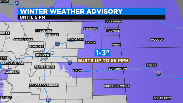
The most adverse travel conditions on Tuesday will be on the plains east of Deer Trail and Fort Morgan. Areas such as Limon, Sterling, Julesburg, Holyoak, Akron, Wray and Burlington are under a Winter Weather Advisory until 5 p.m. Snow accumulation will be somewhat limited with only 1 to 3 inches expected in these areas. But wind gusts up to 55 mph will cause considerable blowing and drifting snow. Near whiteouts are possible along I-70 and I-76 east of Deer Trail and Fort Morgan and well into Kansas and Nebraska.
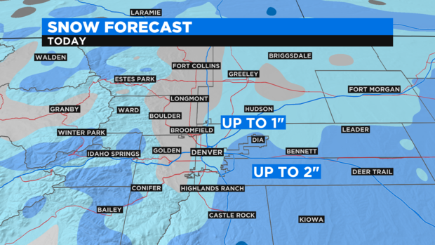
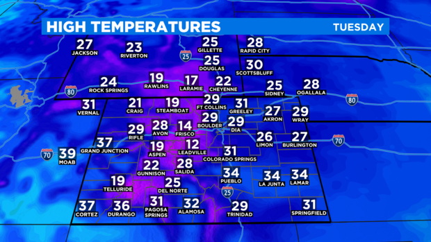
For the Denver metro area, there will also be a lot of wind on Tuesday with gusts up to 45 mph. But there will be less snow compared to the Eastern Plains. Snow showers should still produce no more than 1 inch of accumulation in the metro area. The exception of the east side of town where up to 2 inches is possible from near DIA and south along E-470 to SE Aurora.
It also stays cold statewide with high temperatures stuck in the mid and upper 20s around Denver, Boulder, and Fort Collins. That is more than 20 degrees colder than normal for the final week in February. Most mountain towns will never climb out of the teens.
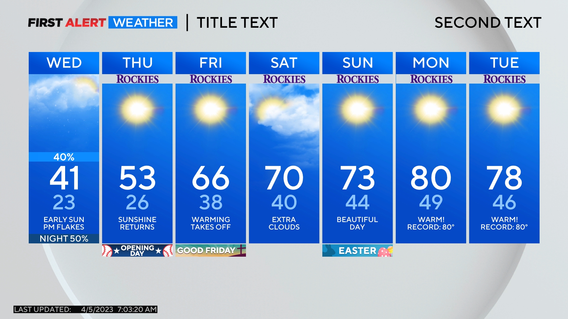
Warmer weather will finally return for the end of the week under mostly sunny skies. The exception will be the mountains where a chance for snow will continue on Wednesday and Thursday.