Denver Weather: Travel Advisory Issued As Snow Returns For Evening Rush
DENVER (CBS4) - Areas of dense freezing fog greeted some of us around the Denver metro area early Monday morning. For a brief time the fog created a ground stop at Denver International Airport, but that was lifted just before sunrise.
Snow will return to skies along the Front Range this afternoon as a cold front moves in from the north. Light snow could develop as early as noon near the Wyoming state line and in the Denver area sometime between 3 and 6 pm.
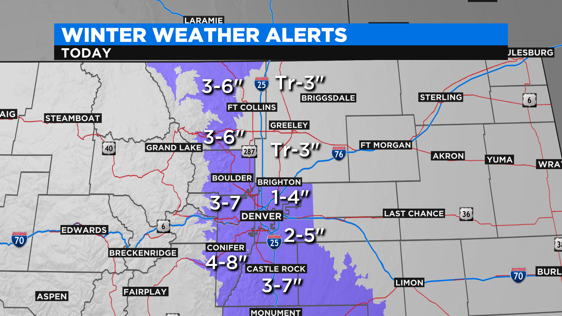
Snow totals in the immediate Denver area should average between 2 and 4 inches. Higher elevations to the west and south of downtown Denver, like Castle Rock, Evergreen and Conifer ... could get up to 8 inches in spots. The lightest totals will be found north of Denver with places like Greeley, Loveland and Fort Collins expecting anywhere from a trace to 3 inches.
Snow should end in the Denver area by sunrise on Tuesday but there could be lingering pockets of flurries. Roads will likely be slick for the morning commute tomorrow.
The brunt of this storm system will hit southern Colorado where the snow could fall until at least the noon hour tomorrow. A Winter Storm Warning has been posted for places like Trinidad and Raton Pass.
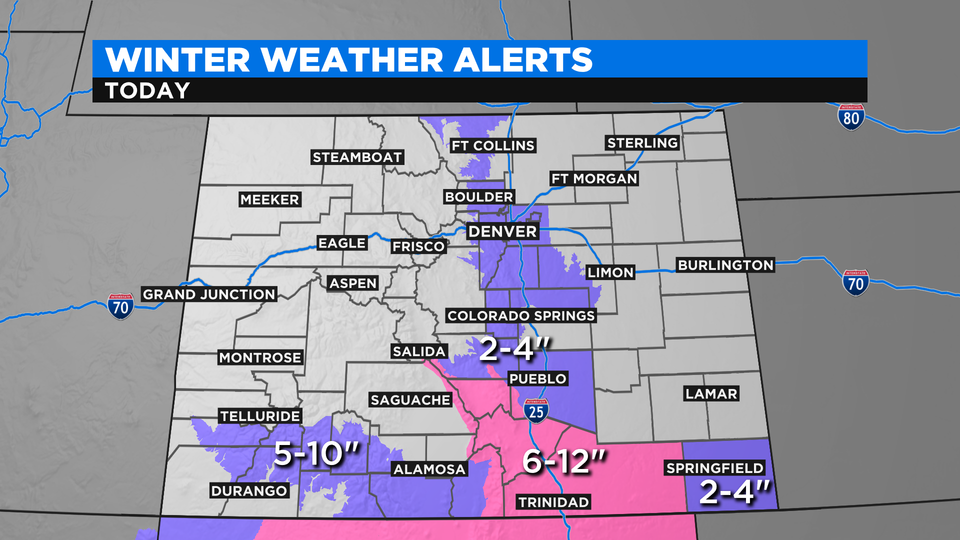
Some occasional snow showers are possible in the central and northern mountains today and tomorrow but nothing heavy enough to trigger and advisories or warnings at this time.

There will be more snow possible as we approach the upcoming weekend.