Denver Weather: Advisory Issued For Additional Snow, Slick Travel
DENVER (CBS4) - During the CBS4 Morning News on Saturday we told you to get out and about and enjoy the first half of your weekend because things would change rapidly overnight. A cold front moved into the state along with a new piece of jet stream energy and the two are combining to bring another round of snow.
In fact most of this week will be cool and unsettled with several chances of snow. It's all because of a large area of low pressure in the upper atmosphere that will hang out near the Four Corners.

For your Sunday we expect occasional snow in the mountains where a Winter Weather Advisory is in effect. Totals up there should range between 5-10 inches on average. Some areas could see a bit more.
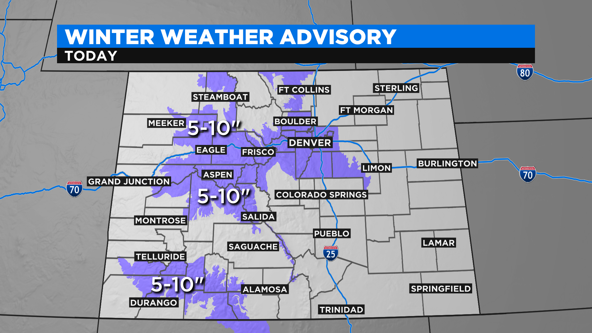
In Denver and along the Front Range we think the bulk of the snow will fall during the morning, but snow showers and pockets of flurries will be possible into the evening. Most of the snow will be in areas along and west of Interstate 25. Little to no snow is anticipated on the far eastern plains.
Totals will vary widely around metro Denver but we do think the highest amounts will be on the west and south sides of the city. As you move north and east the totals will be lighter. Our complex terrain makes for a wide range in the totals over a relatively short distance.
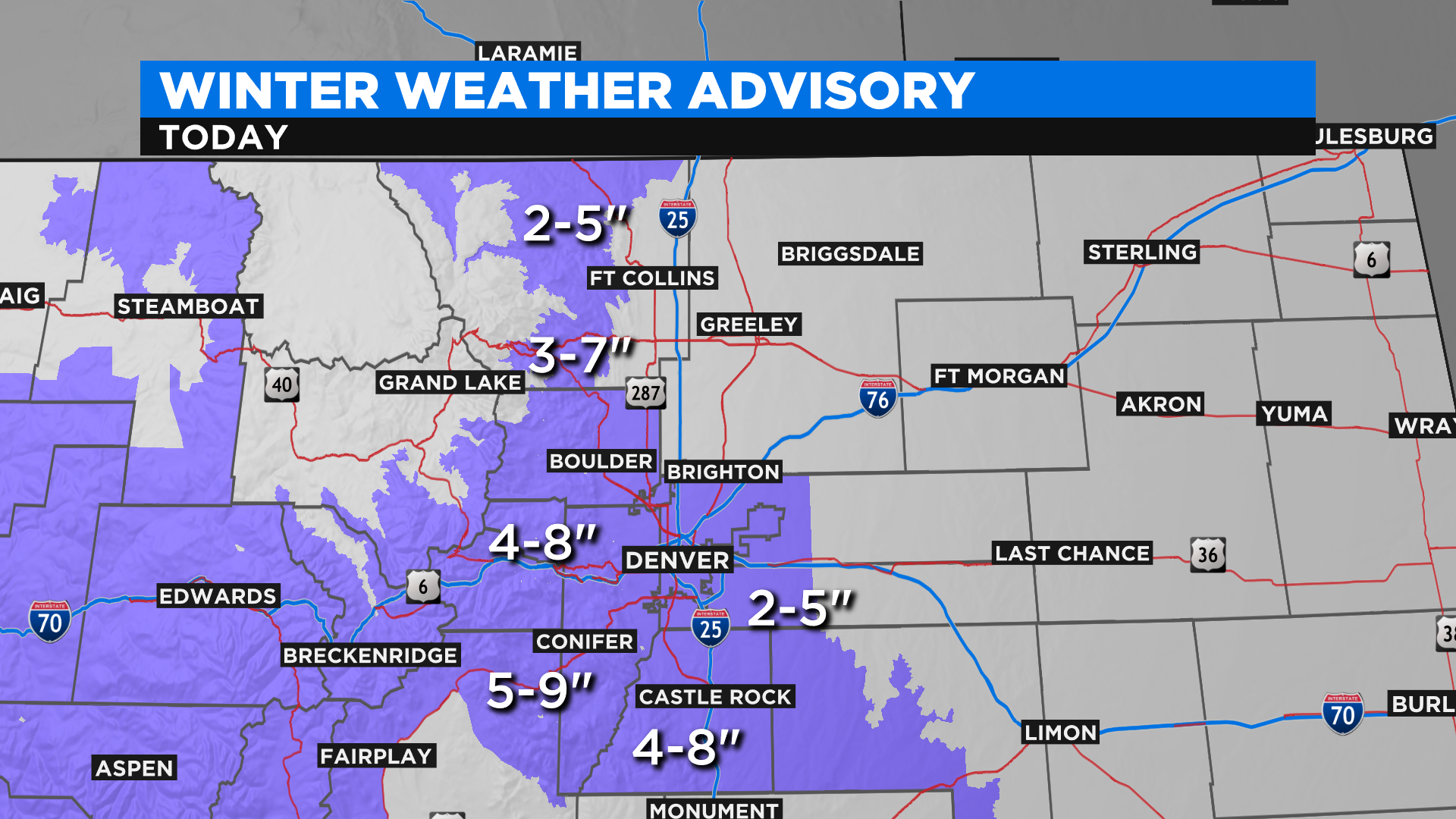
A new round of snow is expected on Monday with a Winter Storm Watch already in effect for the southwest mountains. We could see additional watches, warnings and advisories issued later today.
But before we talk about how much more snow could fall tomorrow, let's first get through today's weather to make sure there are no surprises hidden within this busy jet stream flow. More snow will be possible on Wednesday and again Friday.